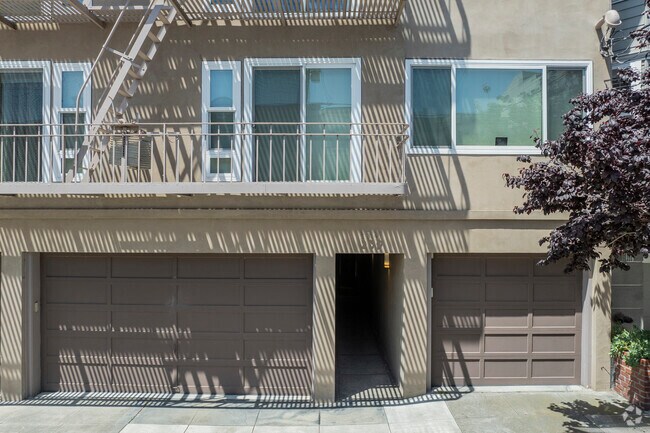
Property Record
239 26Th Ave, San Francisco, CA 94121


NEARBY LISTINGS FOR SALE OR LEASE
Property Detail
239 26Th Ave
San Francisco
Part Of Outside Land
San Francisco-San Mateo-Redwood City, CA
BLK 97
1386-007
San Francisco
Multifamilydwelling
California
2024
7
2025
0.14 AC
042700
Lake Street
11,334 SF
DEMOGRAPHICS near 239 26Th Ave
1 Mile
3 Mile
5 Mile
2024 Total Population
40,785
232,297
628,782
2029 Population
37,962
214,723
583,167
Pop Growth 2024-2029
(6.92%)
(7.57%)
(7.25%)
Average Age
44
42
43
2024 Total Households
16,880
98,017
282,268
HH Growth 2024-2029
(7.47%)
(8.05%)
(7.68%)
Median Household Inc
$123,788
$146,538
$127,271
Avg Household Size
2.40
2.30
2.10
2024 Avg HH Vehicles
1.00
1.00
1.00
Median Home Value
$1,122,926
$1,118,761
$1,109,613
Median Year Built
1947
1947
1948
Nearby Places
Map Layers
Map Styles
 Street
 Aerial
- Restaurants
- Banks
- Shops
- Fitness
- Groceries
PUBLIC TRANSPORTATION
COMMUTER RAIL
San Francisco 4th & King (Caltrain - Caltrain (Caltrain))
DRIVE
WALK
Distance
San Francisco 4th & King (Caltrain - Caltrain (Caltrain))
15 min
5.8 mi
DRIVE
WALK
Distance
16 min
5.8 mi
AIRPORT
San Francisco International
DRIVE
WALK
Distance
San Francisco International
29 min
15.9 mi
Metro Oakland International
DRIVE
WALK
Distance
Metro Oakland International
42 min
23.8 mi
Norman Y Mineta San Jose International
DRIVE
WALK
Distance
Norman Y Mineta San Jose International
66 min
47.5 mi
Freight Ports
Port of San Francisco
DRIVE
WALK
Distance
Port of San Francisco
14 min
5.6 mi
Nearby Properties
Address
Land Use
TOTAL SIZE
Lot Size
Zoning
Address
Land Use
TOTAL SIZE
Lot Size
Zoning
718 SF
18.55 AC
RH2
Address
Land Use
TOTAL SIZE
Lot Size
Zoning
2.40 AC
NC3
Address
Land Use
TOTAL SIZE
Lot Size
Zoning
250,843 SF
6.62 AC
NC3
Address
Land Use
TOTAL SIZE
Lot Size
Zoning
17.91 AC
RH-2
Address
Land Use
TOTAL SIZE
Lot Size
Zoning
420,000 SF
0.79 AC
NC-3
Address
Land Use
TOTAL SIZE
Lot Size
Zoning
4.41 AC
RH-3/RM-2
Address
Land Use
TOTAL SIZE
Lot Size
Zoning
905,491 SF
10.27 AC
RM1
Address
Land Use
TOTAL SIZE
Lot Size
Zoning
230,310 SF
0.65 AC
NC3
Address
Land Use
TOTAL SIZE
Lot Size
Zoning
2.24 AC
RM3
Address
Land Use
TOTAL SIZE
Lot Size
Zoning
90,539 SF
2.28 AC
RH2
Address
Land Use
TOTAL SIZE
Lot Size
Zoning
14,525 SF
0.46 AC
NC2
Address
Land Use
TOTAL SIZE
Lot Size
Zoning
107,588 SF
1.04 AC
RM1
Address
Land Use
TOTAL SIZE
Lot Size
Zoning
146,036 SF
0.49 AC
RH3
Address
Land Use
TOTAL SIZE
Lot Size
Zoning
127,189 SF
0.74 AC
RM2
Address
Land Use
TOTAL SIZE
Lot Size
Zoning
195,791 SF
0.80 AC
NC3
Address
Land Use
TOTAL SIZE
Lot Size
Zoning
76,000 SF
1.48 AC
RM4
Address
Land Use
TOTAL SIZE
Lot Size
Zoning
117,200 SF
1.72 AC
RH-2
Address
Land Use
TOTAL SIZE
Lot Size
Zoning
1.20 AC
RM1
Address
Land Use
TOTAL SIZE
Lot Size
Zoning
67,500 SF
0.51 AC
Address
Land Use
TOTAL SIZE
Lot Size
Zoning
2.99 AC
NC3
Address
Land Use
TOTAL SIZE
Lot Size
Zoning
194,477 SF
11.37 AC
RH1
Address
Land Use
TOTAL SIZE
Lot Size
Zoning
48,931 SF
0.63 AC
RH3
Address
Land Use
TOTAL SIZE
Lot Size
Zoning
205,770 SF
3.37 AC
RM4
Address
Land Use
TOTAL SIZE
Lot Size
Zoning
93,904 SF
0.50 AC
RM2
Address
Land Use
TOTAL SIZE
Lot Size
Zoning
2 AC
RM3
Address
Land Use
TOTAL SIZE
Lot Size
Zoning
44,741 SF
0.22 AC
RM1
Address
Land Use
TOTAL SIZE
Lot Size
Zoning
70,052 SF
1 AC
NC3
Address
Land Use
TOTAL SIZE
Lot Size
Zoning
54,400 SF
0.39 AC
RM1
Address
Land Use
TOTAL SIZE
Lot Size
Zoning
0.40 AC
NC3
Address
Land Use
TOTAL SIZE
Lot Size
Zoning
70,120 SF
6.35 AC
RM2
The World's #1 Commercial Real Estate Marketplace
Connect with us
© 2026 CoStar Group
The information above has been obtained from sources believed reliable. While we do not doubt its accuracy we have not verified it and make no guarantee, warranty or representation about it. It is your responsibility to independently confirm its accuracy and completeness. Any projections, opinions, assumptions, or estimates used are for example only and do not represent the current or future performance of the property. The value of this transaction to you depends on tax and other factors which should be evaluated by your tax, financial, and legal advisors. You and your advisors should conduct a careful, independent investigation of the property to determine to your satisfaction the suitability of the property for your needs.