Property Record
239 2Nd Ave, San Francisco, CA 94118

NEARBY LISTINGS FOR SALE OR LEASE
Property Detail
239 2Nd Ave
San Francisco-San Mateo-Redwood City, CA
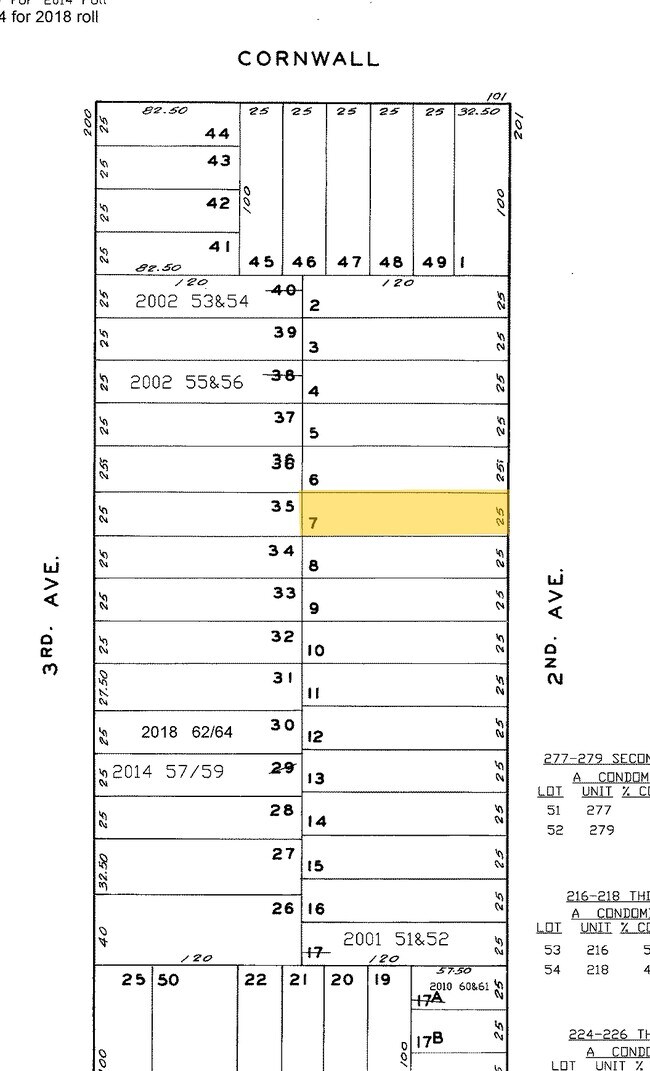
Outside Land Bl 180
1431-007
San Francisco
Apartment
California
2024
7
2025
0.07 AC
040100
Richmond District
4,292 SF
San Francisco
DEMOGRAPHICS near 239 2Nd Ave
1 Mile
3 Mile
5 Mile
2024 Total Population
50,349
440,041
724,071
2029 Population
46,856
408,562
670,420
Pop Growth 2024-2029
(6.94%)
(7.15%)
(7.41%)
Average Age
41
43
43
2024 Total Households
21,011
206,159
317,052
HH Growth 2024-2029
(7.48%)
(7.66%)
(7.77%)
Median Household Inc
$146,338
$125,801
$130,456
Avg Household Size
2.20
2.00
2.20
2024 Avg HH Vehicles
1.00
1.00
1.00
Median Home Value
$1,117,031
$1,110,634
$1,105,778
Median Year Built
1947
1948
1948
Nearby Places
Map Layers
Map Styles
 Street
 Aerial
- Restaurants
- Banks
- Shops
- Fitness
- Groceries
PUBLIC TRANSPORTATION
COMMUTER RAIL
San Francisco 4Th & King (Caltrain - Caltrain (Caltrain))
DRIVE
WALK
Distance
San Francisco 4Th & King (Caltrain - Caltrain (Caltrain))
11 min
5.5 mi
San Francisco Caltrain Station Southbound (Express - Caltrain (Caltrain), Limited - Caltrain (Caltrain), Local Weekday - Caltrain (Caltrain), Local Weekend - Caltrain (Caltrain))
DRIVE
WALK
Distance
San Francisco Caltrain Station Southbound (Express - Caltrain (Caltrain), Limited - Caltrain (Caltrain), Local Weekday - Caltrain (Caltrain), Local Weekend - Caltrain (Caltrain))
11 min
5.5 mi
AIRPORT
San Francisco International
DRIVE
WALK
Distance
San Francisco International
28 min
16.4 mi
Metro Oakland International
DRIVE
WALK
Distance
Metro Oakland International
37 min
22.3 mi
Freight Ports
Port of San Francisco
DRIVE
WALK
Distance
Port of San Francisco
10 min
4.2 mi
Nearby Properties
Address
Land Use
TOTAL SIZE
Lot Size
Zoning
Address
Land Use
TOTAL SIZE
Lot Size
Zoning
1,015,000 SF
2.43 AC
RC4
Address
Land Use
TOTAL SIZE
Lot Size
Zoning
266,143 SF
4 AC
C-3-R
Address
Land Use
TOTAL SIZE
Lot Size
Zoning
508,714 SF
1.29 AC
C3R
Address
Land Use
TOTAL SIZE
Lot Size
Zoning
696,431 SF
0.97 AC
C3G
Address
Land Use
TOTAL SIZE
Lot Size
Zoning
1.52 AC
C3G
Address
Land Use
TOTAL SIZE
Lot Size
Zoning
1,424,230 SF
2.60 AC
C3G
Address
Land Use
TOTAL SIZE
Lot Size
Zoning
263,640 SF
0.72 AC
C3R
Address
Land Use
TOTAL SIZE
Lot Size
Zoning
922,758 SF
1.94 AC
C3R
Address
Land Use
TOTAL SIZE
Lot Size
Zoning
393,918 SF
3.36 AC
WMUG
Address
Land Use
TOTAL SIZE
Lot Size
Zoning
24.37 AC
Address
Land Use
TOTAL SIZE
Lot Size
Zoning
2.93 AC
Address
Land Use
TOTAL SIZE
Lot Size
Zoning
342,727 SF
1.36 AC
C3G
Address
Land Use
TOTAL SIZE
Lot Size
Zoning
291,522 SF
6.66 AC
CM
Address
Land Use
TOTAL SIZE
Lot Size
Zoning
610,645 SF
0.82 AC
C3R
Address
Land Use
TOTAL SIZE
Lot Size
Zoning
718 SF
18.55 AC
RH2
Address
Land Use
TOTAL SIZE
Lot Size
Zoning
243,612 SF
1.94 AC
Address
Land Use
TOTAL SIZE
Lot Size
Zoning
345,000 SF
1.74 AC
WMUG
Address
Land Use
TOTAL SIZE
Lot Size
Zoning
420,654 SF
1.82 AC
C3G
Address
Land Use
TOTAL SIZE
Lot Size
Zoning
804,136 SF
2.60 AC
RM4
Address
Land Use
TOTAL SIZE
Lot Size
Zoning
246,069 SF
0.69 AC
Address
Land Use
TOTAL SIZE
Lot Size
Zoning
89,551 SF
0.73 AC
RC4
Address
Land Use
TOTAL SIZE
Lot Size
Zoning
332,221 SF
1.17 AC
Address
Land Use
TOTAL SIZE
Lot Size
Zoning
146,075 SF
0.52 AC
CRNC
Address
Land Use
TOTAL SIZE
Lot Size
Zoning
450,000 SF
1.07 AC
C3G
Address
Land Use
TOTAL SIZE
Lot Size
Zoning
337,664 SF
0.36 AC
C3G
Address
Land Use
TOTAL SIZE
Lot Size
Zoning
368,488 SF
1.06 AC
C3R
Address
Land Use
TOTAL SIZE
Lot Size
Zoning
113,083 SF
1 AC
C-3-R
Address
Land Use
TOTAL SIZE
Lot Size
Zoning
0.96 AC
C3R
Address
Land Use
TOTAL SIZE
Lot Size
Zoning
213,553 SF
0.46 AC
C3G
Address
Land Use
TOTAL SIZE
Lot Size
Zoning
409,895 SF
7.20 AC
RH3
The World's #1 Commercial Real Estate Marketplace
Connect with us
© 2026 CoStar Group
The information above has been obtained from sources believed reliable. While we do not doubt its accuracy we have not verified it and make no guarantee, warranty or representation about it. It is your responsibility to independently confirm its accuracy and completeness. Any projections, opinions, assumptions, or estimates used are for example only and do not represent the current or future performance of the property. The value of this transaction to you depends on tax and other factors which should be evaluated by your tax, financial, and legal advisors. You and your advisors should conduct a careful, independent investigation of the property to determine to your satisfaction the suitability of the property for your needs.