Property Record
239 Jones Rd, Jacksonville, FL 32220


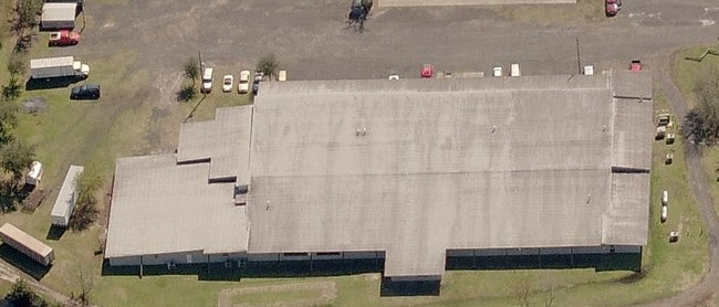

Property Detail
239 Jones Rd
006260-0040
5-32 16-2S-25E 5.38 WARRINGTONS S/D PT TRACTS 5,6,PT CL RD RECD 0/R 7258-1370 O/R 17032-531 BLK 6, 5-93 21-2S-25E JACKSONVILLE HEIGHTS PT TRACT 7,PT CL RD RECD O/R 7258-1370 O/R 17032-531 BLK 1
Warehouse
Duval
CCG-1
Florida
B and X Area of moderate flood hazard, usually the area between the limits of the 100-year and 500-year floods.
5
2025
5.37 AC
2026
West Side
011901
Jacksonville (Florida)
82,297 SF
Jacksonville, FL
NEARBY LISTINGS FOR SALE OR LEASE
DEMOGRAPHICS near 239 Jones Rd
1 mile
3 mile
5 mile
2025 Total Population
2,747
34,780
101,867
2030 Population
2,923
36,887
108,664
Pop Growth 2025-2030
+ 6.41%
+ 6.06%
+ 6.67%
Average Age
41
40
38
2025 Total Households
1,048
12,731
38,217
HH Growth 2025-2030
+ 6.68%
+ 6.31%
+ 6.94%
Median Household Inc
$76,062
$78,007
$66,133
Avg Household Size
2.60
2.70
2.60
2025 Avg HH Vehicles
2.00
2.00
2.00
Median Home Value
$287,499
$282,654
$263,722
Median Year Built
1993
1991
1986
Nearby Places
Map Layers
Map Styles
 Street
 Aerial
Layers
 Traffic
 Biking
Places
Listings with unknown addresses are not visible on the map
- Restaurants
- Banks
- Shops
- Fitness
- Groceries
PUBLIC TRANSPORTATION
COMMUTER RAIL
Jacksonville (Silver Meteor - Amtrak, Silver Star - Amtrak)
Drive
Walk
Distance
Jacksonville (Silver Meteor - Amtrak, Silver Star - Amtrak)
16 min
8.4 mi
AIRPORT
Jacksonville International
Drive
Walk
Distance
Jacksonville International
31 min
20.2 mi
Freight Ports
Jacksonville Port
Drive
Walk
Distance
Jacksonville Port
23 min
14.0 mi
Nearby Properties
Address
Land Use
TOTAL SIZE
Lot Size
Zoning
Address
Land Use
TOTAL SIZE
Lot Size
Zoning
506,816 SF
39.32 AC
IBP
Address
Land Use
TOTAL SIZE
Lot Size
Zoning
874,178 SF
46.91 AC
PBF-2
Address
Land Use
TOTAL SIZE
Lot Size
Zoning
321,547 SF
17.17 AC
PUD
Address
Land Use
TOTAL SIZE
Lot Size
Zoning
505,748 SF
94.71 AC
IL
Address
Land Use
TOTAL SIZE
Lot Size
Zoning
509,686 SF
43.32 AC
IL
Address
Land Use
TOTAL SIZE
Lot Size
Zoning
139,435 SF
7.15 AC
CCG-2
Address
Land Use
TOTAL SIZE
Lot Size
Zoning
481,686 SF
43.54 AC
IL
Address
Land Use
TOTAL SIZE
Lot Size
Zoning
64,013 SF
8.37 AC
PUD
Address
Land Use
TOTAL SIZE
Lot Size
Zoning
114,316 SF
20.57 AC
IL
Address
Land Use
TOTAL SIZE
Lot Size
Zoning
279,053 SF
21.03 AC
IBP
Address
Land Use
TOTAL SIZE
Lot Size
Zoning
167,854 SF
8.01 AC
IL
Address
Land Use
TOTAL SIZE
Lot Size
Zoning
269,178 SF
129.93 AC
PBF-2
Address
Land Use
TOTAL SIZE
Lot Size
Zoning
48,720 SF
9.38 AC
PUD
Address
Land Use
TOTAL SIZE
Lot Size
Zoning
75,247 SF
14.90 AC
CCG-1
Address
Land Use
TOTAL SIZE
Lot Size
Zoning
878.69 AC
PUD
Address
Land Use
TOTAL SIZE
Lot Size
Zoning
30,789 SF
2.10 AC
PUD
Address
Land Use
TOTAL SIZE
Lot Size
Zoning
160,778 SF
25.46 AC
IL
Address
Land Use
TOTAL SIZE
Lot Size
Zoning
98,541 SF
8.68 AC
CCG-2
Address
Land Use
TOTAL SIZE
Lot Size
Zoning
131,247 SF
5.68 AC
PBF-2
Address
Land Use
TOTAL SIZE
Lot Size
Zoning
153,549 SF
15.96 AC
PBF-1
Address
Land Use
TOTAL SIZE
Lot Size
Zoning
212,908 SF
11.10 AC
IL
Address
Land Use
TOTAL SIZE
Lot Size
Zoning
171.06 AC
PUD
Address
Land Use
TOTAL SIZE
Lot Size
Zoning
111,570 SF
4.15 AC
IL
Address
Land Use
TOTAL SIZE
Lot Size
Zoning
29,186 SF
2.61 AC
CCG-1
Address
Land Use
TOTAL SIZE
Lot Size
Zoning
29,022 SF
3.17 AC
PUD
Address
Land Use
TOTAL SIZE
Lot Size
Zoning
204,682 SF
15.80 AC
PBF-1
Address
Land Use
TOTAL SIZE
Lot Size
Zoning
33,424 SF
2.97 AC
PUD
Address
Land Use
TOTAL SIZE
Lot Size
Zoning
121,370 SF
15.26 AC
RMD-D
Address
Land Use
TOTAL SIZE
Lot Size
Zoning
307.14 AC
PUD
Address
Land Use
TOTAL SIZE
Lot Size
Zoning
107,800 SF
8.13 AC
CCG-1
The World's #1 Commercial Real Estate Marketplace
Connect with us
© 2026 CoStar Group
The information above has been obtained from sources believed reliable. While we do not doubt its accuracy we have not verified it and make no guarantee, warranty or representation about it. It is your responsibility to independently confirm its accuracy and completeness. Any projections, opinions, assumptions, or estimates used are for example only and do not represent the current or future performance of the property. The value of this transaction to you depends on tax and other factors which should be evaluated by your tax, financial, and legal advisors. You and your advisors should conduct a careful, independent investigation of the property to determine to your satisfaction the suitability of the property for your needs.