Property Record
301 W Interstate Rd, Addison, IL 60101
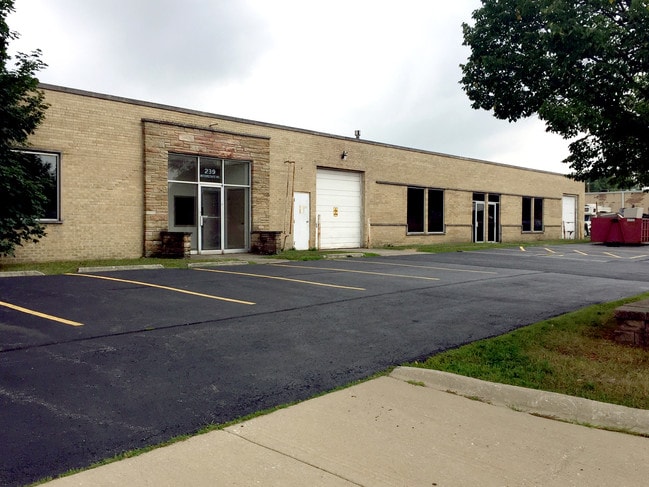

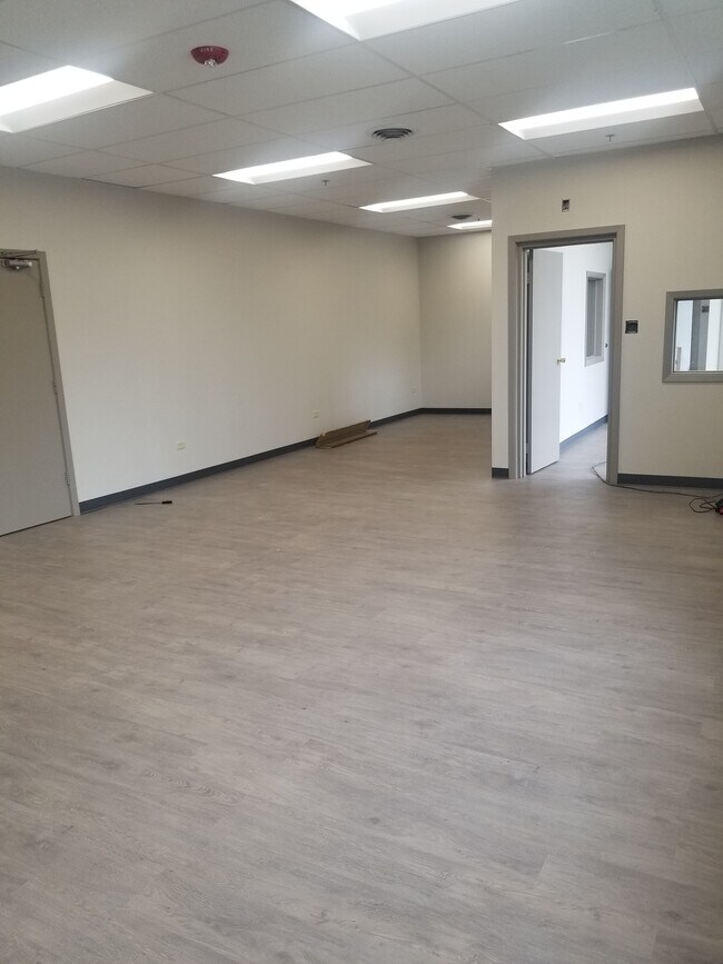

Property Detail
301 W Interstate Rd
03-33-106-020
POWER PORT PRODUCTS RESUB ALL
Industrialgeneral
DuPage
I
Illinois
B and X Area of moderate flood hazard, usually the area between the limits of the 100-year and 500-year floods.
2
2024
0.86 AC
2024
West Suburbs
846702
Chicago
20,000 SF
Chicago-Naperville-Elgin, IL-IN
NEARBY LISTINGS FOR SALE OR LEASE
DEMOGRAPHICS near 301 W Interstate Rd
1 mile
3 mile
5 mile
2024 Total Population
12,383
100,394
283,103
2029 Population
12,471
101,408
286,198
Pop Growth 2024-2029
+ 0.71%
+ 1.01%
+ 1.09%
Average Age
38
40
41
2024 Total Households
3,968
36,562
103,588
HH Growth 2024-2029
+ 0.63%
+ 0.99%
+ 1.15%
Median Household Inc
$86,507
$98,129
$98,652
Avg Household Size
3.00
2.70
2.60
2024 Avg HH Vehicles
2.00
2.00
2.00
Median Home Value
$299,448
$347,827
$354,503
Median Year Built
1966
1964
1969
Nearby Places
Map Layers
Map Styles
 Street
 Aerial
Transit
 Traffic
 Biking
Places
Listings with unknown addresses are not visible on the map
- Restaurants
- Banks
- Shops
- Fitness
- Groceries
PUBLIC TRANSPORTATION
COMMUTER RAIL
Villa Park Station (Union Pacific West Line - Northeast Illinois Regional Commuter Railroad (Metra))
Drive
Walk
Distance
Villa Park Station (Union Pacific West Line - Northeast Illinois Regional Commuter Railroad (Metra))
7 min
2.3 mi
Lombard Station (Union Pacific West Line - Northeast Illinois Regional Commuter Railroad (Metra))
Drive
Walk
Distance
Lombard Station (Union Pacific West Line - Northeast Illinois Regional Commuter Railroad (Metra))
7 min
2.9 mi
AIRPORT
Chicago O'Hare International
Drive
Walk
Distance
Chicago O'Hare International
24 min
13.8 mi
Chicago Midway International
Drive
Walk
Distance
Chicago Midway International
33 min
19.5 mi
Freight Ports
Port Milwaukee
Drive
Walk
Distance
Port Milwaukee
106 min
86.6 mi
SALE & LEASE HISTORY
LISTING DATE
SALE/LEASE

Sep 18, 2021
For Lease
Sep 16, 2021
For Sale
Oct 25, 2023
For Lease
Oct 14, 2021
For Sale
May 29, 2018
For Sale
Nearby Properties
Address
Land Use
TOTAL SIZE
Lot Size
Zoning
Address
Land Use
TOTAL SIZE
Lot Size
Zoning
312,131 SF
13.66 AC
M
Address
Land Use
TOTAL SIZE
Lot Size
Zoning
309,570 SF
1.02 AC
Address
Land Use
TOTAL SIZE
Lot Size
Zoning
224,145 SF
2.48 AC
Address
Land Use
TOTAL SIZE
Lot Size
Zoning
240,073 SF
1.04 AC
Address
Land Use
TOTAL SIZE
Lot Size
Zoning
271,822 SF
26.29 AC
Address
Land Use
TOTAL SIZE
Lot Size
Zoning
780,693 SF
42.30 AC
I
Address
Land Use
TOTAL SIZE
Lot Size
Zoning
204,600 SF
9.45 AC
M
Address
Land Use
TOTAL SIZE
Lot Size
Zoning
102,314 SF
4.16 AC
R
Address
Land Use
TOTAL SIZE
Lot Size
Zoning
459,796 SF
18.15 AC
I
Address
Land Use
TOTAL SIZE
Lot Size
Zoning
14.37 AC
I
Address
Land Use
TOTAL SIZE
Lot Size
Zoning
309,864 SF
37.33 AC
I
Address
Land Use
TOTAL SIZE
Lot Size
Zoning
28,774 SF
4.30 AC
C
Address
Land Use
TOTAL SIZE
Lot Size
Zoning
453,152 SF
20.35 AC
I
Address
Land Use
TOTAL SIZE
Lot Size
Zoning
139,923 SF
11.98 AC
I
Address
Land Use
TOTAL SIZE
Lot Size
Zoning
10.60 AC
Address
Land Use
TOTAL SIZE
Lot Size
Zoning
205,000 SF
16.78 AC
I
Address
Land Use
TOTAL SIZE
Lot Size
Zoning
175,260 SF
1.36 AC
R
Address
Land Use
TOTAL SIZE
Lot Size
Zoning
139,672 SF
15.41 AC
I
Address
Land Use
TOTAL SIZE
Lot Size
Zoning
79,628 SF
9.31 AC
I
Address
Land Use
TOTAL SIZE
Lot Size
Zoning
4.08 AC
Address
Land Use
TOTAL SIZE
Lot Size
Zoning
179,220 SF
9.29 AC
I
Address
Land Use
TOTAL SIZE
Lot Size
Zoning
265,058 SF
15.05 AC
I
Address
Land Use
TOTAL SIZE
Lot Size
Zoning
354,115 SF
24.95 AC
C
Address
Land Use
TOTAL SIZE
Lot Size
Zoning
237,520 SF
9.98 AC
I
Address
Land Use
TOTAL SIZE
Lot Size
Zoning
254,880 SF
12.59 AC
M
Address
Land Use
TOTAL SIZE
Lot Size
Zoning
7.16 AC
I
Address
Land Use
TOTAL SIZE
Lot Size
Zoning
183,257 SF
12.66 AC
Address
Land Use
TOTAL SIZE
Lot Size
Zoning
121,107 SF
3.19 AC
I
Address
Land Use
TOTAL SIZE
Lot Size
Zoning
258,333 SF
14.30 AC
I
Address
Land Use
TOTAL SIZE
Lot Size
Zoning
20,312 SF
3.53 AC
C
The World's #1 Commercial Real Estate Marketplace
Connect with us
© 2026 CoStar Group
The information above has been obtained from sources believed reliable. While we do not doubt its accuracy we have not verified it and make no guarantee, warranty or representation about it. It is your responsibility to independently confirm its accuracy and completeness. Any projections, opinions, assumptions, or estimates used are for example only and do not represent the current or future performance of the property. The value of this transaction to you depends on tax and other factors which should be evaluated by your tax, financial, and legal advisors. You and your advisors should conduct a careful, independent investigation of the property to determine to your satisfaction the suitability of the property for your needs.