Property Record
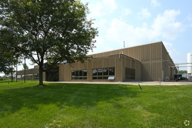
23900 Bell Rd, New Boston, MI 48164


NEARBY LISTINGS FOR SALE OR LEASE
-
-
View all New Boston listings for sale on LoopNet.com
Property Detail
23900 Bell Rd
75-077-99-0001-702
20A1B THAT PT OF THE NE 1/4 OF SEC 20 T4S R9E BEG N89DEG 49M 04S E 1323.21FT AND S01DEG 03M 31S E 1911.30FT AND N89DEG 28M 49S E 386.45FT FROM THE N 1/4 COR SEC 20 TH N89DEG 28M 48S E 873.44FT TH S02DEG 21M 14S E 492.56FT TH ALONG A CURVE CONC TO THE
Industrialgeneral
Wayne
X
Michigan
26163C0370F
0001
2024
10.02 AC
2025
Airport District
590401
Detroit
96,940 SF
Detroit-Warren-Dearborn, MI
DEMOGRAPHICS near 23900 Bell Rd
1 Mile
3 Mile
5 Mile
2024 Total Population
777
8,716
28,239
2029 Population
749
8,414
27,299
Pop Growth 2024-2029
(3.60%)
(3.46%)
(3.33%)
Average Age
40
42
42
2024 Total Households
265
3,199
10,707
HH Growth 2024-2029
(3.77%)
(3.44%)
(3.28%)
Median Household Inc
$90,570
$97,827
$81,324
Avg Household Size
2.90
2.70
2.60
2024 Avg HH Vehicles
2.00
2.00
2.00
Median Home Value
$296,794
$280,576
$261,295
Median Year Built
1991
1991
1989
Nearby Places
Map Layers
Map Styles
 Street
 Aerial
- Restaurants
- Banks
- Shops
- Fitness
- Groceries
PUBLIC TRANSPORTATION
AIRPORT
Detroit Metro Wayne County
DRIVE
WALK
Distance
Detroit Metro Wayne County
12 min
7.8 mi
Windsor International
DRIVE
WALK
Distance
Windsor International
59 min
36.2 mi
Freight Ports
Port of Toledo
DRIVE
WALK
Distance
Port of Toledo
54 min
41.5 mi
Nearby Properties
Address
Land Use
TOTAL SIZE
Lot Size
Zoning
Address
Land Use
TOTAL SIZE
Lot Size
Zoning
516,762 SF
51.63 AC
PDA
Address
Land Use
TOTAL SIZE
Lot Size
Zoning
323,057 SF
Address
Land Use
TOTAL SIZE
Lot Size
Zoning
323,057 SF
39.75 AC
I3 PLAN
Address
Land Use
TOTAL SIZE
Lot Size
Zoning
169,300 SF
229.95 AC
Address
Land Use
TOTAL SIZE
Lot Size
Zoning
285,251 SF
17.27 AC
I3 PLAN
Address
Land Use
TOTAL SIZE
Lot Size
Zoning
195,000 SF
31.38 AC
Address
Land Use
TOTAL SIZE
Lot Size
Zoning
381,545 SF
30.90 AC
I3 PLAN
Address
Land Use
TOTAL SIZE
Lot Size
Zoning
30,719 SF
9.93 AC
AG AGRI
Address
Land Use
TOTAL SIZE
Lot Size
Zoning
76.32 AC
PDA
Address
Land Use
TOTAL SIZE
Lot Size
Zoning
46,948 SF
19.70 AC
I2 HEAV
Address
Land Use
TOTAL SIZE
Lot Size
Zoning
61.35 AC
PDA
Address
Land Use
TOTAL SIZE
Lot Size
Zoning
54,852 SF
26.46 AC
I3 PLAN
Address
Land Use
TOTAL SIZE
Lot Size
Zoning
7,241 SF
63.61 AC
I1 LIGH
Address
Land Use
TOTAL SIZE
Lot Size
Zoning
43,724 SF
7.79 AC
I3 PLAN
Address
Land Use
TOTAL SIZE
Lot Size
Zoning
26.54 AC
MHP MOB
Address
Land Use
TOTAL SIZE
Lot Size
Zoning
62,740 SF
42.43 AC
Address
Land Use
TOTAL SIZE
Lot Size
Zoning
111,244 SF
6.15 AC
I2 HEAV
Address
Land Use
TOTAL SIZE
Lot Size
Zoning
75.90 AC
Address
Land Use
TOTAL SIZE
Lot Size
Zoning
27,567 SF
11.46 AC
Address
Land Use
TOTAL SIZE
Lot Size
Zoning
2,589 SF
10.75 AC
MHP MOB
Address
Land Use
TOTAL SIZE
Lot Size
Zoning
6,141 SF
5.07 AC
B2 GENE
Address
Land Use
TOTAL SIZE
Lot Size
Zoning
81.31 AC
AG AGRI
Address
Land Use
TOTAL SIZE
Lot Size
Zoning
8.65 AC
MHP MOB
Address
Land Use
TOTAL SIZE
Lot Size
Zoning
10.11 AC
MHP MOB
Address
Land Use
TOTAL SIZE
Lot Size
Zoning
48.31 AC
AG AGRI
Address
Land Use
TOTAL SIZE
Lot Size
Zoning
10.11 AC
MHP MOB
Address
Land Use
TOTAL SIZE
Lot Size
Zoning
42.80 AC
AG AGRI
Address
Land Use
TOTAL SIZE
Lot Size
Zoning
42.34 AC
I2 HEAV
Address
Land Use
TOTAL SIZE
Lot Size
Zoning
3,175 SF
1.02 AC
The World's #1 Commercial Real Estate Marketplace
Connect with us
© 2026 CoStar Group
The information above has been obtained from sources believed reliable. While we do not doubt its accuracy we have not verified it and make no guarantee, warranty or representation about it. It is your responsibility to independently confirm its accuracy and completeness. Any projections, opinions, assumptions, or estimates used are for example only and do not represent the current or future performance of the property. The value of this transaction to you depends on tax and other factors which should be evaluated by your tax, financial, and legal advisors. You and your advisors should conduct a careful, independent investigation of the property to determine to your satisfaction the suitability of the property for your needs.