Property Record
23911 Sw 132Nd Ave, Homestead, FL 33032
This Property Is For Sale
NEARBY LISTINGS FOR SALE OR LEASE
Property Detail
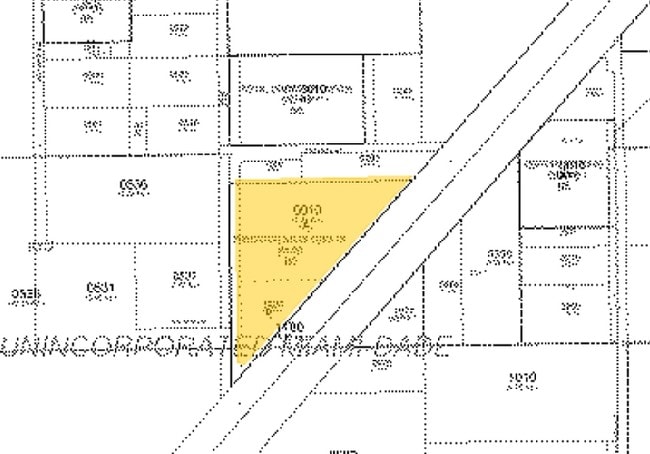
23911 Sw 132Nd Ave
Miami-Miami Beach-Kendall, FL
Pinemount 2Nd
30-6923-002-0010
23 56 39 3.46 AC PB 63-28 PRINCETON SALES CORP TRACT LOT A LOT SIZE 150718 SQUARE FEET OR 25283-1970 12/2006 5 (2)
Industrialacreage
Miami/Dade
X
Florida
12086C0592L
a
2024
3.46 AC
2025
South Dade
010400
South Florida
DEMOGRAPHICS near 23911 Sw 132Nd Ave
1 Mile
3 Mile
5 Mile
2024 Total Population
8,384
100,354
226,681
2029 Population
8,401
99,192
222,165
Pop Growth 2024-2029
+ 0.20%
(1.16%)
(1.99%)
Average Age
37
36
38
2024 Total Households
2,462
29,140
67,876
HH Growth 2024-2029
(0.28%)
(1.55%)
(2.44%)
Median Household Inc
$64,489
$62,074
$62,682
Avg Household Size
3.40
3.30
3.20
2024 Avg HH Vehicles
2.00
2.00
2.00
Median Home Value
$292,827
$326,973
$333,054
Median Year Built
2006
2001
1995
Nearby Places
- Restaurants
- Banks
- Shops
- Fitness
- Groceries
PUBLIC TRANSPORTATION
AIRPORT
Miami International
DRIVE
WALK
Distance
Miami International
36 min
22.9 mi
Freight Ports
Port of Miami
DRIVE
WALK
Distance
Port of Miami
45 min
30.0 mi
Nearby Properties
Address
Land Use
TOTAL SIZE
Lot Size
Zoning
Address
Land Use
TOTAL SIZE
Lot Size
Zoning
1,348,296 SF
76.88 AC
7600
Address
Land Use
TOTAL SIZE
Lot Size
Zoning
255,576 SF
8.77 AC
6051
Address
Land Use
TOTAL SIZE
Lot Size
Zoning
452,003 SF
10.85 AC
3161
Address
Land Use
TOTAL SIZE
Lot Size
Zoning
313,656 SF
10.71 AC
3900
Address
Land Use
TOTAL SIZE
Lot Size
Zoning
193,110 SF
6.73 AC
3900
Address
Land Use
TOTAL SIZE
Lot Size
Zoning
196,538 SF
6.33 AC
3900
Address
Land Use
TOTAL SIZE
Lot Size
Zoning
180,872 SF
5.85 AC
6262
Address
Land Use
TOTAL SIZE
Lot Size
Zoning
218,945 SF
7.92 AC
7061
Address
Land Use
TOTAL SIZE
Lot Size
Zoning
253,088 SF
2.90 AC
6072
Address
Land Use
TOTAL SIZE
Lot Size
Zoning
141,386 SF
9.62 AC
9000
Address
Land Use
TOTAL SIZE
Lot Size
Zoning
183,940 SF
4.80 AC
3050
Address
Land Use
TOTAL SIZE
Lot Size
Zoning
280,512 SF
44.85 AC
7600
Address
Land Use
TOTAL SIZE
Lot Size
Zoning
11,341 SF
212.73 AC
0100
Address
Land Use
TOTAL SIZE
Lot Size
Zoning
157,138 SF
28.11 AC
8050
Address
Land Use
TOTAL SIZE
Lot Size
Zoning
302,577 SF
8.04 AC
3050
Address
Land Use
TOTAL SIZE
Lot Size
Zoning
193,422 SF
15.26 AC
6400
Address
Land Use
TOTAL SIZE
Lot Size
Zoning
232,810 SF
24.61 AC
3800
Address
Land Use
TOTAL SIZE
Lot Size
Zoning
165,300 SF
10 AC
3050
Address
Land Use
TOTAL SIZE
Lot Size
Zoning
183,633 SF
3.78 AC
3802
Address
Land Use
TOTAL SIZE
Lot Size
Zoning
375,167 SF
22.77 AC
6061
Address
Land Use
TOTAL SIZE
Lot Size
Zoning
199,350 SF
3.75 AC
3161
Address
Land Use
TOTAL SIZE
Lot Size
Zoning
71,873 SF
6.54 AC
6400
Address
Land Use
TOTAL SIZE
Lot Size
Zoning
98,855 SF
6.53 AC
3700
Address
Land Use
TOTAL SIZE
Lot Size
Zoning
38.67 AC
3700
Address
Land Use
TOTAL SIZE
Lot Size
Zoning
107,920 SF
1.61 AC
6600
Address
Land Use
TOTAL SIZE
Lot Size
Zoning
233,856 SF
19.50 AC
3700
Address
Land Use
TOTAL SIZE
Lot Size
Zoning
226,882 SF
18.27 AC
3050
Address
Land Use
TOTAL SIZE
Lot Size
Zoning
111,488 SF
5.57 AC
6063
Address
Land Use
TOTAL SIZE
Lot Size
Zoning
158,534 SF
9.56 AC
3800
Address
Land Use
TOTAL SIZE
Lot Size
Zoning
95,130 SF
2.59 AC
3050
The World's #1 Commercial Real Estate Marketplace
Connect with us
© 2025 CoStar Group
The information above has been obtained from sources believed reliable. While we do not doubt its accuracy we have not verified it and make no guarantee, warranty or representation about it. It is your responsibility to independently confirm its accuracy and completeness. Any projections, opinions, assumptions, or estimates used are for example only and do not represent the current or future performance of the property. The value of this transaction to you depends on tax and other factors which should be evaluated by your tax, financial, and legal advisors. You and your advisors should conduct a careful, independent investigation of the property to determine to your satisfaction the suitability of the property for your needs.