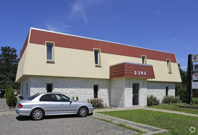
Property Record
2393 Coon Rapids Blvd Nw, Minneapolis, MN 55433
NEARBY LISTINGS FOR SALE OR LEASE
Property Detail
2393 Coon Rapids Blvd Nw
Minneapolis-St. Paul-Bloomington, MN-WI
Dailey & Herda 2Nd Addition
22-31-24-22-0073
THE SELY 95 FT OF FOL DESC TRACT: THAT PRT OF LOT 14 BLK 4 DAILEY & HERDA 2ND ADD LYG ELY OF A LINE DRAWN NELY PRLL/W NWLY LI
Commercialacreage
Anoka
X
Minnesota
27053C0087F
14
2025
0.36 AC
2025
Suburban St Paul
050607
Minneapolis/St Paul
DEMOGRAPHICS near 2393 Coon Rapids Blvd Nw
1 Mile
3 Mile
5 Mile
2024 Total Population
11,674
83,264
219,004
2029 Population
12,096
84,752
222,484
Pop Growth 2024-2029
+ 3.61%
+ 1.79%
+ 1.59%
Average Age
40
40
40
2024 Total Households
4,649
30,762
80,776
HH Growth 2024-2029
+ 3.70%
+ 1.97%
+ 1.73%
Median Household Inc
$65,558
$85,460
$85,972
Avg Household Size
2.40
2.60
2.60
2024 Avg HH Vehicles
2.00
2.00
2.00
Median Home Value
$235,429
$271,723
$275,243
Median Year Built
1973
1984
1984
Nearby Places
Map Layers
Map Styles
 Street
 Aerial
- Restaurants
- Banks
- Shops
- Fitness
- Groceries
PUBLIC TRANSPORTATION
COMMUTER RAIL
Coon Rapids-Riverdale Station (Northstar Corridor - Northstar Commuter Rail)
DRIVE
WALK
Distance
Coon Rapids-Riverdale Station (Northstar Corridor - Northstar Commuter Rail)
6 min
2.4 mi
Anoka Station (Northstar Corridor - Northstar Commuter Rail)
DRIVE
WALK
Distance
Anoka Station (Northstar Corridor - Northstar Commuter Rail)
10 min
4.7 mi
AIRPORT
Minneapolis-St Paul International/Wold-Chamberlain
DRIVE
WALK
Distance
Minneapolis-St Paul International/Wold-Chamberlain
43 min
26.5 mi
SALE & LEASE HISTORY
LISTING DATE
SALE/LEASE

Oct 05, 2022
For Lease
Aug 06, 2018
For Lease
Nearby Properties
Address
Land Use
TOTAL SIZE
Lot Size
Zoning
Address
Land Use
TOTAL SIZE
Lot Size
Zoning
517,619 SF
3.85 AC
Address
Land Use
TOTAL SIZE
Lot Size
Zoning
412,914 SF
40 AC
Address
Land Use
TOTAL SIZE
Lot Size
Zoning
Address
Land Use
TOTAL SIZE
Lot Size
Zoning
319,826 SF
37.97 AC
Address
Land Use
TOTAL SIZE
Lot Size
Zoning
5,110 SF
38.62 AC
Address
Land Use
TOTAL SIZE
Lot Size
Zoning
Address
Land Use
TOTAL SIZE
Lot Size
Zoning
122,816 SF
27.84 AC
Address
Land Use
TOTAL SIZE
Lot Size
Zoning
Address
Land Use
TOTAL SIZE
Lot Size
Zoning
4.51 AC
Address
Land Use
TOTAL SIZE
Lot Size
Zoning
129,060 SF
10.21 AC
Address
Land Use
TOTAL SIZE
Lot Size
Zoning
Address
Land Use
TOTAL SIZE
Lot Size
Zoning
167 SF
4.73 AC
Address
Land Use
TOTAL SIZE
Lot Size
Zoning
342,686 SF
13.60 AC
Address
Land Use
TOTAL SIZE
Lot Size
Zoning
159,335 SF
13.64 AC
Address
Land Use
TOTAL SIZE
Lot Size
Zoning
148 SF
39.49 AC
Address
Land Use
TOTAL SIZE
Lot Size
Zoning
2.95 AC
Address
Land Use
TOTAL SIZE
Lot Size
Zoning
116,452 SF
8.68 AC
Address
Land Use
TOTAL SIZE
Lot Size
Zoning
151,862 SF
12.97 AC
Address
Land Use
TOTAL SIZE
Lot Size
Zoning
137 SF
8.50 AC
Address
Land Use
TOTAL SIZE
Lot Size
Zoning
126 SF
7.19 AC
Address
Land Use
TOTAL SIZE
Lot Size
Zoning
160,668 SF
14.87 AC
Address
Land Use
TOTAL SIZE
Lot Size
Zoning
8,227 SF
23.35 AC
Address
Land Use
TOTAL SIZE
Lot Size
Zoning
89,466 SF
5.76 AC
Address
Land Use
TOTAL SIZE
Lot Size
Zoning
195,228 SF
14.77 AC
Address
Land Use
TOTAL SIZE
Lot Size
Zoning
30,308 SF
54.48 AC
Address
Land Use
TOTAL SIZE
Lot Size
Zoning
Address
Land Use
TOTAL SIZE
Lot Size
Zoning
3.80 AC
Address
Land Use
TOTAL SIZE
Lot Size
Zoning
115,846 SF
2.35 AC
Address
Land Use
TOTAL SIZE
Lot Size
Zoning
110 SF
4.48 AC
Address
Land Use
TOTAL SIZE
Lot Size
Zoning
The World's #1 Commercial Real Estate Marketplace
Connect with us
© 2025 CoStar Group
The information above has been obtained from sources believed reliable. While we do not doubt its accuracy we have not verified it and make no guarantee, warranty or representation about it. It is your responsibility to independently confirm its accuracy and completeness. Any projections, opinions, assumptions, or estimates used are for example only and do not represent the current or future performance of the property. The value of this transaction to you depends on tax and other factors which should be evaluated by your tax, financial, and legal advisors. You and your advisors should conduct a careful, independent investigation of the property to determine to your satisfaction the suitability of the property for your needs.