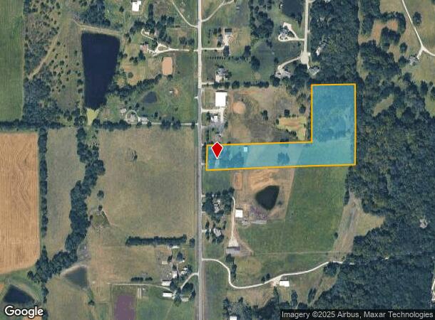
Property Record
23950 147Th St, Leavenworth, KS 66048

NEARBY LISTINGS FOR SALE OR LEASE
Property Detail
23950 147Th St
151-01-0-00-00-009.00-0
S01, T10, R22E, ACRES 10.04, PT W1/2 W1/2; BEG 151S & 30E NW COR, E925, N485, E366.78, S686.59, W TO 147TH ST, N201.59 TO POB LESS ROW
Agriculturalland
Leavenworth
X
Kansas
20103C0233G
10.04 AC
2024
Leavenworth County
2025
Kansas City
071104
Kansas City, MO-KS
4,077 SF
DEMOGRAPHICS near 23950 147Th St
1 Mile
3 Mile
5 Mile
2024 Total Population
544
8,439
24,196
2029 Population
558
8,645
24,608
Pop Growth 2024-2029
+ 2.57%
+ 2.44%
+ 1.70%
Average Age
41
41
41
2024 Total Households
179
2,724
7,908
HH Growth 2024-2029
+ 2.79%
+ 2.57%
+ 1.77%
Median Household Inc
$154,762
$133,178
$109,028
Avg Household Size
3.00
2.80
2.70
2024 Avg HH Vehicles
3.00
3.00
2.00
Median Home Value
$365,624
$340,930
$307,718
Median Year Built
2000
1993
1990
Nearby Places
Map Layers
Map Styles
 Street
 Aerial
- Restaurants
- Banks
- Shops
- Fitness
- Groceries
PUBLIC TRANSPORTATION
AIRPORT
Kansas City International
DRIVE
WALK
Distance
Kansas City International
40 min
28.6 mi
Freight Ports
Tulsa Port Of Catoosa
DRIVE
WALK
Distance
Tulsa Port Of Catoosa
284 min
251.7 mi
Nearby Properties
Address
Land Use
TOTAL SIZE
Lot Size
Zoning
Address
Land Use
TOTAL SIZE
Lot Size
Zoning
238,164 SF
153.40 AC
Address
Land Use
TOTAL SIZE
Lot Size
Zoning
141,398 SF
24.20 AC
Address
Land Use
TOTAL SIZE
Lot Size
Zoning
200,862 SF
39.51 AC
Address
Land Use
TOTAL SIZE
Lot Size
Zoning
26,000 SF
109.21 AC
WYAG
Address
Land Use
TOTAL SIZE
Lot Size
Zoning
32,463 SF
7.60 AC
Address
Land Use
TOTAL SIZE
Lot Size
Zoning
55,961 SF
22.45 AC
Address
Land Use
TOTAL SIZE
Lot Size
Zoning
12,000 SF
1.24 AC
Address
Land Use
TOTAL SIZE
Lot Size
Zoning
20,573 SF
4.60 AC
Address
Land Use
TOTAL SIZE
Lot Size
Zoning
572 SF
127.94 AC
Address
Land Use
TOTAL SIZE
Lot Size
Zoning
15,444 SF
4.91 AC
Address
Land Use
TOTAL SIZE
Lot Size
Zoning
47.61 AC
WYAG
Address
Land Use
TOTAL SIZE
Lot Size
Zoning
31,671 SF
2.85 AC
Address
Land Use
TOTAL SIZE
Lot Size
Zoning
10,500 SF
1.44 AC
Address
Land Use
TOTAL SIZE
Lot Size
Zoning
13,466 SF
23.41 AC
Address
Land Use
TOTAL SIZE
Lot Size
Zoning
12,390 SF
2.42 AC
Address
Land Use
TOTAL SIZE
Lot Size
Zoning
4,080 SF
3.22 AC
COM
Address
Land Use
TOTAL SIZE
Lot Size
Zoning
4,212 SF
9.85 AC
Address
Land Use
TOTAL SIZE
Lot Size
Zoning
15,059 SF
1.69 AC
Address
Land Use
TOTAL SIZE
Lot Size
Zoning
11,600 SF
2.26 AC
Address
Land Use
TOTAL SIZE
Lot Size
Zoning
6,768 SF
2.97 AC
Address
Land Use
TOTAL SIZE
Lot Size
Zoning
3,524 SF
1.25 AC
Address
Land Use
TOTAL SIZE
Lot Size
Zoning
3,801 SF
9.51 AC
WR1
Address
Land Use
TOTAL SIZE
Lot Size
Zoning
20,000 SF
2.25 AC
Address
Land Use
TOTAL SIZE
Lot Size
Zoning
18,156 SF
175.09 AC
Address
Land Use
TOTAL SIZE
Lot Size
Zoning
1,067 SF
14.86 AC
Address
Land Use
TOTAL SIZE
Lot Size
Zoning
9,600 SF
3.40 AC
Address
Land Use
TOTAL SIZE
Lot Size
Zoning
2,448 SF
1.42 AC
Address
Land Use
TOTAL SIZE
Lot Size
Zoning
6,582 SF
2.06 AC
Address
Land Use
TOTAL SIZE
Lot Size
Zoning
1,296 SF
15.26 AC
Address
Land Use
TOTAL SIZE
Lot Size
Zoning
27,872 SF
5.06 AC
The World's #1 Commercial Real Estate Marketplace
Connect with us
© 2025 CoStar Group
The information above has been obtained from sources believed reliable. While we do not doubt its accuracy we have not verified it and make no guarantee, warranty or representation about it. It is your responsibility to independently confirm its accuracy and completeness. Any projections, opinions, assumptions, or estimates used are for example only and do not represent the current or future performance of the property. The value of this transaction to you depends on tax and other factors which should be evaluated by your tax, financial, and legal advisors. You and your advisors should conduct a careful, independent investigation of the property to determine to your satisfaction the suitability of the property for your needs.