Property Record
24 Computer Dr W, Albany, NY 12205
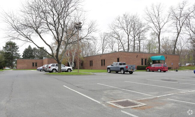

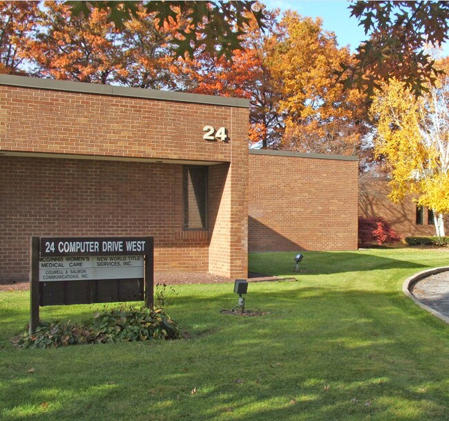

Property Detail
24 Computer Dr W
012689-042-001-0001-034-000-0000
N-RT 87 E-12 CERONE C-17-73.1
Officebuilding
Albany
12
New York
B and X Area of moderate flood hazard, usually the area between the limits of the 100-year and 500-year floods.
34.000
2025
1.90 AC
2025
E Outer Albany County
013703
Albany/Schenectady/Troy
21,494 SF
Albany-Schenectady-Troy, NY
NEARBY LISTINGS FOR SALE OR LEASE
DEMOGRAPHICS near 24 Computer Dr W
1 mile
3 mile
5 mile
2025 Total Population
4,570
51,607
173,318
2030 Population
4,622
52,242
175,522
Pop Growth 2025-2030
+ 1.14%
+ 1.23%
+ 1.27%
Average Age
45
41
40
2025 Total Households
2,220
18,966
70,440
HH Growth 2025-2030
+ 1.49%
+ 1.44%
+ 1.38%
Median Household Inc
$91,260
$94,129
$81,646
Avg Household Size
2.00
2.30
2.20
2025 Avg HH Vehicles
1.00
2.00
2.00
Median Home Value
$343,358
$299,139
$296,844
Median Year Built
1978
1967
1966
Nearby Places
Map Layers
Map Styles
 Street
 Aerial
Layers
 Traffic
 Biking
Places
Listings with unknown addresses are not visible on the map
- Restaurants
- Banks
- Shops
- Fitness
- Groceries
PUBLIC TRANSPORTATION
COMMUTER RAIL
Drive
Walk
Distance
20 min
9.2 mi
AIRPORT
Albany International
Drive
Walk
Distance
Albany International
9 min
4.1 mi
SALE & LEASE HISTORY
LISTING DATE
SALE/LEASE

Sep 25, 2016
For Lease
Jun 10, 2021
For Lease
Nearby Properties
Address
Land Use
TOTAL SIZE
Lot Size
Zoning
Address
Land Use
TOTAL SIZE
Lot Size
Zoning
72,000 SF
279.23 AC
CO
Address
Land Use
TOTAL SIZE
Lot Size
Zoning
5.04 AC
CM
Address
Land Use
TOTAL SIZE
Lot Size
Zoning
Address
Land Use
TOTAL SIZE
Lot Size
Zoning
821,670 SF
803.50 AC
17
Address
Land Use
TOTAL SIZE
Lot Size
Zoning
18,340 SF
159.67 AC
04 - FARM
Address
Land Use
TOTAL SIZE
Lot Size
Zoning
151,305 SF
9.60 AC
R4
Address
Land Use
TOTAL SIZE
Lot Size
Zoning
10,216 SF
48.37 AC
16
Address
Land Use
TOTAL SIZE
Lot Size
Zoning
595,472 SF
6.06 AC
CO
Address
Land Use
TOTAL SIZE
Lot Size
Zoning
12,096 SF
73.12 AC
CM
Address
Land Use
TOTAL SIZE
Lot Size
Zoning
242,658 SF
29 AC
19
Address
Land Use
TOTAL SIZE
Lot Size
Zoning
373,296 SF
11.70 AC
46
Address
Land Use
TOTAL SIZE
Lot Size
Zoning
213,860 SF
28.20 AC
C2
Address
Land Use
TOTAL SIZE
Lot Size
Zoning
135,000 SF
14.64 AC
R1B
Address
Land Use
TOTAL SIZE
Lot Size
Zoning
226,171 SF
26.39 AC
12
Address
Land Use
TOTAL SIZE
Lot Size
Zoning
301,834 SF
9 AC
26
Address
Land Use
TOTAL SIZE
Lot Size
Zoning
279,150 SF
21.10 AC
CO
Address
Land Use
TOTAL SIZE
Lot Size
Zoning
266,600 SF
22.60 AC
47
Address
Land Use
TOTAL SIZE
Lot Size
Zoning
84,242 SF
43.60 AC
12
Address
Land Use
TOTAL SIZE
Lot Size
Zoning
25,786 SF
8 AC
17
Address
Land Use
TOTAL SIZE
Lot Size
Zoning
8,084 SF
36.30 AC
25
Address
Land Use
TOTAL SIZE
Lot Size
Zoning
31,080 SF
13.60 AC
LB
Address
Land Use
TOTAL SIZE
Lot Size
Zoning
167,222 SF
15.65 AC
14
Address
Land Use
TOTAL SIZE
Lot Size
Zoning
66,419 SF
2 AC
CPB
Address
Land Use
TOTAL SIZE
Lot Size
Zoning
87.50 AC
CO
Address
Land Use
TOTAL SIZE
Lot Size
Zoning
10,500 SF
40.10 AC
CO
Address
Land Use
TOTAL SIZE
Lot Size
Zoning
77.50 AC
M1
Address
Land Use
TOTAL SIZE
Lot Size
Zoning
162,500 SF
19.90 AC
17
Address
Land Use
TOTAL SIZE
Lot Size
Zoning
256,101 SF
9 AC
12
Address
Land Use
TOTAL SIZE
Lot Size
Zoning
150,000 SF
1 AC
CM
Address
Land Use
TOTAL SIZE
Lot Size
Zoning
137,784 SF
2.30 AC
C2
The World's #1 Commercial Real Estate Marketplace
Connect with us
© 2026 CoStar Group
The information above has been obtained from sources believed reliable. While we do not doubt its accuracy we have not verified it and make no guarantee, warranty or representation about it. It is your responsibility to independently confirm its accuracy and completeness. Any projections, opinions, assumptions, or estimates used are for example only and do not represent the current or future performance of the property. The value of this transaction to you depends on tax and other factors which should be evaluated by your tax, financial, and legal advisors. You and your advisors should conduct a careful, independent investigation of the property to determine to your satisfaction the suitability of the property for your needs.