Property Record
24 Jarrod Rd, Boulder, WY 82923
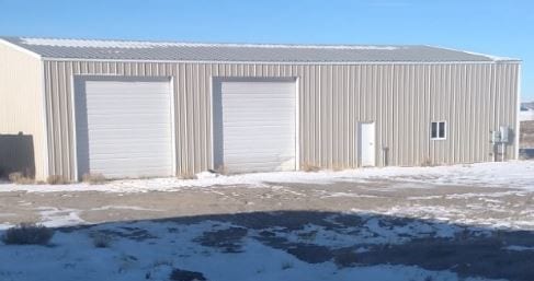

Property Detail
24 Jarrod Rd
01-00-11199
SAND DRAW INDUSTRIAL PARK SECOND, LOT 65.
Commercialnec
SUBLETTE
IH
Wyoming
2025
65
2025
3.34 AC
000104
Wyoming Area
4,000 SF
Other Market Areas
NEARBY LISTINGS FOR SALE OR LEASE
-
-
View all Boulder listings for sale on LoopNet.com
DEMOGRAPHICS near 24 Jarrod Rd
1 mile
3 mile
5 mile
2025 Total Population
272
353
449
2030 Population
281
364
463
Pop Growth 2025-2030
+ 3.31%
+ 3.12%
+ 3.12%
Average Age
41
41
41
2025 Total Households
108
140
178
HH Growth 2025-2030
+ 2.78%
+ 2.86%
+ 2.81%
Median Household Inc
$81,875
$82,211
$82,197
Avg Household Size
2.50
2.50
2.50
2025 Avg HH Vehicles
3.00
3.00
3.00
Median Home Value
$492,856
$499,999
$490,908
Median Year Built
1986
1987
1986
Nearby Places
Map Layers
Map Styles
 Street
 Aerial
Layers
 Traffic
 Biking
Places
Listings with unknown addresses are not visible on the map
- Restaurants
- Banks
- Shops
- Fitness
- Groceries
SALE & LEASE HISTORY
LISTING DATE
SALE/LEASE

Dec 15, 2017
For Sale
Nearby Properties
Address
Land Use
TOTAL SIZE
Lot Size
Zoning
Address
Land Use
TOTAL SIZE
Lot Size
Zoning
1,782 SF
9.09 AC
IL
Address
Land Use
TOTAL SIZE
Lot Size
Zoning
3,200 SF
5 AC
IH
Address
Land Use
TOTAL SIZE
Lot Size
Zoning
5,696 SF
5 AC
IH
Address
Land Use
TOTAL SIZE
Lot Size
Zoning
11,024 SF
2.46 AC
IH
Address
Land Use
TOTAL SIZE
Lot Size
Zoning
1,296 SF
26.41 AC
IH
Address
Land Use
TOTAL SIZE
Lot Size
Zoning
6,000 SF
4.55 AC
IL
Address
Land Use
TOTAL SIZE
Lot Size
Zoning
2,280 SF
8.37 AC
IH
Address
Land Use
TOTAL SIZE
Lot Size
Zoning
11,448 SF
4.67 AC
IH
Address
Land Use
TOTAL SIZE
Lot Size
Zoning
3,024 SF
2.69 AC
CH1
Address
Land Use
TOTAL SIZE
Lot Size
Zoning
2,784 SF
4.33 AC
IL
Address
Land Use
TOTAL SIZE
Lot Size
Zoning
1,782 SF
4.45 AC
IH
Address
Land Use
TOTAL SIZE
Lot Size
Zoning
7,320 SF
4.55 AC
IL
Address
Land Use
TOTAL SIZE
Lot Size
Zoning
5,000 SF
4.55 AC
IL
Address
Land Use
TOTAL SIZE
Lot Size
Zoning
6,400 SF
3.08 AC
IL
Address
Land Use
TOTAL SIZE
Lot Size
Zoning
24,000 SF
8.98 AC
IL
Address
Land Use
TOTAL SIZE
Lot Size
Zoning
630 SF
4.12 AC
IH
Address
Land Use
TOTAL SIZE
Lot Size
Zoning
7,200 SF
4.45 AC
IL
Address
Land Use
TOTAL SIZE
Lot Size
Zoning
4,800 SF
4.55 AC
IL
Address
Land Use
TOTAL SIZE
Lot Size
Zoning
6,660 SF
4.20 AC
IH
Address
Land Use
TOTAL SIZE
Lot Size
Zoning
2,146 SF
9.09 AC
IH
Address
Land Use
TOTAL SIZE
Lot Size
Zoning
5,000 SF
2.61 AC
IH
Address
Land Use
TOTAL SIZE
Lot Size
Zoning
3,472 SF
4.99 AC
IH
Address
Land Use
TOTAL SIZE
Lot Size
Zoning
3,072 SF
4.91 AC
IH
Address
Land Use
TOTAL SIZE
Lot Size
Zoning
11,700 SF
4.55 AC
IH
Address
Land Use
TOTAL SIZE
Lot Size
Zoning
3,500 SF
4.70 AC
IH
Address
Land Use
TOTAL SIZE
Lot Size
Zoning
3,472 SF
2.59 AC
IH
Address
Land Use
TOTAL SIZE
Lot Size
Zoning
4,800 SF
5 AC
IH
Address
Land Use
TOTAL SIZE
Lot Size
Zoning
1,404 SF
2.46 AC
IH
Address
Land Use
TOTAL SIZE
Lot Size
Zoning
5,040 SF
4.55 AC
IL
The World's #1 Commercial Real Estate Marketplace
Connect with us
© 2026 CoStar Group
The information above has been obtained from sources believed reliable. While we do not doubt its accuracy we have not verified it and make no guarantee, warranty or representation about it. It is your responsibility to independently confirm its accuracy and completeness. Any projections, opinions, assumptions, or estimates used are for example only and do not represent the current or future performance of the property. The value of this transaction to you depends on tax and other factors which should be evaluated by your tax, financial, and legal advisors. You and your advisors should conduct a careful, independent investigation of the property to determine to your satisfaction the suitability of the property for your needs.