Property Record
24 Narragansett Ave, Jamestown, RI 02835
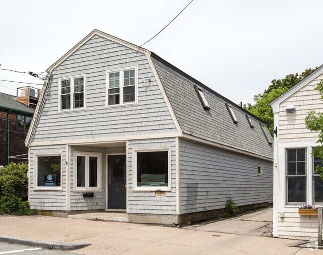

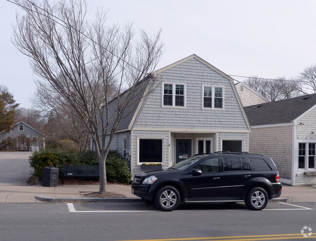
Property Detail
24 Narragansett Ave
JAME-000008-000000-000604
Newport
Commercialofficeresidentialmixeduse
Rhode Island
CD
604
B and X Area of moderate flood hazard, usually the area between the limits of the 100-year and 500-year floods.
0.09 AC
2025
Newport County
2025
Providence
041300
Providence-Warwick, RI-MA
1,757 SF
NEARBY LISTINGS FOR SALE OR LEASE
-
-
View all Jamestown listings for sale on LoopNet.com
DEMOGRAPHICS near 24 Narragansett Ave
1 mile
3 mile
5 mile
2025 Total Population
2,239
13,923
53,585
2030 Population
2,210
13,925
53,242
Pop Growth 2025-2030
(1.30%)
+ 0.01%
(0.64%)
Average Age
53
45
44
2025 Total Households
1,060
6,076
23,059
HH Growth 2025-2030
(0.47%)
+ 0.69%
(1.60%)
Median Household Inc
$124,801
$81,250
$100,810
Avg Household Size
2.10
2.10
2.10
2025 Avg HH Vehicles
2.00
2.00
2.00
Median Home Value
$954,917
$877,278
$726,434
Median Year Built
1959
1964
1964
Nearby Places
Map Layers
Map Styles
 Street
 Aerial
Layers
 Traffic
 Biking
Places
Listings with unknown addresses are not visible on the map
- Restaurants
- Banks
- Shops
- Fitness
- Groceries
PUBLIC TRANSPORTATION
AIRPORT
Rhode Island Tf Green International
Drive
Walk
Distance
Rhode Island Tf Green International
40 min
25.4 mi
SALE & LEASE HISTORY
LISTING DATE
SALE/LEASE

Jun 20, 2017
For Sale
Nearby Properties
Address
Land Use
TOTAL SIZE
Lot Size
Zoning
Address
Land Use
TOTAL SIZE
Lot Size
Zoning
264,032 SF
3.73 AC
GB
Address
Land Use
TOTAL SIZE
Lot Size
Zoning
237,976 SF
8.99 AC
WB
Address
Land Use
TOTAL SIZE
Lot Size
Zoning
17,739 SF
103.90 AC
P
Address
Land Use
TOTAL SIZE
Lot Size
Zoning
249,902 SF
27.88 AC
UV
Address
Land Use
TOTAL SIZE
Lot Size
Zoning
76,534 SF
5.29 AC
WB
Address
Land Use
TOTAL SIZE
Lot Size
Zoning
217,212 SF
10.46 AC
R10
Address
Land Use
TOTAL SIZE
Lot Size
Zoning
172,320 SF
10.14 AC
R10
Address
Land Use
TOTAL SIZE
Lot Size
Zoning
21,977 SF
36.71 AC
R120
Address
Land Use
TOTAL SIZE
Lot Size
Zoning
21.21 AC
RR20
Address
Land Use
TOTAL SIZE
Lot Size
Zoning
41,145 SF
9.33 AC
R120
Address
Land Use
TOTAL SIZE
Lot Size
Zoning
36,984 SF
10 AC
R10
Address
Land Use
TOTAL SIZE
Lot Size
Zoning
50,220 SF
8.83 AC
TM
Address
Land Use
TOTAL SIZE
Lot Size
Zoning
24 AC
R120
Address
Land Use
TOTAL SIZE
Lot Size
Zoning
45,283 SF
1.66 AC
WB
Address
Land Use
TOTAL SIZE
Lot Size
Zoning
77.46 AC
R80
Address
Land Use
TOTAL SIZE
Lot Size
Zoning
121,259 SF
6.40 AC
GB
Address
Land Use
TOTAL SIZE
Lot Size
Zoning
56,313 SF
0.53 AC
GB
Address
Land Use
TOTAL SIZE
Lot Size
Zoning
10.64 AC
P
Address
Land Use
TOTAL SIZE
Lot Size
Zoning
87,092 SF
1.46 AC
WB
Address
Land Use
TOTAL SIZE
Lot Size
Zoning
51,686 SF
2.46 AC
WB
Address
Land Use
TOTAL SIZE
Lot Size
Zoning
9,744 SF
15 AC
R120
Address
Land Use
TOTAL SIZE
Lot Size
Zoning
44,396 SF
0.80 AC
GB
Address
Land Use
TOTAL SIZE
Lot Size
Zoning
52.56 AC
R120
Address
Land Use
TOTAL SIZE
Lot Size
Zoning
1,929 SF
2.70 AC
R80
Address
Land Use
TOTAL SIZE
Lot Size
Zoning
43,454 SF
3.68 AC
P
Address
Land Use
TOTAL SIZE
Lot Size
Zoning
22,901 SF
139.98 AC
R160
Address
Land Use
TOTAL SIZE
Lot Size
Zoning
14,844 SF
1.75 AC
WB
Address
Land Use
TOTAL SIZE
Lot Size
Zoning
96,672 SF
2.30 AC
GB
Address
Land Use
TOTAL SIZE
Lot Size
Zoning
5.80 AC
R80
Address
Land Use
TOTAL SIZE
Lot Size
Zoning
26,503 SF
9.58 AC
R120
The World's #1 Commercial Real Estate Marketplace
Connect with us
© 2026 CoStar Group
The information above has been obtained from sources believed reliable. While we do not doubt its accuracy we have not verified it and make no guarantee, warranty or representation about it. It is your responsibility to independently confirm its accuracy and completeness. Any projections, opinions, assumptions, or estimates used are for example only and do not represent the current or future performance of the property. The value of this transaction to you depends on tax and other factors which should be evaluated by your tax, financial, and legal advisors. You and your advisors should conduct a careful, independent investigation of the property to determine to your satisfaction the suitability of the property for your needs.