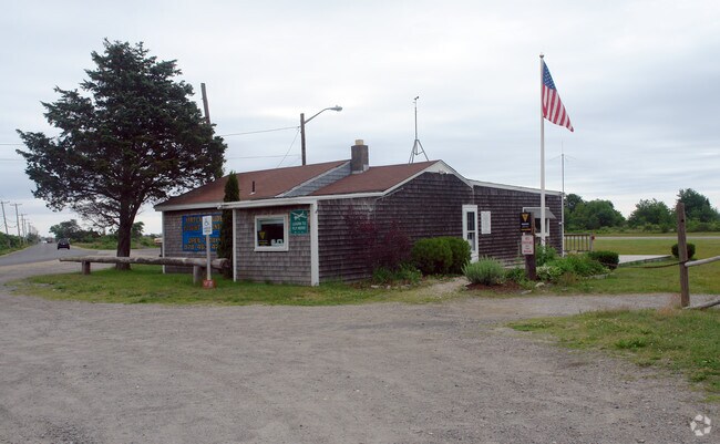
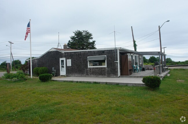
Property Record
24 Plum Island Tpke, Newbury, MA 01951
NEARBY LISTINGS FOR SALE OR LEASE
Property Detail
24 Plum Island Tpke
NEWB-000049R-000000-000009
Essex
Taxexempt
Massachusetts
AE
9
25009C0137G
43.79 AC
0
Amesbury/Ipswich
2025
Boston
269100
Boston-Cambridge-Newton, MA-NH
DEMOGRAPHICS near 24 Plum Island Tpke
1 Mile
3 Mile
5 Mile
2024 Total Population
1,240
17,245
33,734
2029 Population
1,270
17,432
33,946
Pop Growth 2024-2029
+ 2.42%
+ 1.08%
+ 0.63%
Average Age
49
48
47
2024 Total Households
570
7,961
14,811
HH Growth 2024-2029
+ 2.46%
+ 0.82%
+ 0.52%
Median Household Inc
$113,994
$113,861
$111,336
Avg Household Size
2.20
2.10
2.20
2024 Avg HH Vehicles
2.00
2.00
2.00
Median Home Value
$740,384
$721,077
$681,704
Median Year Built
1953
1948
1961
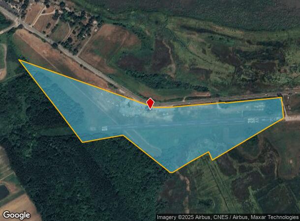
Nearby Places
Map Layers
Map Styles
 Street
 Aerial
- Restaurants
- Banks
- Shops
- Fitness
- Groceries
PUBLIC TRANSPORTATION
COMMUTER RAIL
Newburyport (Newburyport/Rockport Line - Massachusetts Bay Transportation Authority Commuter Rail (Purple Line))
DRIVE
WALK
Distance
Newburyport (Newburyport/Rockport Line - Massachusetts Bay Transportation Authority Commuter Rail (Purple Line))
5 min
2.5 mi
Rowley (Newburyport/Rockport Line - Massachusetts Bay Transportation Authority Commuter Rail (Purple Line))
DRIVE
WALK
Distance
Rowley (Newburyport/Rockport Line - Massachusetts Bay Transportation Authority Commuter Rail (Purple Line))
14 min
7.3 mi
AIRPORT
Portsmouth International at Pease
DRIVE
WALK
Distance
Portsmouth International at Pease
37 min
25.4 mi
Freight Ports
Port of Boston
DRIVE
WALK
Distance
Port of Boston
59 min
40.7 mi
Nearby Properties
Address
Land Use
TOTAL SIZE
Lot Size
Zoning
Address
Land Use
TOTAL SIZE
Lot Size
Zoning
207,982 SF
14.58 AC
Address
Land Use
TOTAL SIZE
Lot Size
Zoning
2,295.68 AC
AR4
Address
Land Use
TOTAL SIZE
Lot Size
Zoning
170,444 SF
13.30 AC
Address
Land Use
TOTAL SIZE
Lot Size
Zoning
163,948 SF
20.31 AC
Address
Land Use
TOTAL SIZE
Lot Size
Zoning
1,109 AC
AR4
Address
Land Use
TOTAL SIZE
Lot Size
Zoning
100,874 SF
2.10 AC
Address
Land Use
TOTAL SIZE
Lot Size
Zoning
441.30 AC
BC
Address
Land Use
TOTAL SIZE
Lot Size
Zoning
792.79 AC
AR4
Address
Land Use
TOTAL SIZE
Lot Size
Zoning
81,324 SF
2.01 AC
Address
Land Use
TOTAL SIZE
Lot Size
Zoning
37,208 SF
1.83 AC
Address
Land Use
TOTAL SIZE
Lot Size
Zoning
7,768 SF
3.98 AC
Address
Land Use
TOTAL SIZE
Lot Size
Zoning
44,661 SF
4.47 AC
Address
Land Use
TOTAL SIZE
Lot Size
Zoning
95,903 SF
1.64 AC
Address
Land Use
TOTAL SIZE
Lot Size
Zoning
93,090 SF
87 SF
Address
Land Use
TOTAL SIZE
Lot Size
Zoning
57,754 SF
5.27 AC
Address
Land Use
TOTAL SIZE
Lot Size
Zoning
65,124 SF
0.79 AC
Address
Land Use
TOTAL SIZE
Lot Size
Zoning
31,428 SF
10.61 AC
Address
Land Use
TOTAL SIZE
Lot Size
Zoning
92,907 SF
5.76 AC
Address
Land Use
TOTAL SIZE
Lot Size
Zoning
133,559 SF
10.31 AC
Address
Land Use
TOTAL SIZE
Lot Size
Zoning
78,027 SF
10.63 AC
Address
Land Use
TOTAL SIZE
Lot Size
Zoning
52.50 AC
Address
Land Use
TOTAL SIZE
Lot Size
Zoning
131,400 SF
13.80 AC
Address
Land Use
TOTAL SIZE
Lot Size
Zoning
66,372 SF
4.08 AC
Address
Land Use
TOTAL SIZE
Lot Size
Zoning
36,701 SF
1.10 AC
Address
Land Use
TOTAL SIZE
Lot Size
Zoning
30,270 SF
0.74 AC
Address
Land Use
TOTAL SIZE
Lot Size
Zoning
79,394 SF
9.90 AC
Address
Land Use
TOTAL SIZE
Lot Size
Zoning
82,000 SF
24.10 AC
Address
Land Use
TOTAL SIZE
Lot Size
Zoning
121,400 SF
11.39 AC
AR4
Address
Land Use
TOTAL SIZE
Lot Size
Zoning
4.11 AC
Address
Land Use
TOTAL SIZE
Lot Size
Zoning
29,376 SF
5.34 AC
The World's #1 Commercial Real Estate Marketplace
Connect with us
© 2026 CoStar Group
The information above has been obtained from sources believed reliable. While we do not doubt its accuracy we have not verified it and make no guarantee, warranty or representation about it. It is your responsibility to independently confirm its accuracy and completeness. Any projections, opinions, assumptions, or estimates used are for example only and do not represent the current or future performance of the property. The value of this transaction to you depends on tax and other factors which should be evaluated by your tax, financial, and legal advisors. You and your advisors should conduct a careful, independent investigation of the property to determine to your satisfaction the suitability of the property for your needs.