Property Record
24 Pratt St, Southington, CT 06489
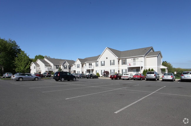


Property Detail
24 Pratt St
SOUT-000015-000000-000026
HARTFORD
Apartmenthouse5plusunits
Connecticut
B
26
B and X Area of moderate flood hazard, usually the area between the limits of the 100-year and 500-year floods.
2 AC
2025
Southington/Berlin
2025
Hartford
430301
Hartford-West Hartford-East Hartford, CT
35,060 SF
NEARBY LISTINGS FOR SALE OR LEASE
DEMOGRAPHICS near 24 Pratt St
1 mile
3 mile
5 mile
2025 Total Population
3,167
40,159
118,597
2030 Population
3,254
40,598
120,283
Pop Growth 2025-2030
+ 2.75%
+ 1.09%
+ 1.42%
Average Age
43
42
42
2025 Total Households
1,210
15,227
46,177
HH Growth 2025-2030
+ 2.81%
+ 1.13%
+ 1.42%
Median Household Inc
$150,955
$90,600
$91,605
Avg Household Size
2.60
2.50
2.50
2025 Avg HH Vehicles
2.00
2.00
2.00
Median Home Value
$402,535
$325,134
$329,604
Median Year Built
1974
1963
1966
Nearby Places
Map Layers
Map Styles
 Street
 Aerial
Layers
 Traffic
 Biking
Places
Listings with unknown addresses are not visible on the map
- Restaurants
- Banks
- Shops
- Fitness
- Groceries
PUBLIC TRANSPORTATION
COMMUTER RAIL
Meriden (Hartford Line - CONN DOT)
Drive
Walk
Distance
Meriden (Hartford Line - CONN DOT)
6 min
4.0 mi
AIRPORT
Tweed/New Haven
Drive
Walk
Distance
Tweed/New Haven
38 min
25.6 mi
Bradley International
Drive
Walk
Distance
Bradley International
60 min
39.1 mi
Freight Ports
Port of New Haven
Drive
Walk
Distance
Port of New Haven
34 min
23.3 mi
Nearby Properties
Address
Land Use
TOTAL SIZE
Lot Size
Zoning
Address
Land Use
TOTAL SIZE
Lot Size
Zoning
313,293 SF
53.21 AC
I-1
Address
Land Use
TOTAL SIZE
Lot Size
Zoning
276,631 SF
27.60 AC
R-1
Address
Land Use
TOTAL SIZE
Lot Size
Zoning
30.10 AC
ICSDD
Address
Land Use
TOTAL SIZE
Lot Size
Zoning
5,600 SF
59 AC
R-40
Address
Land Use
TOTAL SIZE
Lot Size
Zoning
531,397 SF
82.40 AC
I-2
Address
Land Use
TOTAL SIZE
Lot Size
Zoning
245,122 SF
32.60 AC
R-1
Address
Land Use
TOTAL SIZE
Lot Size
Zoning
243,820 SF
39.42 AC
I-2
Address
Land Use
TOTAL SIZE
Lot Size
Zoning
106,970 SF
7.92 AC
R-12
Address
Land Use
TOTAL SIZE
Lot Size
Zoning
86,019 SF
7.51 AC
B
Address
Land Use
TOTAL SIZE
Lot Size
Zoning
162,601 SF
11.44 AC
R-1
Address
Land Use
TOTAL SIZE
Lot Size
Zoning
3,952 SF
21.76 AC
R-1
Address
Land Use
TOTAL SIZE
Lot Size
Zoning
130,912 SF
11 AC
R-12
Address
Land Use
TOTAL SIZE
Lot Size
Zoning
14,307 SF
13.39 AC
R-20/2
Address
Land Use
TOTAL SIZE
Lot Size
Zoning
16.24 AC
C-3
Address
Land Use
TOTAL SIZE
Lot Size
Zoning
228,233 SF
1.97 AC
TODH
Address
Land Use
TOTAL SIZE
Lot Size
Zoning
825.43 AC
R-R
Address
Land Use
TOTAL SIZE
Lot Size
Zoning
241,500 SF
16.93 AC
I-1
Address
Land Use
TOTAL SIZE
Lot Size
Zoning
100,512 SF
6 AC
C-2
Address
Land Use
TOTAL SIZE
Lot Size
Zoning
125,462 SF
16.02 AC
C-3
Address
Land Use
TOTAL SIZE
Lot Size
Zoning
134,876 SF
19.44 AC
R-12
Address
Land Use
TOTAL SIZE
Lot Size
Zoning
83,470 SF
1.13 AC
C-3
Address
Land Use
TOTAL SIZE
Lot Size
Zoning
14,200 SF
19.20 AC
I-2
Address
Land Use
TOTAL SIZE
Lot Size
Zoning
101,250 SF
16.91 AC
B
Address
Land Use
TOTAL SIZE
Lot Size
Zoning
111,360 SF
1.30 AC
TODH
Address
Land Use
TOTAL SIZE
Lot Size
Zoning
22,512 SF
3.31 AC
CB
Address
Land Use
TOTAL SIZE
Lot Size
Zoning
8,896 SF
8.47 AC
R-3
Address
Land Use
TOTAL SIZE
Lot Size
Zoning
57,572 SF
9.87 AC
I-1
Address
Land Use
TOTAL SIZE
Lot Size
Zoning
143,115 SF
13.14 AC
I-2
Address
Land Use
TOTAL SIZE
Lot Size
Zoning
94,200 SF
TOD
Address
Land Use
TOTAL SIZE
Lot Size
Zoning
151,071 SF
10.53 AC
C-2
The World's #1 Commercial Real Estate Marketplace
Connect with us
© 2026 CoStar Group
The information above has been obtained from sources believed reliable. While we do not doubt its accuracy we have not verified it and make no guarantee, warranty or representation about it. It is your responsibility to independently confirm its accuracy and completeness. Any projections, opinions, assumptions, or estimates used are for example only and do not represent the current or future performance of the property. The value of this transaction to you depends on tax and other factors which should be evaluated by your tax, financial, and legal advisors. You and your advisors should conduct a careful, independent investigation of the property to determine to your satisfaction the suitability of the property for your needs.