Property Record
24 Schilling Rd, Hunt Valley, MD 21031
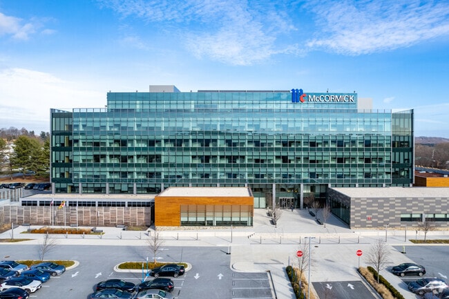

Property Detail
24 Schilling Rd
08-2500013989
OFFICE UNIT
Officebuilding
Baltimore
B and X Area of moderate flood hazard, usually the area between the limits of the 100-year and 500-year floods.
Maryland
2024
19.65 AC
2025
Route 83 Corridor North
408900
Baltimore
343,606 SF
Baltimore-Columbia-Towson, MD
NEARBY LISTINGS FOR SALE OR LEASE
DEMOGRAPHICS near 24 Schilling Rd
1 mile
3 mile
5 mile
2025 Total Population
4,206
32,171
69,862
2030 Population
4,312
32,346
70,031
Pop Growth 2025-2030
+ 2.52%
+ 0.54%
+ 0.24%
Average Age
47
43
43
2025 Total Households
1,784
14,151
28,289
HH Growth 2025-2030
+ 2.80%
+ 0.54%
+ 0.24%
Median Household Inc
$144,062
$96,742
$113,702
Avg Household Size
2.10
2.20
2.40
2025 Avg HH Vehicles
2.00
2.00
2.00
Median Home Value
$455,882
$435,692
$495,134
Median Year Built
2000
1982
1980
Nearby Places
Map Layers
Map Styles
 Street
 Aerial
Layers
 Traffic
 Biking
Places
Listings with unknown addresses are not visible on the map
- Restaurants
- Banks
- Shops
- Fitness
- Groceries
PUBLIC TRANSPORTATION
TRANSIT/SUBWAY
Hunt Valley (Hunt Valley & BWI Marshall - Maryland Transit Administration Light Rail (Baltimore Light Rail))
Drive
Walk
Distance
Hunt Valley (Hunt Valley & BWI Marshall - Maryland Transit Administration Light Rail (Baltimore Light Rail))
2 min
5 min
0.3 mi
Pepper Road (Hunt Valley & BWI Marshall - Maryland Transit Administration Light Rail (Baltimore Light Rail))
Drive
Walk
Distance
Pepper Road (Hunt Valley & BWI Marshall - Maryland Transit Administration Light Rail (Baltimore Light Rail))
2 min
8 min
0.4 mi
Mccormick Road (Hunt Valley & BWI Marshall - Maryland Transit Administration Light Rail (Baltimore Light Rail))
Drive
Walk
Distance
Mccormick Road (Hunt Valley & BWI Marshall - Maryland Transit Administration Light Rail (Baltimore Light Rail))
3 min
13 min
0.7 mi
AIRPORT
Baltimore/Washington International Thurgood Marshall
Drive
Walk
Distance
Baltimore/Washington International Thurgood Marshall
44 min
29.3 mi
Freight Ports
Port of Baltimore
Drive
Walk
Distance
Port of Baltimore
37 min
21.0 mi
The World's #1 Commercial Real Estate Marketplace
Connect with us
© 2026 CoStar Group
The information above has been obtained from sources believed reliable. While we do not doubt its accuracy we have not verified it and make no guarantee, warranty or representation about it. It is your responsibility to independently confirm its accuracy and completeness. Any projections, opinions, assumptions, or estimates used are for example only and do not represent the current or future performance of the property. The value of this transaction to you depends on tax and other factors which should be evaluated by your tax, financial, and legal advisors. You and your advisors should conduct a careful, independent investigation of the property to determine to your satisfaction the suitability of the property for your needs.