Property Record
24 Stateline Rd, Crystal Bay, NV 89402


NEARBY LISTINGS FOR SALE OR LEASE
-
-
View all Crystal Bay listings for sale on LoopNet.com
Property Detail
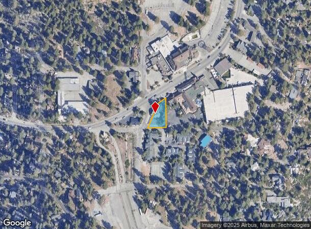
24 Stateline Rd
Reno/Sparks
Nevada Vista Subdivision Add
Reno, NV
NEVADA VISTA ADDITION LT 11 BLK B
123-042-07
Washoe
Commercialnec
Nevada
2025
11
2026
0.28 AC
003308
Incline Village
5,573 SF
DEMOGRAPHICS near 24 Stateline Rd
1 Mile
3 Mile
5 Mile
2024 Total Population
689
8,096
21,208
2029 Population
722
8,706
23,523
Pop Growth 2024-2029
+ 4.79%
+ 7.53%
+ 10.92%
Average Age
41
43
45
2024 Total Households
280
3,442
9,302
HH Growth 2024-2029
+ 4.64%
+ 7.84%
+ 11.26%
Median Household Inc
$55,754
$86,314
$115,026
Avg Household Size
2.30
2.30
2.20
2024 Avg HH Vehicles
2.00
2.00
2.00
Median Home Value
$1,033,929
$967,886
$977,048
Median Year Built
1974
1976
1977
Nearby Places
Map Layers
Map Styles
 Street
 Aerial
- Restaurants
- Banks
- Shops
- Fitness
- Groceries
PUBLIC TRANSPORTATION
AIRPORT
Reno/Tahoe International
DRIVE
WALK
Distance
Reno/Tahoe International
60 min
36.4 mi
Nearby Properties
Address
Land Use
TOTAL SIZE
Lot Size
Zoning
Address
Land Use
TOTAL SIZE
Lot Size
Zoning
38,050 SF
5.46 AC
Address
Land Use
TOTAL SIZE
Lot Size
Zoning
4,682 SF
3.50 AC
022
Address
Land Use
TOTAL SIZE
Lot Size
Zoning
2,997 SF
0.24 AC
Address
Land Use
TOTAL SIZE
Lot Size
Zoning
15,621 SF
1.74 AC
022
Address
Land Use
TOTAL SIZE
Lot Size
Zoning
2,282 SF
12.01 AC
TA_L
Address
Land Use
TOTAL SIZE
Lot Size
Zoning
70,916 SF
3.31 AC
032
Address
Land Use
TOTAL SIZE
Lot Size
Zoning
612 SF
4.21 AC
TA_L
Address
Land Use
TOTAL SIZE
Lot Size
Zoning
9,308 SF
0.70 AC
022
Address
Land Use
TOTAL SIZE
Lot Size
Zoning
6.25 AC
022
Address
Land Use
TOTAL SIZE
Lot Size
Zoning
54,085 SF
1.50 AC
029
Address
Land Use
TOTAL SIZE
Lot Size
Zoning
8,335 SF
0.81 AC
022
Address
Land Use
TOTAL SIZE
Lot Size
Zoning
12,993 SF
3.89 AC
TA_CB
Address
Land Use
TOTAL SIZE
Lot Size
Zoning
52,257 SF
1.75 AC
032
Address
Land Use
TOTAL SIZE
Lot Size
Zoning
5,710 SF
2.25 AC
029
Address
Land Use
TOTAL SIZE
Lot Size
Zoning
10,463 SF
1.50 AC
022
Address
Land Use
TOTAL SIZE
Lot Size
Zoning
139,654 SF
8.46 AC
TA_CBT
Address
Land Use
TOTAL SIZE
Lot Size
Zoning
1,653 SF
0.24 AC
029
Address
Land Use
TOTAL SIZE
Lot Size
Zoning
12,933 SF
5.10 AC
022
Address
Land Use
TOTAL SIZE
Lot Size
Zoning
4,536 SF
0.85 AC
TA_L
Address
Land Use
TOTAL SIZE
Lot Size
Zoning
22,350 SF
1.94 AC
022
Address
Land Use
TOTAL SIZE
Lot Size
Zoning
1,175.62 AC
TA_MR 90%
Address
Land Use
TOTAL SIZE
Lot Size
Zoning
3,368 SF
0.57 AC
029
Address
Land Use
TOTAL SIZE
Lot Size
Zoning
0.91 AC
032
Address
Land Use
TOTAL SIZE
Lot Size
Zoning
2,972 SF
0.17 AC
029
Address
Land Use
TOTAL SIZE
Lot Size
Zoning
236,983 SF
2.92 AC
TA_CBT
Address
Land Use
TOTAL SIZE
Lot Size
Zoning
Address
Land Use
TOTAL SIZE
Lot Size
Zoning
4,529 SF
0.57 AC
028
Address
Land Use
TOTAL SIZE
Lot Size
Zoning
7,711 SF
1.69 AC
023
Address
Land Use
TOTAL SIZE
Lot Size
Zoning
8,212 SF
0.26 AC
029
Address
Land Use
TOTAL SIZE
Lot Size
Zoning
18,000 SF
2.90 AC
022
The World's #1 Commercial Real Estate Marketplace
Connect with us
© 2026 CoStar Group
The information above has been obtained from sources believed reliable. While we do not doubt its accuracy we have not verified it and make no guarantee, warranty or representation about it. It is your responsibility to independently confirm its accuracy and completeness. Any projections, opinions, assumptions, or estimates used are for example only and do not represent the current or future performance of the property. The value of this transaction to you depends on tax and other factors which should be evaluated by your tax, financial, and legal advisors. You and your advisors should conduct a careful, independent investigation of the property to determine to your satisfaction the suitability of the property for your needs.