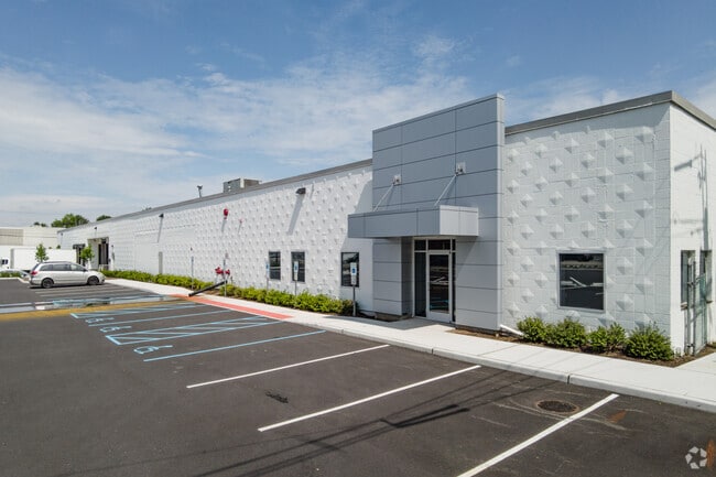
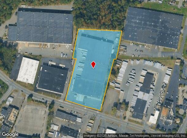
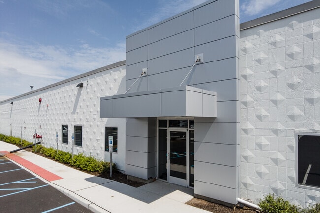
Property Record
250 Moonachie Ave, Moonachie, NJ 07074
Current Lease Availabilities
NEARBY LISTINGS FOR SALE OR LEASE
Property Detail
250 Moonachie Ave
New York-Jersey City-White Plains, NY-NJ
6.7
37-00057-0000-00010
Bergen
Industrialgeneral
New Jersey
AE
10
34003C0258H
6.70 AC
2024
Teterboro Airport
2025
Northern New Jersey
036200
DEMOGRAPHICS near 250 Moonachie Ave
1 Mile
3 Mile
5 Mile
2024 Total Population
4,621
121,353
676,557
2029 Population
4,566
118,356
659,538
Pop Growth 2024-2029
(1.19%)
(2.47%)
(2.52%)
Average Age
42
41
40
2024 Total Households
1,744
45,679
254,366
HH Growth 2024-2029
(1.03%)
(2.55%)
(2.54%)
Median Household Inc
$84,542
$90,725
$78,188
Avg Household Size
2.60
2.60
2.60
2024 Avg HH Vehicles
2.00
2.00
1.00
Median Home Value
$411,943
$465,159
$454,644
Median Year Built
1965
1956
1959
Nearby Places
- Restaurants
- Banks
- Shops
- Fitness
- Groceries
PUBLIC TRANSPORTATION
COMMUTER RAIL
Meadowlands Sports Complex Station (BetMGM Meadowlands Rail Line - NJ TRANSIT RAIL)
DRIVE
WALK
Distance
Meadowlands Sports Complex Station (BetMGM Meadowlands Rail Line - NJ TRANSIT RAIL)
3 min
2.2 mi
Wood Ridge (Pascack Valley Line - NJ Transit Commuter Rail (NJ Transit))
DRIVE
WALK
Distance
Wood Ridge (Pascack Valley Line - NJ Transit Commuter Rail (NJ Transit))
6 min
4.1 mi
AIRPORT
Newark Liberty International
DRIVE
WALK
Distance
Newark Liberty International
16 min
13.0 mi
LaGuardia
DRIVE
WALK
Distance
LaGuardia
30 min
18.0 mi
John F Kennedy International
DRIVE
WALK
Distance
John F Kennedy International
41 min
29.1 mi
Freight Ports
NY - Red Hook Container Terminal
DRIVE
WALK
Distance
NY - Red Hook Container Terminal
28 min
15.6 mi
Nearby Properties
Address
Land Use
TOTAL SIZE
Lot Size
Zoning
Address
Land Use
TOTAL SIZE
Lot Size
Zoning
Address
Land Use
TOTAL SIZE
Lot Size
Zoning
Address
Land Use
TOTAL SIZE
Lot Size
Zoning
4,014 SF
21 AC
Address
Land Use
TOTAL SIZE
Lot Size
Zoning
612 AC
SEA
Address
Land Use
TOTAL SIZE
Lot Size
Zoning
335.71 AC
AF
Address
Land Use
TOTAL SIZE
Lot Size
Zoning
Address
Land Use
TOTAL SIZE
Lot Size
Zoning
Address
Land Use
TOTAL SIZE
Lot Size
Zoning
Address
Land Use
TOTAL SIZE
Lot Size
Zoning
Address
Land Use
TOTAL SIZE
Lot Size
Zoning
Address
Land Use
TOTAL SIZE
Lot Size
Zoning
Address
Land Use
TOTAL SIZE
Lot Size
Zoning
9.57 AC
I2
Address
Land Use
TOTAL SIZE
Lot Size
Zoning
555 SF
4.89 AC
H
Address
Land Use
TOTAL SIZE
Lot Size
Zoning
35.58 AC
I
Address
Land Use
TOTAL SIZE
Lot Size
Zoning
68.93 AC
Address
Land Use
TOTAL SIZE
Lot Size
Zoning
Address
Land Use
TOTAL SIZE
Lot Size
Zoning
602,220 SF
25.91 AC
Address
Land Use
TOTAL SIZE
Lot Size
Zoning
416,340 SF
10.49 AC
Address
Land Use
TOTAL SIZE
Lot Size
Zoning
555 SF
32 AC
H
Address
Land Use
TOTAL SIZE
Lot Size
Zoning
26 AC
H
Address
Land Use
TOTAL SIZE
Lot Size
Zoning
608,596 SF
27.10 AC
LID
Address
Land Use
TOTAL SIZE
Lot Size
Zoning
555 SF
23 AC
Address
Land Use
TOTAL SIZE
Lot Size
Zoning
30.46 AC
I
Address
Land Use
TOTAL SIZE
Lot Size
Zoning
8.88 AC
ORD
Address
Land Use
TOTAL SIZE
Lot Size
Zoning
12.65 AC
I
Address
Land Use
TOTAL SIZE
Lot Size
Zoning
29 AC
H
Address
Land Use
TOTAL SIZE
Lot Size
Zoning
261,303 SF
5.60 AC
O
Address
Land Use
TOTAL SIZE
Lot Size
Zoning
8.79 AC
Address
Land Use
TOTAL SIZE
Lot Size
Zoning
4.80 AC
Address
Land Use
TOTAL SIZE
Lot Size
Zoning
555 SF
27 AC
H
The World's #1 Commercial Real Estate Marketplace
Connect with us
© 2025 CoStar Group
The information above has been obtained from sources believed reliable. While we do not doubt its accuracy we have not verified it and make no guarantee, warranty or representation about it. It is your responsibility to independently confirm its accuracy and completeness. Any projections, opinions, assumptions, or estimates used are for example only and do not represent the current or future performance of the property. The value of this transaction to you depends on tax and other factors which should be evaluated by your tax, financial, and legal advisors. You and your advisors should conduct a careful, independent investigation of the property to determine to your satisfaction the suitability of the property for your needs.