Property Record
240 Bay Shore Rd, North Babylon, NY 11703
NEARBY LISTINGS FOR SALE OR LEASE
-
-
View all North Babylon listings for sale on LoopNet.com
Property Detail
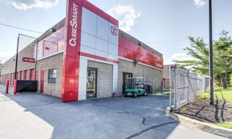
240 Bay Shore Rd
0100-117-00-01-00-108-001
N-BAYSHORE RD. E-J&L CIRELLO S-CIRELLO PK W-KARP
Industrialgeneral
Suffolk
X
New York
36103C0855H
102
2024
1.90 AC
2024
Western Suffolk
123101
Long Island (New York)
46,800 SF
Nassau County-Suffolk County, NY
DEMOGRAPHICS near 240 Bay Shore Rd
1 Mile
3 Mile
5 Mile
2024 Total Population
18,292
123,700
278,434
2029 Population
17,905
120,784
271,472
Pop Growth 2024-2029
(2.12%)
(2.36%)
(2.50%)
Average Age
41
40
40
2024 Total Households
5,941
38,308
84,703
HH Growth 2024-2029
(2.32%)
(2.56%)
(2.64%)
Median Household Inc
$102,465
$119,889
$117,768
Avg Household Size
3.00
3.10
3.10
2024 Avg HH Vehicles
2.00
2.00
2.00
Median Home Value
$428,215
$451,980
$463,840
Median Year Built
1960
1962
1963
Nearby Places
- Restaurants
- Banks
- Shops
- Fitness
- Groceries
PUBLIC TRANSPORTATION
COMMUTER RAIL
Wyandanch Station (Ronkonkoma Branch - Long Island Rail Road)
DRIVE
WALK
Distance
Wyandanch Station (Ronkonkoma Branch - Long Island Rail Road)
6 min
3.0 mi
Deer Park Station (Ronkonkoma Branch - Long Island Rail Road)
DRIVE
WALK
Distance
Deer Park Station (Ronkonkoma Branch - Long Island Rail Road)
6 min
3.1 mi
AIRPORT
Long Island MacArthur
DRIVE
WALK
Distance
Long Island MacArthur
24 min
14.7 mi
John F Kennedy International
DRIVE
WALK
Distance
John F Kennedy International
41 min
30.8 mi
LaGuardia
DRIVE
WALK
Distance
LaGuardia
52 min
35.7 mi
Freight Ports
NY - Red Hook Container Terminal
DRIVE
WALK
Distance
NY - Red Hook Container Terminal
62 min
42.2 mi
Nearby Properties
Address
Land Use
TOTAL SIZE
Lot Size
Zoning
Address
Land Use
TOTAL SIZE
Lot Size
Zoning
1,400 SF
10.27 AC
BD
Address
Land Use
TOTAL SIZE
Lot Size
Zoning
12 AC
A
Address
Land Use
TOTAL SIZE
Lot Size
Zoning
16.23 AC
A
Address
Land Use
TOTAL SIZE
Lot Size
Zoning
19.56 AC
BUS3
Address
Land Use
TOTAL SIZE
Lot Size
Zoning
30 AC
IND1
Address
Land Use
TOTAL SIZE
Lot Size
Zoning
20.50 AC
B
Address
Land Use
TOTAL SIZE
Lot Size
Zoning
15 AC
A
Address
Land Use
TOTAL SIZE
Lot Size
Zoning
10.74 AC
Address
Land Use
TOTAL SIZE
Lot Size
Zoning
18.37 AC
IND1
Address
Land Use
TOTAL SIZE
Lot Size
Zoning
20.13 AC
Address
Land Use
TOTAL SIZE
Lot Size
Zoning
10.44 AC
BUS3
Address
Land Use
TOTAL SIZE
Lot Size
Zoning
777,483 SF
80.70 AC
GA
Address
Land Use
TOTAL SIZE
Lot Size
Zoning
14.63 AC
IND1
Address
Land Use
TOTAL SIZE
Lot Size
Zoning
9.70 AC
B
Address
Land Use
TOTAL SIZE
Lot Size
Zoning
6.66 AC
A
Address
Land Use
TOTAL SIZE
Lot Size
Zoning
19.70 AC
B
Address
Land Use
TOTAL SIZE
Lot Size
Zoning
13.28 AC
IND1
Address
Land Use
TOTAL SIZE
Lot Size
Zoning
10.22 AC
IBD
Address
Land Use
TOTAL SIZE
Lot Size
Zoning
13.30 AC
A
Address
Land Use
TOTAL SIZE
Lot Size
Zoning
10.90 AC
IND1
Address
Land Use
TOTAL SIZE
Lot Size
Zoning
756 SF
0.36 AC
B1
Address
Land Use
TOTAL SIZE
Lot Size
Zoning
9.20 AC
IND1
Address
Land Use
TOTAL SIZE
Lot Size
Zoning
10.95 AC
IND1
Address
Land Use
TOTAL SIZE
Lot Size
Zoning
9.70 AC
B
Address
Land Use
TOTAL SIZE
Lot Size
Zoning
19.40 AC
IND1
Address
Land Use
TOTAL SIZE
Lot Size
Zoning
11 AC
B
Address
Land Use
TOTAL SIZE
Lot Size
Zoning
7.50 AC
B
Address
Land Use
TOTAL SIZE
Lot Size
Zoning
13.81 AC
IND1
Address
Land Use
TOTAL SIZE
Lot Size
Zoning
512 SF
10.55 AC
IND1
Address
Land Use
TOTAL SIZE
Lot Size
Zoning
9.79 AC
IND1
The World's #1 Commercial Real Estate Marketplace
Connect with us
© 2025 CoStar Group
The information above has been obtained from sources believed reliable. While we do not doubt its accuracy we have not verified it and make no guarantee, warranty or representation about it. It is your responsibility to independently confirm its accuracy and completeness. Any projections, opinions, assumptions, or estimates used are for example only and do not represent the current or future performance of the property. The value of this transaction to you depends on tax and other factors which should be evaluated by your tax, financial, and legal advisors. You and your advisors should conduct a careful, independent investigation of the property to determine to your satisfaction the suitability of the property for your needs.