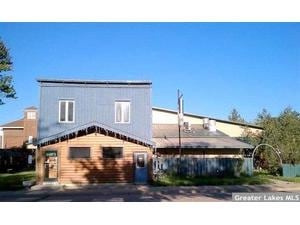
Property Record
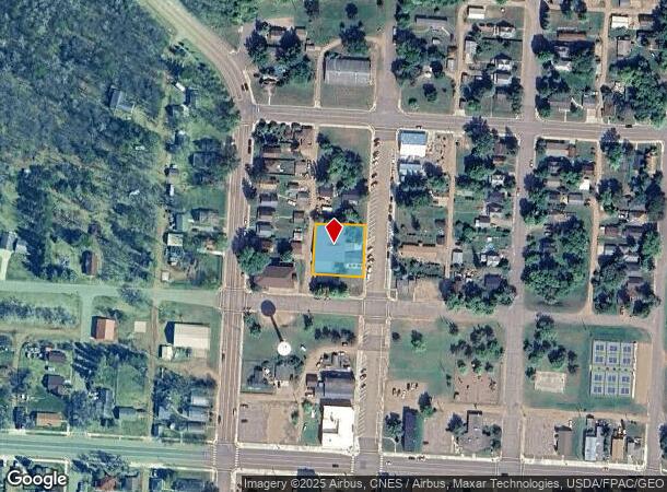
240 Curtis Ave, Ironton, MN 56455
NEARBY LISTINGS FOR SALE OR LEASE
Property Detail
240 Curtis Ave
Brainerd, MN
Ironton
251020110120889
LOTS 10 THRU 14 BLOCK 11 INCL
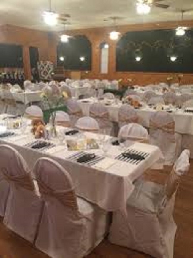
Commercialnec
Crow Wing
X
Minnesota
27035C0451C
10-14
2025
0.36 AC
2025
Minnesota Central Area
950702
Other Market Areas
9,087 SF
DEMOGRAPHICS near 240 Curtis Ave
1 Mile
3 Mile
5 Mile
2024 Total Population
1,537
4,263
5,977
2029 Population
1,607
4,487
6,293
Pop Growth 2024-2029
+ 4.55%
+ 5.25%
+ 5.29%
Average Age
40
44
44
2024 Total Households
630
1,847
2,585
HH Growth 2024-2029
+ 4.29%
+ 5.14%
+ 5.15%
Median Household Inc
$49,411
$47,930
$52,590
Avg Household Size
2.40
2.20
2.20
2024 Avg HH Vehicles
2.00
2.00
2.00
Median Home Value
$149,532
$172,557
$190,559
Median Year Built
1967
1973
1976
Nearby Places
Map Layers
Map Styles
 Street
 Aerial
- Restaurants
- Banks
- Shops
- Fitness
- Groceries
SALE & LEASE HISTORY
LISTING DATE
SALE/LEASE

Oct 23, 2017
For Sale
May 23, 2019
For Sale
Nearby Properties
Address
Land Use
TOTAL SIZE
Lot Size
Zoning
Address
Land Use
TOTAL SIZE
Lot Size
Zoning
200,040 SF
17.25 AC
Address
Land Use
TOTAL SIZE
Lot Size
Zoning
101,043 SF
26.64 AC
Address
Land Use
TOTAL SIZE
Lot Size
Zoning
139,176 SF
24.17 AC
Address
Land Use
TOTAL SIZE
Lot Size
Zoning
31,592 SF
4.41 AC
Address
Land Use
TOTAL SIZE
Lot Size
Zoning
45,357 SF
7.83 AC
Address
Land Use
TOTAL SIZE
Lot Size
Zoning
6,001 SF
15.20 AC
Address
Land Use
TOTAL SIZE
Lot Size
Zoning
45,719 SF
3.13 AC
Address
Land Use
TOTAL SIZE
Lot Size
Zoning
9,464 SF
3.05 AC
Address
Land Use
TOTAL SIZE
Lot Size
Zoning
8,218 SF
1.54 AC
Address
Land Use
TOTAL SIZE
Lot Size
Zoning
26,270 SF
2.55 AC
Address
Land Use
TOTAL SIZE
Lot Size
Zoning
20,879 SF
1.31 AC
Address
Land Use
TOTAL SIZE
Lot Size
Zoning
56,857 SF
13.28 AC
Address
Land Use
TOTAL SIZE
Lot Size
Zoning
9,884 SF
1.20 AC
Address
Land Use
TOTAL SIZE
Lot Size
Zoning
13,524 SF
19.01 AC
Address
Land Use
TOTAL SIZE
Lot Size
Zoning
166,172 SF
39.40 AC
Address
Land Use
TOTAL SIZE
Lot Size
Zoning
11,657 SF
0.77 AC
Address
Land Use
TOTAL SIZE
Lot Size
Zoning
425.58 AC
Address
Land Use
TOTAL SIZE
Lot Size
Zoning
4,320 SF
1.33 AC
Address
Land Use
TOTAL SIZE
Lot Size
Zoning
8,208 SF
8.35 AC
Address
Land Use
TOTAL SIZE
Lot Size
Zoning
31,491 SF
4.17 AC
Address
Land Use
TOTAL SIZE
Lot Size
Zoning
13,344 SF
0.53 AC
Address
Land Use
TOTAL SIZE
Lot Size
Zoning
27,144 SF
7.60 AC
Address
Land Use
TOTAL SIZE
Lot Size
Zoning
10,394 SF
2.11 AC
Address
Land Use
TOTAL SIZE
Lot Size
Zoning
740 SF
3.85 AC
Address
Land Use
TOTAL SIZE
Lot Size
Zoning
51.20 AC
Address
Land Use
TOTAL SIZE
Lot Size
Zoning
432 SF
3.82 AC
Address
Land Use
TOTAL SIZE
Lot Size
Zoning
9,450 SF
2.44 AC
The World's #1 Commercial Real Estate Marketplace
Connect with us
© 2026 CoStar Group
The information above has been obtained from sources believed reliable. While we do not doubt its accuracy we have not verified it and make no guarantee, warranty or representation about it. It is your responsibility to independently confirm its accuracy and completeness. Any projections, opinions, assumptions, or estimates used are for example only and do not represent the current or future performance of the property. The value of this transaction to you depends on tax and other factors which should be evaluated by your tax, financial, and legal advisors. You and your advisors should conduct a careful, independent investigation of the property to determine to your satisfaction the suitability of the property for your needs.