Property Record
240 E Horizon Dr, Henderson, NV 89015
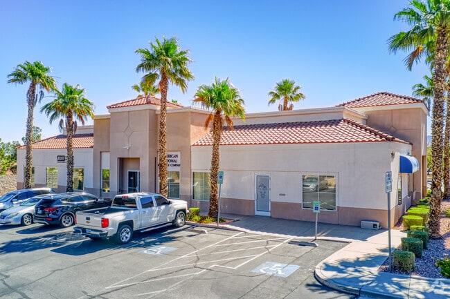


Property Detail
240 E Horizon Dr
179-19-805-014
PARCEL MAP FILE 92 PAGE 47 LOT 3
Commercialnec
Clark
CN
Nevada
B and X Area of moderate flood hazard, usually the area between the limits of the 100-year and 500-year floods.
3
2026
0.30 AC
2026
SE Las Vegas/Henderson
005335
Las Vegas
4,968 SF
Las Vegas-Henderson-North Las Vegas, NV
NEARBY LISTINGS FOR SALE OR LEASE
DEMOGRAPHICS near 240 E Horizon Dr
1 mile
3 mile
5 mile
2025 Total Population
13,246
88,275
175,188
2030 Population
14,043
93,110
185,623
Pop Growth 2025-2030
+ 6.02%
+ 5.48%
+ 5.96%
Average Age
44
41
41
2025 Total Households
4,986
32,701
67,049
HH Growth 2025-2030
+ 5.92%
+ 5.56%
+ 6.02%
Median Household Inc
$101,144
$90,729
$91,027
Avg Household Size
2.60
2.60
2.50
2025 Avg HH Vehicles
2.00
2.00
2.00
Median Home Value
$432,888
$448,478
$465,238
Median Year Built
1992
1997
1999
Nearby Places
Map Layers
Map Styles
 Street
 Aerial
Transit
 Traffic
 Biking
Places
Listings with unknown addresses are not visible on the map
- Restaurants
- Banks
- Shops
- Fitness
- Groceries
PUBLIC TRANSPORTATION
AIRPORT
Boulder City Municipal
Drive
Walk
Distance
Boulder City Municipal
16 min
10.7 mi
Harry Reid International
Drive
Walk
Distance
Harry Reid International
18 min
13.6 mi
Freight Ports
Port of Long Beach
Drive
Walk
Distance
Port of Long Beach
316 min
282.2 mi
SALE & LEASE HISTORY
LISTING DATE
SALE/LEASE

Sep 24, 2016
For Lease
Nearby Properties
Address
Land Use
TOTAL SIZE
Lot Size
Zoning
Address
Land Use
TOTAL SIZE
Lot Size
Zoning
Address
Land Use
TOTAL SIZE
Lot Size
Zoning
917,210 SF
60.42 AC
Address
Land Use
TOTAL SIZE
Lot Size
Zoning
46.75 AC
PS
Address
Land Use
TOTAL SIZE
Lot Size
Zoning
10.50 AC
Address
Land Use
TOTAL SIZE
Lot Size
Zoning
81,485 SF
160.06 AC
PS
Address
Land Use
TOTAL SIZE
Lot Size
Zoning
1,500 SF
25.08 AC
Address
Land Use
TOTAL SIZE
Lot Size
Zoning
26.83 AC
PS
Address
Land Use
TOTAL SIZE
Lot Size
Zoning
40,031 SF
21.25 AC
Address
Land Use
TOTAL SIZE
Lot Size
Zoning
78,760 SF
1.23 AC
Address
Land Use
TOTAL SIZE
Lot Size
Zoning
4,578 SF
13.23 AC
H:RH-24-MP
Address
Land Use
TOTAL SIZE
Lot Size
Zoning
23,087 SF
71.36 AC
PS
Address
Land Use
TOTAL SIZE
Lot Size
Zoning
239,288 SF
14.10 AC
Address
Land Use
TOTAL SIZE
Lot Size
Zoning
250,076 SF
24.61 AC
Address
Land Use
TOTAL SIZE
Lot Size
Zoning
295,238 SF
23.49 AC
IP
Address
Land Use
TOTAL SIZE
Lot Size
Zoning
4,280 SF
18.25 AC
H:RM-16-MP
Address
Land Use
TOTAL SIZE
Lot Size
Zoning
71,133 SF
7.56 AC
DP
Address
Land Use
TOTAL SIZE
Lot Size
Zoning
13.05 AC
PS
Address
Land Use
TOTAL SIZE
Lot Size
Zoning
19,753 SF
10.21 AC
DP
Address
Land Use
TOTAL SIZE
Lot Size
Zoning
2,860 SF
15.43 AC
RM16
Address
Land Use
TOTAL SIZE
Lot Size
Zoning
213,472 SF
7.46 AC
Address
Land Use
TOTAL SIZE
Lot Size
Zoning
3,664 SF
16.09 AC
RH20
Address
Land Use
TOTAL SIZE
Lot Size
Zoning
241,207 SF
13.42 AC
IG
Address
Land Use
TOTAL SIZE
Lot Size
Zoning
168,361 SF
10.84 AC
Address
Land Use
TOTAL SIZE
Lot Size
Zoning
320 AC
PS
Address
Land Use
TOTAL SIZE
Lot Size
Zoning
292,375 SF
39.22 AC
M2
Address
Land Use
TOTAL SIZE
Lot Size
Zoning
4,627 SF
7.01 AC
MC
Address
Land Use
TOTAL SIZE
Lot Size
Zoning
4,148 SF
4.38 AC
MC
The World's #1 Commercial Real Estate Marketplace
Connect with us
© 2026 CoStar Group
The information above has been obtained from sources believed reliable. While we do not doubt its accuracy we have not verified it and make no guarantee, warranty or representation about it. It is your responsibility to independently confirm its accuracy and completeness. Any projections, opinions, assumptions, or estimates used are for example only and do not represent the current or future performance of the property. The value of this transaction to you depends on tax and other factors which should be evaluated by your tax, financial, and legal advisors. You and your advisors should conduct a careful, independent investigation of the property to determine to your satisfaction the suitability of the property for your needs.