Property Record
240 Kalama River Rd, Kalama, WA 98625


Current Lease Availabilities
NEARBY LISTINGS FOR SALE OR LEASE
-
-
View all Kalama listings for lease on LoopNet.com
Property Detail
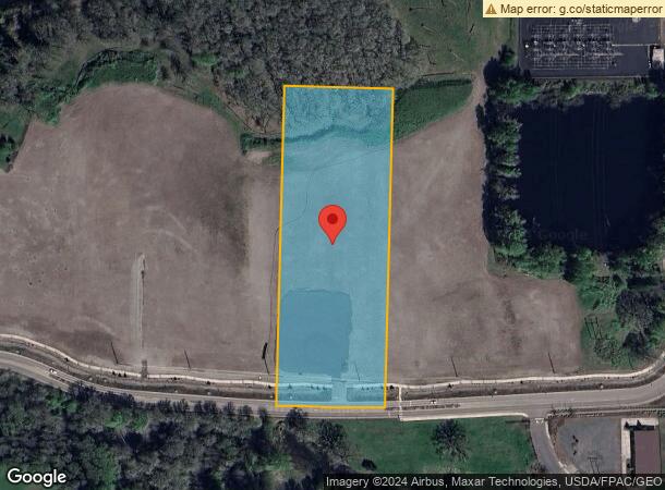
240 Kalama River Rd
Longview, WA
Kalama Outlot
4-12220124
815 (KALAMA OUTLOT) -KAOL -273 31 -7N -1W EXC ROW AFN 3697086
Commercialacreage
Cowlitz
AE
Washington
53015C0711G
273
2025
5 AC
2024
Cowlitz County
001601
Portland
836 SF
DEMOGRAPHICS near 240 Kalama River Rd
1 Mile
3 Mile
5 Mile
2024 Total Population
385
4,783
10,606
2029 Population
393
4,930
11,006
Pop Growth 2024-2029
+ 2.08%
+ 3.07%
+ 3.77%
Average Age
45
44
44
2024 Total Households
162
1,904
4,086
HH Growth 2024-2029
+ 1.85%
+ 2.99%
+ 3.65%
Median Household Inc
$100,735
$93,850
$94,258
Avg Household Size
2.40
2.50
2.60
2024 Avg HH Vehicles
2.00
2.00
2.00
Median Home Value
$428,205
$434,980
$433,539
Median Year Built
1993
1991
1990
Nearby Places
Map Layers
Map Styles
 Street
 Aerial
- Restaurants
- Banks
- Shops
- Fitness
- Groceries
PUBLIC TRANSPORTATION
COMMUTER RAIL
DRIVE
WALK
Distance
13 min
9.2 mi
AIRPORT
Portland International
DRIVE
WALK
Distance
Portland International
51 min
40.4 mi
Freight Ports
Port of Kalama, WA
DRIVE
WALK
Distance
Port of Kalama, WA
7 min
3.5 mi
Nearby Properties
Address
Land Use
TOTAL SIZE
Lot Size
Zoning
Address
Land Use
TOTAL SIZE
Lot Size
Zoning
80.24 AC
UZ0
Address
Land Use
TOTAL SIZE
Lot Size
Zoning
154.96 AC
UZ0
Address
Land Use
TOTAL SIZE
Lot Size
Zoning
1,440 SF
85.37 AC
UZ0
Address
Land Use
TOTAL SIZE
Lot Size
Zoning
135.52 AC
UZ0
Address
Land Use
TOTAL SIZE
Lot Size
Zoning
53,442 SF
11.65 AC
UZ0
Address
Land Use
TOTAL SIZE
Lot Size
Zoning
10.50 AC
I01
Address
Land Use
TOTAL SIZE
Lot Size
Zoning
54.37 AC
UZ0
Address
Land Use
TOTAL SIZE
Lot Size
Zoning
142,354 SF
2.25 AC
R01
Address
Land Use
TOTAL SIZE
Lot Size
Zoning
37.27 AC
I01
Address
Land Use
TOTAL SIZE
Lot Size
Zoning
25,702 SF
23.20 AC
I01
Address
Land Use
TOTAL SIZE
Lot Size
Zoning
35,453 SF
11.80 AC
UZ0
Address
Land Use
TOTAL SIZE
Lot Size
Zoning
14,168 SF
5.85 AC
RR1
Address
Land Use
TOTAL SIZE
Lot Size
Zoning
6,450 SF
38 AC
Address
Land Use
TOTAL SIZE
Lot Size
Zoning
12.57 AC
UZ0
Address
Land Use
TOTAL SIZE
Lot Size
Zoning
9,975 SF
0.16 AC
C01
Address
Land Use
TOTAL SIZE
Lot Size
Zoning
15,386 SF
2.01 AC
Address
Land Use
TOTAL SIZE
Lot Size
Zoning
0.32 AC
C01
Address
Land Use
TOTAL SIZE
Lot Size
Zoning
13,752 SF
0.57 AC
C01
Address
Land Use
TOTAL SIZE
Lot Size
Zoning
3,360 SF
0.32 AC
C01
Address
Land Use
TOTAL SIZE
Lot Size
Zoning
12,750 SF
0.16 AC
C01
Address
Land Use
TOTAL SIZE
Lot Size
Zoning
3,250 SF
0.08 AC
C01
Address
Land Use
TOTAL SIZE
Lot Size
Zoning
6,000 SF
0.16 AC
C01
Address
Land Use
TOTAL SIZE
Lot Size
Zoning
7,444 SF
0.16 AC
C01
Address
Land Use
TOTAL SIZE
Lot Size
Zoning
0.24 AC
R02
Address
Land Use
TOTAL SIZE
Lot Size
Zoning
4,482 SF
0.16 AC
C01
Address
Land Use
TOTAL SIZE
Lot Size
Zoning
3,750 SF
0.16 AC
C01
Address
Land Use
TOTAL SIZE
Lot Size
Zoning
1,300 SF
0.48 AC
C01
Address
Land Use
TOTAL SIZE
Lot Size
Zoning
4,048 SF
0.21 AC
R02
The World's #1 Commercial Real Estate Marketplace
Connect with us
© 2026 CoStar Group
The information above has been obtained from sources believed reliable. While we do not doubt its accuracy we have not verified it and make no guarantee, warranty or representation about it. It is your responsibility to independently confirm its accuracy and completeness. Any projections, opinions, assumptions, or estimates used are for example only and do not represent the current or future performance of the property. The value of this transaction to you depends on tax and other factors which should be evaluated by your tax, financial, and legal advisors. You and your advisors should conduct a careful, independent investigation of the property to determine to your satisfaction the suitability of the property for your needs.