Property Record
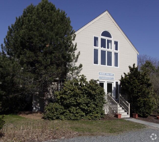
240 Wareham Rd, Marion, MA 02738


Property Detail
240 Wareham Rd
MARI-000008-000002-B000001
PLYMOUTH
Officecondo
Massachusetts
VE and V1-30 Coastal areas with a 1% or greater chance of flooding and an additional hazard associated with storm waves. These areas have a 26% chance of flooding over the life of a 30-year mortgage.
b1
2025
Route 3 South
2025
Boston
561100
Boston-Cambridge-Newton, MA-NH
1,124 SF
NEARBY LISTINGS FOR SALE OR LEASE
-
-
View all Marion listings for sale on LoopNet.com
DEMOGRAPHICS near 240 Wareham Rd
1 mile
3 mile
5 mile
2025 Total Population
1,908
13,288
30,172
2030 Population
1,988
14,019
31,594
Pop Growth 2025-2030
+ 4.19%
+ 5.50%
+ 4.71%
Average Age
46
46
46
2025 Total Households
761
5,554
12,491
HH Growth 2025-2030
+ 4.34%
+ 5.82%
+ 4.85%
Median Household Inc
$140,104
$102,671
$99,515
Avg Household Size
2.40
2.30
2.30
2025 Avg HH Vehicles
2.00
2.00
2.00
Median Home Value
$753,993
$494,527
$532,471
Median Year Built
1949
1963
1971
Nearby Places
Map Layers
Map Styles
 Street
 Aerial
Layers
 Traffic
 Biking
Places
Listings with unknown addresses are not visible on the map
- Restaurants
- Banks
- Shops
- Fitness
- Groceries
PUBLIC TRANSPORTATION
COMMUTER RAIL
Wareham Village (CapeFLYER - Cape Cod Regional Transit Authority)
Drive
Walk
Distance
Wareham Village (CapeFLYER - Cape Cod Regional Transit Authority)
6 min
3.9 mi
Buzzards Bay (CapeFLYER - Cape Cod Regional Transit Authority)
Drive
Walk
Distance
Buzzards Bay (CapeFLYER - Cape Cod Regional Transit Authority)
17 min
9.8 mi
AIRPORT
Martha's Vineyard
Drive
Walk
Distance
Martha's Vineyard
109 min
44.6 mi
Freight Ports
Port of New Bedford Harbor
Drive
Walk
Distance
Port of New Bedford Harbor
20 min
13.9 mi
Nearby Properties
Address
Land Use
TOTAL SIZE
Lot Size
Zoning
Address
Land Use
TOTAL SIZE
Lot Size
Zoning
142,119 SF
9.44 AC
Address
Land Use
TOTAL SIZE
Lot Size
Zoning
58,742 SF
10.84 AC
Address
Land Use
TOTAL SIZE
Lot Size
Zoning
160,186 SF
5.14 AC
Address
Land Use
TOTAL SIZE
Lot Size
Zoning
45,509 SF
9.72 AC
Address
Land Use
TOTAL SIZE
Lot Size
Zoning
12.46 AC
Address
Land Use
TOTAL SIZE
Lot Size
Zoning
8,578 SF
17.79 AC
Address
Land Use
TOTAL SIZE
Lot Size
Zoning
4,980 SF
16.34 AC
Address
Land Use
TOTAL SIZE
Lot Size
Zoning
12,832 SF
3.45 AC
Address
Land Use
TOTAL SIZE
Lot Size
Zoning
1,280 SF
11.12 AC
Address
Land Use
TOTAL SIZE
Lot Size
Zoning
7,420 SF
1.10 AC
Address
Land Use
TOTAL SIZE
Lot Size
Zoning
10,398 SF
5.93 AC
Address
Land Use
TOTAL SIZE
Lot Size
Zoning
6,943 SF
2.50 AC
Address
Land Use
TOTAL SIZE
Lot Size
Zoning
73,442 SF
22.50 AC
Address
Land Use
TOTAL SIZE
Lot Size
Zoning
6,519 SF
2.87 AC
Address
Land Use
TOTAL SIZE
Lot Size
Zoning
4,382 SF
6.66 AC
Address
Land Use
TOTAL SIZE
Lot Size
Zoning
1,632 SF
13.04 AC
MB
Address
Land Use
TOTAL SIZE
Lot Size
Zoning
4,168 SF
0.58 AC
Address
Land Use
TOTAL SIZE
Lot Size
Zoning
57,042 SF
3.71 AC
Address
Land Use
TOTAL SIZE
Lot Size
Zoning
186.52 AC
Address
Land Use
TOTAL SIZE
Lot Size
Zoning
7,656 SF
1.60 AC
Address
Land Use
TOTAL SIZE
Lot Size
Zoning
30,588 SF
11.69 AC
Address
Land Use
TOTAL SIZE
Lot Size
Zoning
4,146 SF
8.45 AC
Address
Land Use
TOTAL SIZE
Lot Size
Zoning
4,324 SF
2.05 AC
Address
Land Use
TOTAL SIZE
Lot Size
Zoning
4,537 SF
0.82 AC
Address
Land Use
TOTAL SIZE
Lot Size
Zoning
3,140 SF
4.43 AC
Address
Land Use
TOTAL SIZE
Lot Size
Zoning
3,848 SF
4 AC
Address
Land Use
TOTAL SIZE
Lot Size
Zoning
4,004 SF
0.74 AC
Address
Land Use
TOTAL SIZE
Lot Size
Zoning
6,789 SF
5.82 AC
Address
Land Use
TOTAL SIZE
Lot Size
Zoning
6.42 AC
Address
Land Use
TOTAL SIZE
Lot Size
Zoning
10,090 SF
1.37 AC
The World's #1 Commercial Real Estate Marketplace
Connect with us
© 2026 CoStar Group
The information above has been obtained from sources believed reliable. While we do not doubt its accuracy we have not verified it and make no guarantee, warranty or representation about it. It is your responsibility to independently confirm its accuracy and completeness. Any projections, opinions, assumptions, or estimates used are for example only and do not represent the current or future performance of the property. The value of this transaction to you depends on tax and other factors which should be evaluated by your tax, financial, and legal advisors. You and your advisors should conduct a careful, independent investigation of the property to determine to your satisfaction the suitability of the property for your needs.