Property Record
2400 16Th St, Greensboro, NC 27405


NEARBY LISTINGS FOR SALE OR LEASE
Property Detail
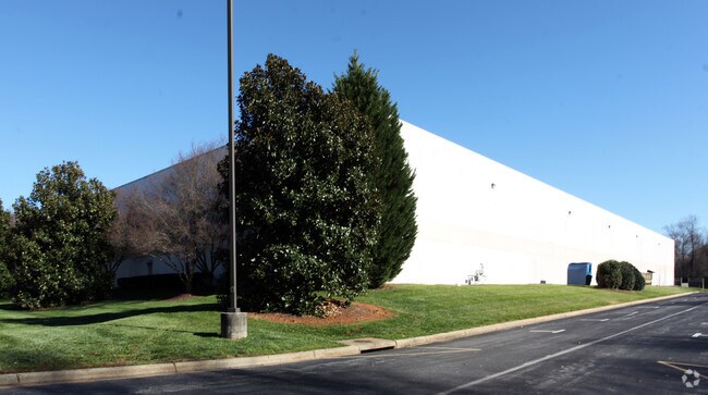
2400 16Th St
Greensboro-High Point, NC
Belk
0055991
GREENSBORO SPORTSPLEX/SIXTEENTH ST LO:1 PL:117-57
Parkplaygroundpicnicarea
Guilford
AE
North Carolina
3710787600J
1
0
9.24 AC
2025
NE Guilford County
015402
Greensboro/Winston-Salem
112,050 SF
DEMOGRAPHICS near 2400 16Th St
1 Mile
3 Mile
5 Mile
2024 Total Population
8,315
61,460
143,177
2029 Population
8,359
61,814
143,442
Pop Growth 2024-2029
+ 0.53%
+ 0.58%
+ 0.19%
Average Age
37
36
37
2024 Total Households
3,336
23,422
54,715
HH Growth 2024-2029
+ 0.66%
+ 0.58%
+ 0.26%
Median Household Inc
$33,337
$41,644
$48,696
Avg Household Size
2.40
2.40
2.30
2024 Avg HH Vehicles
1.00
2.00
2.00
Median Home Value
$99,311
$139,158
$177,046
Median Year Built
1974
1977
1977
Nearby Places
Map Layers
Map Styles
 Street
 Aerial
- Restaurants
- Banks
- Shops
- Fitness
- Groceries
PUBLIC TRANSPORTATION
COMMUTER RAIL
Greensboro Station (Piedmont - North Carolina by Train (NC Train))
DRIVE
WALK
Distance
Greensboro Station (Piedmont - North Carolina by Train (NC Train))
8 min
4.3 mi
AIRPORT
Piedmont Triad International
DRIVE
WALK
Distance
Piedmont Triad International
28 min
15.6 mi
Freight Ports
Virginia Port Authority - Richmond
DRIVE
WALK
Distance
Virginia Port Authority - Richmond
231 min
198.0 mi
Nearby Properties
Address
Land Use
TOTAL SIZE
Lot Size
Zoning
Address
Land Use
TOTAL SIZE
Lot Size
Zoning
908,421 SF
62.30 AC
PI
Address
Land Use
TOTAL SIZE
Lot Size
Zoning
646,229 SF
25.47 AC
LI
Address
Land Use
TOTAL SIZE
Lot Size
Zoning
905,672 SF
28.64 AC
PI
Address
Land Use
TOTAL SIZE
Lot Size
Zoning
1,546,815 SF
93.94 AC
CU-LI
Address
Land Use
TOTAL SIZE
Lot Size
Zoning
413,840 SF
3.68 AC
PI
Address
Land Use
TOTAL SIZE
Lot Size
Zoning
224,444 SF
80.09 AC
PI
Address
Land Use
TOTAL SIZE
Lot Size
Zoning
275,282 SF
43.43 AC
PI
Address
Land Use
TOTAL SIZE
Lot Size
Zoning
661,843 SF
46.38 AC
PI
Address
Land Use
TOTAL SIZE
Lot Size
Zoning
267,277 SF
12.97 AC
PI
Address
Land Use
TOTAL SIZE
Lot Size
Zoning
252,109 SF
8.83 AC
PUD
Address
Land Use
TOTAL SIZE
Lot Size
Zoning
336,133 SF
23.93 AC
CU-RM-12
Address
Land Use
TOTAL SIZE
Lot Size
Zoning
344,972 SF
65.45 AC
LI
Address
Land Use
TOTAL SIZE
Lot Size
Zoning
120,204 SF
9.82 AC
C-H
Address
Land Use
TOTAL SIZE
Lot Size
Zoning
133,444 SF
4.09 AC
PI
Address
Land Use
TOTAL SIZE
Lot Size
Zoning
270,848 SF
18.28 AC
RM-18
Address
Land Use
TOTAL SIZE
Lot Size
Zoning
238,315 SF
19.63 AC
RM-12
Address
Land Use
TOTAL SIZE
Lot Size
Zoning
214,583 SF
20.64 AC
C-H
Address
Land Use
TOTAL SIZE
Lot Size
Zoning
259,434 SF
23.69 AC
RM-12
Address
Land Use
TOTAL SIZE
Lot Size
Zoning
163,506 SF
25.89 AC
RM-12
Address
Land Use
TOTAL SIZE
Lot Size
Zoning
38,940 SF
19.33 AC
R-3
Address
Land Use
TOTAL SIZE
Lot Size
Zoning
168,798 SF
15.45 AC
RM-12
Address
Land Use
TOTAL SIZE
Lot Size
Zoning
101,171 SF
4.21 AC
PI
Address
Land Use
TOTAL SIZE
Lot Size
Zoning
1,097,293 SF
73.53 AC
HI
Address
Land Use
TOTAL SIZE
Lot Size
Zoning
236,995 SF
14.09 AC
RM-18
Address
Land Use
TOTAL SIZE
Lot Size
Zoning
204,260 SF
11.83 AC
RM-18
Address
Land Use
TOTAL SIZE
Lot Size
Zoning
99,926 SF
8.13 AC
O
Address
Land Use
TOTAL SIZE
Lot Size
Zoning
189,979 SF
44.76 AC
PI
Address
Land Use
TOTAL SIZE
Lot Size
Zoning
191,654 SF
11.31 AC
RM-12
Address
Land Use
TOTAL SIZE
Lot Size
Zoning
152,857 SF
11.58 AC
RM-18
The World's #1 Commercial Real Estate Marketplace
Connect with us
© 2025 CoStar Group
The information above has been obtained from sources believed reliable. While we do not doubt its accuracy we have not verified it and make no guarantee, warranty or representation about it. It is your responsibility to independently confirm its accuracy and completeness. Any projections, opinions, assumptions, or estimates used are for example only and do not represent the current or future performance of the property. The value of this transaction to you depends on tax and other factors which should be evaluated by your tax, financial, and legal advisors. You and your advisors should conduct a careful, independent investigation of the property to determine to your satisfaction the suitability of the property for your needs.