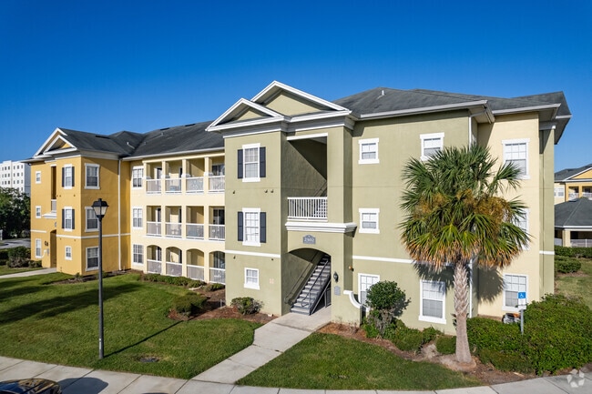
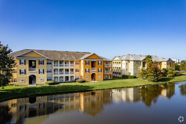
Property Record
2400 Academy Cir E, Kissimmee, FL 34744
NEARBY LISTINGS FOR SALE OR LEASE
-
-
View all Kissimmee listings for sale on LoopNet.com
Property Detail
2400 Academy Cir E
Orlando-Kissimmee-Sanford, FL
Academy Village
30-25-30-4007-0001-0030
ACADEMY VILLAGE PB 26 PGS 83-88 LOT 3
Multifamilydwelling
Osceola
AE
Florida
12095C0650G
3
2024
10.27 AC
2025
NeoCity
042902
Orlando
203,265 SF
DEMOGRAPHICS near 2400 Academy Cir E
1 Mile
3 Mile
5 Mile
2024 Total Population
11,895
51,207
137,292
2029 Population
14,394
61,085
162,587
Pop Growth 2024-2029
+ 21.01%
+ 19.29%
+ 18.42%
Average Age
36
38
39
2024 Total Households
4,212
16,769
45,784
HH Growth 2024-2029
+ 21.18%
+ 19.21%
+ 18.33%
Median Household Inc
$37,486
$51,703
$54,655
Avg Household Size
2.80
2.90
2.90
2024 Avg HH Vehicles
1.00
2.00
2.00
Median Home Value
$270,366
$272,816
$259,701
Median Year Built
2009
2000
1994
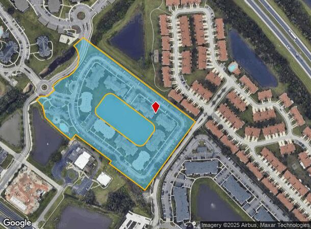
Nearby Places
Map Layers
Map Styles
 Street
 Aerial
- Restaurants
- Banks
- Shops
- Fitness
- Groceries
PUBLIC TRANSPORTATION
COMMUTER RAIL
Kissimmee Amtrak Station (Silver Meteor - Amtrak, Silver Star - Amtrak, SunRail - Amtrak)
DRIVE
WALK
Distance
Kissimmee Amtrak Station (Silver Meteor - Amtrak, Silver Star - Amtrak, SunRail - Amtrak)
10 min
5.2 mi
Tupperware (SunRail - Florida Department of Transportation)
DRIVE
WALK
Distance
Tupperware (SunRail - Florida Department of Transportation)
11 min
6.4 mi
AIRPORT
Orlando International
DRIVE
WALK
Distance
Orlando International
24 min
13.8 mi
Freight Ports
Port Canaveral
DRIVE
WALK
Distance
Port Canaveral
71 min
55.5 mi
Nearby Properties
Address
Land Use
TOTAL SIZE
Lot Size
Zoning
Address
Land Use
TOTAL SIZE
Lot Size
Zoning
457,374 SF
30.93 AC
OCT
Address
Land Use
TOTAL SIZE
Lot Size
Zoning
402,010 SF
22.33 AC
OCR
Address
Land Use
TOTAL SIZE
Lot Size
Zoning
416,762 SF
99.87 AC
KCF
Address
Land Use
TOTAL SIZE
Lot Size
Zoning
343,107 SF
16.26 AC
OEC
Address
Land Use
TOTAL SIZE
Lot Size
Zoning
379,943 SF
14.07 AC
OCT
Address
Land Use
TOTAL SIZE
Lot Size
Zoning
142,570 SF
20.16 AC
OPD
Address
Land Use
TOTAL SIZE
Lot Size
Zoning
351,537 SF
44.58 AC
OPD
Address
Land Use
TOTAL SIZE
Lot Size
Zoning
275,507 SF
22.19 AC
RM-2
Address
Land Use
TOTAL SIZE
Lot Size
Zoning
437,037 SF
34.76 AC
OPUD
Address
Land Use
TOTAL SIZE
Lot Size
Zoning
188,719 SF
10.81 AC
Address
Land Use
TOTAL SIZE
Lot Size
Zoning
374,081 SF
36.66 AC
KRC1
Address
Land Use
TOTAL SIZE
Lot Size
Zoning
187,302 SF
20.85 AC
Address
Land Use
TOTAL SIZE
Lot Size
Zoning
343,593 SF
49.46 AC
OAC
Address
Land Use
TOTAL SIZE
Lot Size
Zoning
145,028 SF
6.85 AC
Address
Land Use
TOTAL SIZE
Lot Size
Zoning
57,939 SF
80.04 AC
OPD
Address
Land Use
TOTAL SIZE
Lot Size
Zoning
309,075 SF
16.94 AC
OPUD
Address
Land Use
TOTAL SIZE
Lot Size
Zoning
304,494 SF
15.67 AC
Address
Land Use
TOTAL SIZE
Lot Size
Zoning
258,588 SF
119.70 AC
OAC
Address
Land Use
TOTAL SIZE
Lot Size
Zoning
208,677 SF
12.64 AC
Address
Land Use
TOTAL SIZE
Lot Size
Zoning
73,910 SF
4.61 AC
OCT
Address
Land Use
TOTAL SIZE
Lot Size
Zoning
113,079 SF
8.96 AC
OCT
Address
Land Use
TOTAL SIZE
Lot Size
Zoning
198,144 SF
12.18 AC
SR4
Address
Land Use
TOTAL SIZE
Lot Size
Zoning
82,614 SF
9.89 AC
SHB
Address
Land Use
TOTAL SIZE
Lot Size
Zoning
170,800 SF
44.94 AC
KCF
Address
Land Use
TOTAL SIZE
Lot Size
Zoning
63,524 SF
10.88 AC
OCR
Address
Land Use
TOTAL SIZE
Lot Size
Zoning
42,528 SF
17 AC
ORM3
Address
Land Use
TOTAL SIZE
Lot Size
Zoning
113,362 SF
40.78 AC
OPUD
Address
Land Use
TOTAL SIZE
Lot Size
Zoning
66,171 SF
8.42 AC
OCR
Address
Land Use
TOTAL SIZE
Lot Size
Zoning
91,320 SF
1.90 AC
OCR
The World's #1 Commercial Real Estate Marketplace
Connect with us
© 2026 CoStar Group
The information above has been obtained from sources believed reliable. While we do not doubt its accuracy we have not verified it and make no guarantee, warranty or representation about it. It is your responsibility to independently confirm its accuracy and completeness. Any projections, opinions, assumptions, or estimates used are for example only and do not represent the current or future performance of the property. The value of this transaction to you depends on tax and other factors which should be evaluated by your tax, financial, and legal advisors. You and your advisors should conduct a careful, independent investigation of the property to determine to your satisfaction the suitability of the property for your needs.