Property Record
2400 Aurora Cove Ct, Raleigh, NC 27610
NEARBY LISTINGS FOR SALE OR LEASE
-
-
View all Raleigh listings for sale on LoopNet.com
Property Detail
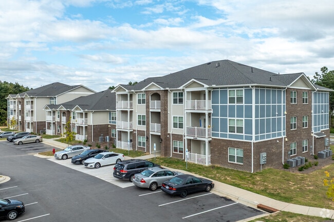
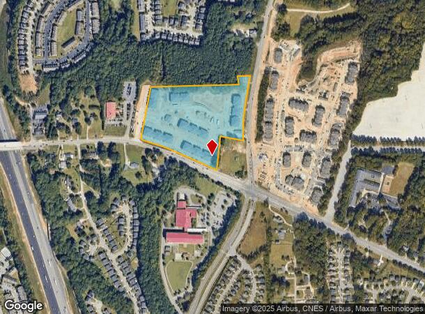
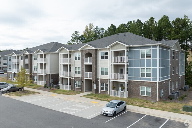
2400 Aurora Cove Ct
Raleigh/Durham
Rock Quarry Landing
Raleigh, NC
LO1 ROCK QUARRY LANDING BM2022-00808
1722.09-27-2590-000
Wake
Apartment
North Carolina
2025
1
2025
12.41 AC
052102
Walnut Creek
209,454 SF
DEMOGRAPHICS near 2400 Aurora Cove Ct
1 Mile
3 Mile
5 Mile
2024 Total Population
7,732
64,370
175,015
2029 Population
8,343
70,131
190,497
Pop Growth 2024-2029
+ 7.90%
+ 8.95%
+ 8.85%
Average Age
35
37
37
2024 Total Households
2,512
22,423
68,841
HH Growth 2024-2029
+ 7.92%
+ 9.22%
+ 9.16%
Median Household Inc
$69,592
$48,713
$65,903
Avg Household Size
3.00
2.70
2.40
2024 Avg HH Vehicles
2.00
2.00
2.00
Median Home Value
$189,918
$201,564
$257,755
Median Year Built
2002
1990
1994
Nearby Places
Map Layers
Map Styles
 Street
 Aerial
- Restaurants
- Banks
- Shops
- Fitness
- Groceries
PUBLIC TRANSPORTATION
COMMUTER RAIL
Raleigh Union Station (Piedmont - North Carolina by Train (NC Train))
DRIVE
WALK
Distance
Raleigh Union Station (Piedmont - North Carolina by Train (NC Train))
11 min
6.0 mi
AIRPORT
Raleigh-Durham International
DRIVE
WALK
Distance
Raleigh-Durham International
28 min
20.0 mi
Freight Ports
Port of Wilmington
DRIVE
WALK
Distance
Port of Wilmington
148 min
129.1 mi
Nearby Properties
Address
Land Use
TOTAL SIZE
Lot Size
Zoning
Address
Land Use
TOTAL SIZE
Lot Size
Zoning
2,660,245 SF
38.98 AC
CMP
Address
Land Use
TOTAL SIZE
Lot Size
Zoning
2,583,746 SF
87.16 AC
HI
Address
Land Use
TOTAL SIZE
Lot Size
Zoning
376,902 SF
189.85 AC
OX-3
Address
Land Use
TOTAL SIZE
Lot Size
Zoning
701,923 SF
64.64 AC
RX-5
Address
Land Use
TOTAL SIZE
Lot Size
Zoning
327,776 SF
14.48 AC
CX-5
Address
Land Use
TOTAL SIZE
Lot Size
Zoning
347,818 SF
32.02 AC
CX-3
Address
Land Use
TOTAL SIZE
Lot Size
Zoning
517,912 SF
27.44 AC
R-10
Address
Land Use
TOTAL SIZE
Lot Size
Zoning
438,469 SF
50 AC
R-4
Address
Land Use
TOTAL SIZE
Lot Size
Zoning
433,221 SF
7.78 AC
CMP
Address
Land Use
TOTAL SIZE
Lot Size
Zoning
235,588 SF
128.17 AC
OX-3
Address
Land Use
TOTAL SIZE
Lot Size
Zoning
276,494 SF
58.90 AC
R-6
Address
Land Use
TOTAL SIZE
Lot Size
Zoning
234,353 SF
102.82 AC
IX-3
Address
Land Use
TOTAL SIZE
Lot Size
Zoning
2,916 SF
81 AC
R-6
Address
Land Use
TOTAL SIZE
Lot Size
Zoning
420,962 SF
44 AC
IH
Address
Land Use
TOTAL SIZE
Lot Size
Zoning
175,250 SF
1.74 AC
OX-5
Address
Land Use
TOTAL SIZE
Lot Size
Zoning
487,635 SF
27.81 AC
IX-3
Address
Land Use
TOTAL SIZE
Lot Size
Zoning
38,341 SF
259.59 AC
IH
Address
Land Use
TOTAL SIZE
Lot Size
Zoning
275,215 SF
18.17 AC
HI
Address
Land Use
TOTAL SIZE
Lot Size
Zoning
196,732 SF
12.02 AC
RX-3
Address
Land Use
TOTAL SIZE
Lot Size
Zoning
116,551 SF
18.76 AC
CX-5
Address
Land Use
TOTAL SIZE
Lot Size
Zoning
259,480 SF
17.19 AC
HI
Address
Land Use
TOTAL SIZE
Lot Size
Zoning
94,876 SF
42.83 AC
OX-3
Address
Land Use
TOTAL SIZE
Lot Size
Zoning
84,446 SF
22.87 AC
IX-3
Address
Land Use
TOTAL SIZE
Lot Size
Zoning
183,981 SF
5.37 AC
OX-4
Address
Land Use
TOTAL SIZE
Lot Size
Zoning
105,512 SF
19.47 AC
R-6
Address
Land Use
TOTAL SIZE
Lot Size
Zoning
110,680 SF
107.82 AC
IH
Address
Land Use
TOTAL SIZE
Lot Size
Zoning
156,078 SF
67.93 AC
HI
Address
Land Use
TOTAL SIZE
Lot Size
Zoning
166,859 SF
17.79 AC
R4
Address
Land Use
TOTAL SIZE
Lot Size
Zoning
166,261 SF
17.30 AC
R-10
The World's #1 Commercial Real Estate Marketplace
Connect with us
© 2025 CoStar Group
The information above has been obtained from sources believed reliable. While we do not doubt its accuracy we have not verified it and make no guarantee, warranty or representation about it. It is your responsibility to independently confirm its accuracy and completeness. Any projections, opinions, assumptions, or estimates used are for example only and do not represent the current or future performance of the property. The value of this transaction to you depends on tax and other factors which should be evaluated by your tax, financial, and legal advisors. You and your advisors should conduct a careful, independent investigation of the property to determine to your satisfaction the suitability of the property for your needs.