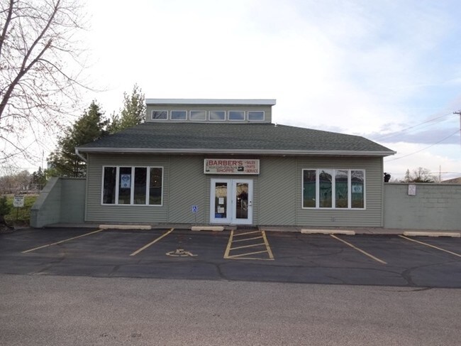
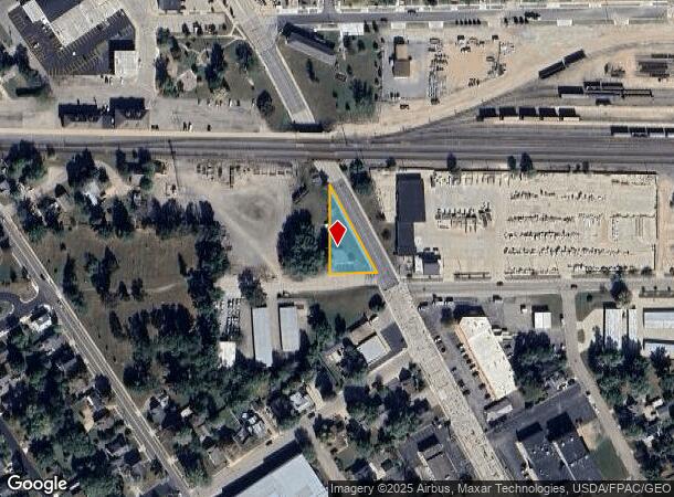
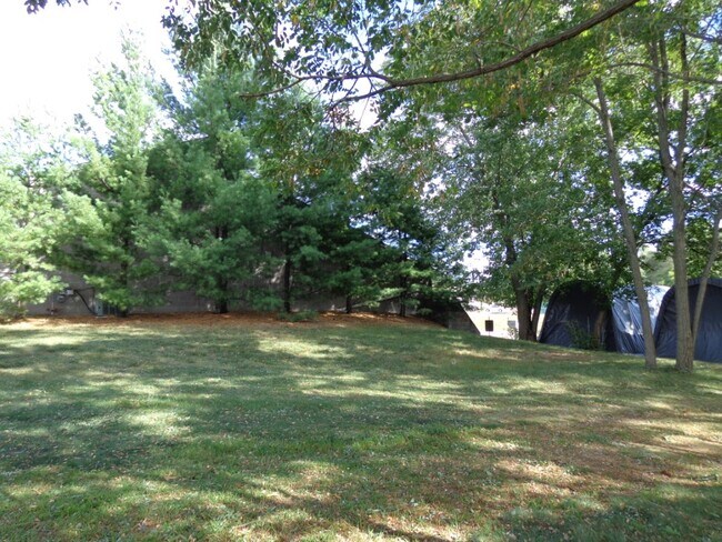
Property Record
2400 Church St, Stevens Point, WI 54481
NEARBY LISTINGS FOR SALE OR LEASE
Property Detail
2400 Church St
Stevens Point, WI
Helms Add
281-24-0832402902
LOT A CSM#2809-10- 67 BNG PRT LOTS 8 9 &10 BLK 11 HELMS ADD & PRT OF WYATT AVE VAC 434/9 SEWER ESMT 439/390 898363
Commercialnec
Portage
X
Wisconsin
55097C0214D
a-8
2024
0.29 AC
2024
Wausau/Stevens Point
961102
Other Market Areas
DEMOGRAPHICS near 2400 Church St
1 Mile
3 Mile
5 Mile
2024 Total Population
9,294
31,679
47,996
2029 Population
9,522
32,224
48,861
Pop Growth 2024-2029
+ 2.45%
+ 1.72%
+ 1.80%
Average Age
38
38
39
2024 Total Households
4,434
13,495
20,162
HH Growth 2024-2029
+ 2.59%
+ 1.87%
+ 1.91%
Median Household Inc
$52,197
$55,099
$62,433
Avg Household Size
2.00
2.10
2.20
2024 Avg HH Vehicles
2.00
2.00
2.00
Median Home Value
$142,999
$166,896
$177,206
Median Year Built
1959
1974
1979
Nearby Places
- Restaurants
- Banks
- Shops
- Fitness
- Groceries
PUBLIC TRANSPORTATION
AIRPORT
Central Wisconsin
DRIVE
WALK
Distance
Central Wisconsin
26 min
19.7 mi
Freight Ports
Port Milwaukee
DRIVE
WALK
Distance
Port Milwaukee
186 min
157.2 mi
SALE & LEASE HISTORY
LISTING DATE
SALE/LEASE

Sep 24, 2016
For Sale
Sep 23, 2016
For Sale
Sep 09, 2020
For Sale
Nov 09, 2021
For Sale
Mar 30, 2022
For Sale
Nearby Properties
Address
Land Use
TOTAL SIZE
Lot Size
Zoning
Address
Land Use
TOTAL SIZE
Lot Size
Zoning
13.17 AC
Address
Land Use
TOTAL SIZE
Lot Size
Zoning
85.85 AC
Address
Land Use
TOTAL SIZE
Lot Size
Zoning
43.36 AC
Address
Land Use
TOTAL SIZE
Lot Size
Zoning
Address
Land Use
TOTAL SIZE
Lot Size
Zoning
Address
Land Use
TOTAL SIZE
Lot Size
Zoning
Address
Land Use
TOTAL SIZE
Lot Size
Zoning
260.24 AC
Address
Land Use
TOTAL SIZE
Lot Size
Zoning
Address
Land Use
TOTAL SIZE
Lot Size
Zoning
20.78 AC
Address
Land Use
TOTAL SIZE
Lot Size
Zoning
Address
Land Use
TOTAL SIZE
Lot Size
Zoning
11.03 AC
Address
Land Use
TOTAL SIZE
Lot Size
Zoning
22.22 AC
Address
Land Use
TOTAL SIZE
Lot Size
Zoning
Address
Land Use
TOTAL SIZE
Lot Size
Zoning
Address
Land Use
TOTAL SIZE
Lot Size
Zoning
Address
Land Use
TOTAL SIZE
Lot Size
Zoning
Address
Land Use
TOTAL SIZE
Lot Size
Zoning
Address
Land Use
TOTAL SIZE
Lot Size
Zoning
3.54 AC
Address
Land Use
TOTAL SIZE
Lot Size
Zoning
Address
Land Use
TOTAL SIZE
Lot Size
Zoning
Address
Land Use
TOTAL SIZE
Lot Size
Zoning
9.19 AC
Address
Land Use
TOTAL SIZE
Lot Size
Zoning
Address
Land Use
TOTAL SIZE
Lot Size
Zoning
28.75 AC
Address
Land Use
TOTAL SIZE
Lot Size
Zoning
11.97 AC
Address
Land Use
TOTAL SIZE
Lot Size
Zoning
Address
Land Use
TOTAL SIZE
Lot Size
Zoning
Address
Land Use
TOTAL SIZE
Lot Size
Zoning
7.78 AC
Address
Land Use
TOTAL SIZE
Lot Size
Zoning
10.04 AC
Address
Land Use
TOTAL SIZE
Lot Size
Zoning
Address
Land Use
TOTAL SIZE
Lot Size
Zoning
0.92 AC
The World's #1 Commercial Real Estate Marketplace
Connect with us
© 2025 CoStar Group
The information above has been obtained from sources believed reliable. While we do not doubt its accuracy we have not verified it and make no guarantee, warranty or representation about it. It is your responsibility to independently confirm its accuracy and completeness. Any projections, opinions, assumptions, or estimates used are for example only and do not represent the current or future performance of the property. The value of this transaction to you depends on tax and other factors which should be evaluated by your tax, financial, and legal advisors. You and your advisors should conduct a careful, independent investigation of the property to determine to your satisfaction the suitability of the property for your needs.