Property Record
2400 Gambrinus Ave Sw, Canton, OH 44706

Save to a Folder
{{folder.Name}}
{{folder.ListingIds.length}} Properties
{{folder.ListingIds.length}} Property
Create a New Folder
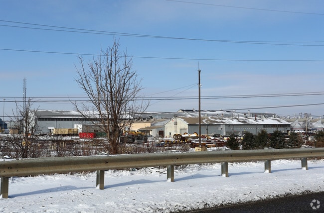
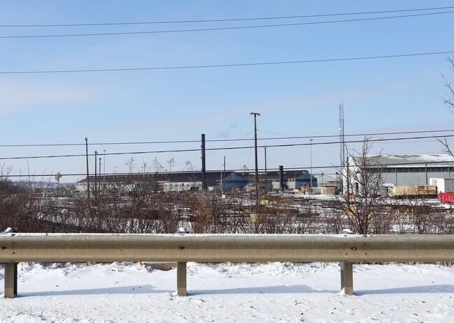
Property Detail
2400 Gambrinus Ave Sw
10005219
19 NW 99.09A; 19 SW 2.39A
Heavyindustrial
STARK
B and X Area of moderate flood hazard, usually the area between the limits of the 100-year and 500-year floods.
Ohio
0
101.48 AC
2025
Stark County
713202
Cleveland
1,097,518 SF
Canton-Massillon, OH
NEARBY LISTINGS FOR SALE OR LEASE
DEMOGRAPHICS near 2400 Gambrinus Ave Sw
1 mile
3 mile
5 mile
2025 Total Population
1,131
42,468
110,530
2030 Population
1,132
42,142
110,263
Pop Growth 2025-2030
+ 0.09%
(0.77%)
(0.24%)
Average Age
44
40
41
2025 Total Households
476
17,786
47,038
HH Growth 2025-2030
+ 0.21%
(0.78%)
(0.28%)
Median Household Inc
$53,703
$48,858
$51,776
Avg Household Size
2.30
2.30
2.20
2025 Avg HH Vehicles
2.00
2.00
2.00
Median Home Value
$130,345
$121,750
$143,096
Median Year Built
1960
1953
1955
Nearby Places
Map Layers
Map Styles
 Street
 Aerial
Layers
 Traffic
 Biking
Places
Listings with unknown addresses are not visible on the map
- Restaurants
- Banks
- Shops
- Fitness
- Groceries
PUBLIC TRANSPORTATION
AIRPORT
Akron-Canton Regional
Drive
Walk
Distance
Akron-Canton Regional
28 min
15.6 mi
Freight Ports
Port of Toledo
Drive
Walk
Distance
Port of Toledo
198 min
159.0 mi
Nearby Properties
Address
Land Use
TOTAL SIZE
Lot Size
Zoning
Address
Land Use
TOTAL SIZE
Lot Size
Zoning
551,338 SF
7.26 AC
Address
Land Use
TOTAL SIZE
Lot Size
Zoning
397,897 SF
3.76 AC
Address
Land Use
TOTAL SIZE
Lot Size
Zoning
356,172 SF
4.06 AC
Address
Land Use
TOTAL SIZE
Lot Size
Zoning
194,249 SF
10.90 AC
Address
Land Use
TOTAL SIZE
Lot Size
Zoning
433,773 SF
67.53 AC
Address
Land Use
TOTAL SIZE
Lot Size
Zoning
299,975 SF
18.92 AC
Address
Land Use
TOTAL SIZE
Lot Size
Zoning
194,249 SF
10.86 AC
Address
Land Use
TOTAL SIZE
Lot Size
Zoning
168,731 SF
57.06 AC
Address
Land Use
TOTAL SIZE
Lot Size
Zoning
912,918 SF
266.76 AC
Address
Land Use
TOTAL SIZE
Lot Size
Zoning
188,816 SF
34.72 AC
Address
Land Use
TOTAL SIZE
Lot Size
Zoning
68,518 SF
40.92 AC
Address
Land Use
TOTAL SIZE
Lot Size
Zoning
107,248 SF
0.09 AC
Address
Land Use
TOTAL SIZE
Lot Size
Zoning
68,518 SF
9.36 AC
Address
Land Use
TOTAL SIZE
Lot Size
Zoning
116,912 SF
18.85 AC
Address
Land Use
TOTAL SIZE
Lot Size
Zoning
102,436 SF
4.95 AC
Address
Land Use
TOTAL SIZE
Lot Size
Zoning
61,884 SF
2.18 AC
Address
Land Use
TOTAL SIZE
Lot Size
Zoning
89,344 SF
3.77 AC
Address
Land Use
TOTAL SIZE
Lot Size
Zoning
63,011 SF
2.72 AC
Address
Land Use
TOTAL SIZE
Lot Size
Zoning
1,213,508 SF
44.15 AC
Address
Land Use
TOTAL SIZE
Lot Size
Zoning
220,897 SF
24.02 AC
Address
Land Use
TOTAL SIZE
Lot Size
Zoning
82,746 SF
2.68 AC
Address
Land Use
TOTAL SIZE
Lot Size
Zoning
45,583 SF
2.34 AC
Address
Land Use
TOTAL SIZE
Lot Size
Zoning
42,372 SF
6.74 AC
Address
Land Use
TOTAL SIZE
Lot Size
Zoning
51,028 SF
3.22 AC
Address
Land Use
TOTAL SIZE
Lot Size
Zoning
71,898 SF
55 AC
Address
Land Use
TOTAL SIZE
Lot Size
Zoning
105,396 SF
3.66 AC
Address
Land Use
TOTAL SIZE
Lot Size
Zoning
198,870 SF
0.83 AC
Address
Land Use
TOTAL SIZE
Lot Size
Zoning
89,657 SF
9 AC
Address
Land Use
TOTAL SIZE
Lot Size
Zoning
107,152 SF
1.51 AC
Address
Land Use
TOTAL SIZE
Lot Size
Zoning
105,077 SF
4.80 AC
The World's #1 Commercial Real Estate Marketplace
Connect with us
© 2026 CoStar Group
The information above has been obtained from sources believed reliable. While we do not doubt its accuracy we have not verified it and make no guarantee, warranty or representation about it. It is your responsibility to independently confirm its accuracy and completeness. Any projections, opinions, assumptions, or estimates used are for example only and do not represent the current or future performance of the property. The value of this transaction to you depends on tax and other factors which should be evaluated by your tax, financial, and legal advisors. You and your advisors should conduct a careful, independent investigation of the property to determine to your satisfaction the suitability of the property for your needs.