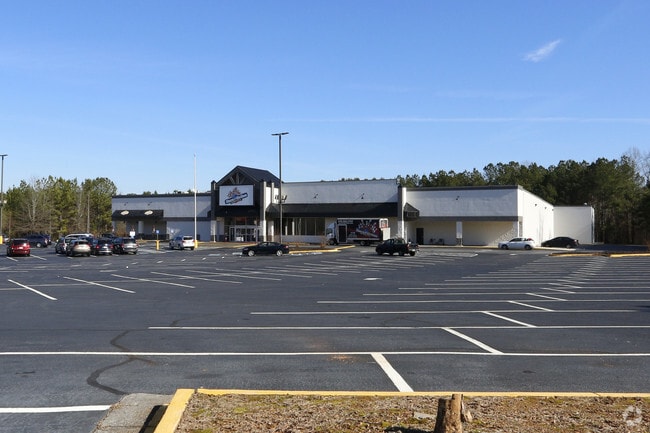
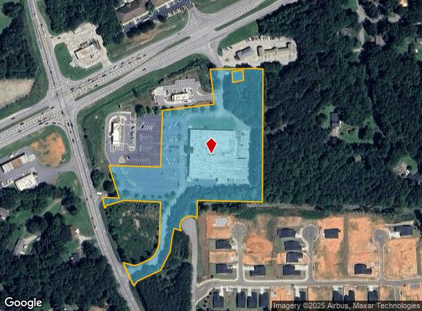
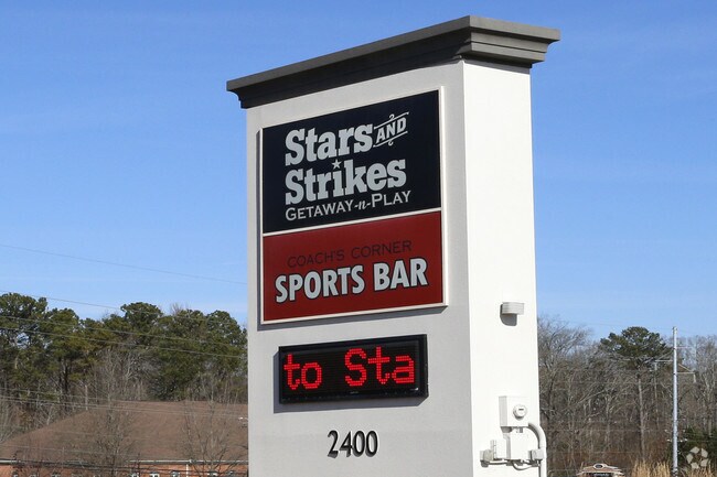
Property Record
2400 Hiram Acworth Hwy, Dallas, GA 30157

NEARBY LISTINGS FOR SALE OR LEASE
Property Detail
2400 Hiram Acworth Hwy
Atlanta-Sandy Springs-Roswell, GA
Commercial Nh County
111.4.3.008.0000
REAL PROPERTY
Bowlingalley
Paulding
X
Georgia
13067C0086G
251
2024
7.57 AC
2024
Paulding Cnty/Dallas
120206
Atlanta
52,413 SF
DEMOGRAPHICS near 2400 Hiram Acworth Hwy
1 Mile
3 Mile
5 Mile
2024 Total Population
4,894
37,116
100,229
2029 Population
5,586
41,228
109,616
Pop Growth 2024-2029
+ 14.14%
+ 11.08%
+ 9.37%
Average Age
39
39
39
2024 Total Households
1,695
13,071
34,288
HH Growth 2024-2029
+ 14.16%
+ 11.45%
+ 9.65%
Median Household Inc
$109,706
$106,229
$105,740
Avg Household Size
2.80
2.80
2.90
2024 Avg HH Vehicles
3.00
2.00
2.00
Median Home Value
$301,638
$298,560
$314,626
Median Year Built
1999
1996
1998
Nearby Places
Map Layers
Map Styles
 Street
 Aerial
- Restaurants
- Banks
- Shops
- Fitness
- Groceries
PUBLIC TRANSPORTATION
AIRPORT
Hartsfield - Jackson Atlanta International
DRIVE
WALK
Distance
Hartsfield - Jackson Atlanta International
55 min
36.9 mi
Freight Ports
Georgia Ports - Savannah
DRIVE
WALK
Distance
Georgia Ports - Savannah
318 min
276.2 mi
Nearby Properties
Address
Land Use
TOTAL SIZE
Lot Size
Zoning
Address
Land Use
TOTAL SIZE
Lot Size
Zoning
62,628 SF
32.23 AC
B2
Address
Land Use
TOTAL SIZE
Lot Size
Zoning
46.05 AC
Address
Land Use
TOTAL SIZE
Lot Size
Zoning
126,638 SF
20.26 AC
R4
Address
Land Use
TOTAL SIZE
Lot Size
Zoning
187,435 SF
31.39 AC
R55
Address
Land Use
TOTAL SIZE
Lot Size
Zoning
25.10 AC
Address
Land Use
TOTAL SIZE
Lot Size
Zoning
37.28 AC
Address
Land Use
TOTAL SIZE
Lot Size
Zoning
174,472 SF
60.63 AC
Address
Land Use
TOTAL SIZE
Lot Size
Zoning
238,291 SF
22.51 AC
B2
Address
Land Use
TOTAL SIZE
Lot Size
Zoning
19,718 SF
0.52 AC
B1
Address
Land Use
TOTAL SIZE
Lot Size
Zoning
141,658 SF
17.36 AC
PSC
Address
Land Use
TOTAL SIZE
Lot Size
Zoning
35,442 SF
0.66 AC
B1
Address
Land Use
TOTAL SIZE
Lot Size
Zoning
223,686 SF
30.20 AC
B2
Address
Land Use
TOTAL SIZE
Lot Size
Zoning
Address
Land Use
TOTAL SIZE
Lot Size
Zoning
Address
Land Use
TOTAL SIZE
Lot Size
Zoning
138,725 SF
11.66 AC
B2
Address
Land Use
TOTAL SIZE
Lot Size
Zoning
198,684 SF
21.35 AC
B2
Address
Land Use
TOTAL SIZE
Lot Size
Zoning
171,184 SF
14.63 AC
PSC
Address
Land Use
TOTAL SIZE
Lot Size
Zoning
151,906 SF
21.07 AC
B2
Address
Land Use
TOTAL SIZE
Lot Size
Zoning
71,122 SF
30.70 AC
C2
Address
Land Use
TOTAL SIZE
Lot Size
Zoning
99,972 SF
3.18 AC
NRC/O&I
Address
Land Use
TOTAL SIZE
Lot Size
Zoning
133,006 SF
15.53 AC
PSC
Address
Land Use
TOTAL SIZE
Lot Size
Zoning
44,972 SF
7.81 AC
B2
Address
Land Use
TOTAL SIZE
Lot Size
Zoning
71,301 SF
3.88 AC
B1
Address
Land Use
TOTAL SIZE
Lot Size
Zoning
136,556 SF
7.24 AC
B2
Address
Land Use
TOTAL SIZE
Lot Size
Zoning
185,183 SF
6.99 AC
OI
Address
Land Use
TOTAL SIZE
Lot Size
Zoning
103,185 SF
13.41 AC
B2
Address
Land Use
TOTAL SIZE
Lot Size
Zoning
74,036 SF
23.20 AC
B2
Address
Land Use
TOTAL SIZE
Lot Size
Zoning
7.69 AC
Address
Land Use
TOTAL SIZE
Lot Size
Zoning
86,556 SF
8.10 AC
PSC
Address
Land Use
TOTAL SIZE
Lot Size
Zoning
68,669 SF
7.95 AC
B1
The World's #1 Commercial Real Estate Marketplace
Connect with us
© 2025 CoStar Group
The information above has been obtained from sources believed reliable. While we do not doubt its accuracy we have not verified it and make no guarantee, warranty or representation about it. It is your responsibility to independently confirm its accuracy and completeness. Any projections, opinions, assumptions, or estimates used are for example only and do not represent the current or future performance of the property. The value of this transaction to you depends on tax and other factors which should be evaluated by your tax, financial, and legal advisors. You and your advisors should conduct a careful, independent investigation of the property to determine to your satisfaction the suitability of the property for your needs.