Property Record
2400 Lpga Blvd, Daytona Beach, FL 32124


NEARBY LISTINGS FOR SALE OR LEASE
Property Detail
2400 Lpga Blvd
5209-00-00-001A
Parcel
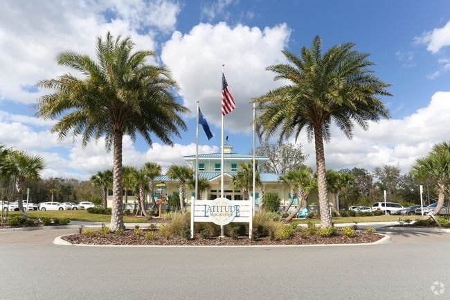
Officebuilding
9-15-32 PER OR 8766 PG 2638 COMMENCE AT THE SW CORNER OF THE NW 1/4 OF SAID SECTION 9 RUN THENCE ALONG THE W BOUNDARY THEREOF N00-45-53W 195.42 FT TO THE CENTERLINE OF LPGA BLVD THENCE ALONG SAID CENTERLINE N64-21-26E 1306.62 FT THENCE DEPARTING SAID
AE
Volusia
12127C0351H
Florida
2025
3.12 AC
2026
North Daytona Beach
083205
Deltona/Daytona Beach
8,362 SF
Deltona-Daytona Beach-Ormond Beach, FL
DEMOGRAPHICS near 2400 Lpga Blvd
1 Mile
3 Mile
5 Mile
2024 Total Population
3,988
35,371
97,735
2029 Population
4,688
40,528
109,702
Pop Growth 2024-2029
+ 17.55%
+ 14.58%
+ 12.24%
Average Age
48
43
43
2024 Total Households
1,830
15,500
40,901
HH Growth 2024-2029
+ 17.54%
+ 15.01%
+ 12.70%
Median Household Inc
$68,209
$57,876
$52,671
Avg Household Size
2.10
2.20
2.20
2024 Avg HH Vehicles
2.00
2.00
2.00
Median Home Value
$314,668
$259,291
$222,247
Median Year Built
2010
1998
1985
Nearby Places
Map Layers
Map Styles
 Street
 Aerial
- Restaurants
- Banks
- Shops
- Fitness
- Groceries
PUBLIC TRANSPORTATION
AIRPORT
Daytona Beach International
DRIVE
WALK
Distance
Daytona Beach International
12 min
6.2 mi
Freight Ports
Port Canaveral
DRIVE
WALK
Distance
Port Canaveral
85 min
73.4 mi
Nearby Properties
Address
Land Use
TOTAL SIZE
Lot Size
Zoning
Address
Land Use
TOTAL SIZE
Lot Size
Zoning
849,735 SF
140.62 AC
01A2
Address
Land Use
TOTAL SIZE
Lot Size
Zoning
663,508 SF
73.48 AC
Address
Land Use
TOTAL SIZE
Lot Size
Zoning
451,526 SF
17.96 AC
Address
Land Use
TOTAL SIZE
Lot Size
Zoning
293,850 SF
29.38 AC
Address
Land Use
TOTAL SIZE
Lot Size
Zoning
400,964 SF
38.93 AC
Address
Land Use
TOTAL SIZE
Lot Size
Zoning
135,122 SF
78 AC
Address
Land Use
TOTAL SIZE
Lot Size
Zoning
318,230 SF
21.28 AC
Address
Land Use
TOTAL SIZE
Lot Size
Zoning
470,843 SF
1.78 AC
RC
Address
Land Use
TOTAL SIZE
Lot Size
Zoning
10,637 SF
0.15 AC
R2
Address
Land Use
TOTAL SIZE
Lot Size
Zoning
356,386 SF
0.75 AC
Address
Land Use
TOTAL SIZE
Lot Size
Zoning
375,572 SF
0.13 AC
R2
Address
Land Use
TOTAL SIZE
Lot Size
Zoning
409,718 SF
12.86 AC
Address
Land Use
TOTAL SIZE
Lot Size
Zoning
434,487 SF
20.54 AC
Address
Land Use
TOTAL SIZE
Lot Size
Zoning
422,146 SF
32.67 AC
Address
Land Use
TOTAL SIZE
Lot Size
Zoning
359,180 SF
29.73 AC
01A2
Address
Land Use
TOTAL SIZE
Lot Size
Zoning
535,856 SF
46.85 AC
Address
Land Use
TOTAL SIZE
Lot Size
Zoning
333,708 SF
0.24 AC
01A2
Address
Land Use
TOTAL SIZE
Lot Size
Zoning
417,015 SF
27.55 AC
Address
Land Use
TOTAL SIZE
Lot Size
Zoning
425,548 SF
10.16 AC
Address
Land Use
TOTAL SIZE
Lot Size
Zoning
259,175 SF
23.45 AC
Address
Land Use
TOTAL SIZE
Lot Size
Zoning
346,734 SF
14 AC
Address
Land Use
TOTAL SIZE
Lot Size
Zoning
318,707 SF
12.16 AC
Address
Land Use
TOTAL SIZE
Lot Size
Zoning
208,825 SF
30.30 AC
02BA
Address
Land Use
TOTAL SIZE
Lot Size
Zoning
158,299 SF
22 AC
Address
Land Use
TOTAL SIZE
Lot Size
Zoning
280,265 SF
11.95 AC
Address
Land Use
TOTAL SIZE
Lot Size
Zoning
153,293 SF
10.95 AC
Address
Land Use
TOTAL SIZE
Lot Size
Zoning
207,607 SF
9.83 AC
Address
Land Use
TOTAL SIZE
Lot Size
Zoning
180,767 SF
27.05 AC
13R6
Address
Land Use
TOTAL SIZE
Lot Size
Zoning
198,182 SF
7.43 AC
Address
Land Use
TOTAL SIZE
Lot Size
Zoning
243,686 SF
0.17 AC
The World's #1 Commercial Real Estate Marketplace
Connect with us
© 2026 CoStar Group
The information above has been obtained from sources believed reliable. While we do not doubt its accuracy we have not verified it and make no guarantee, warranty or representation about it. It is your responsibility to independently confirm its accuracy and completeness. Any projections, opinions, assumptions, or estimates used are for example only and do not represent the current or future performance of the property. The value of this transaction to you depends on tax and other factors which should be evaluated by your tax, financial, and legal advisors. You and your advisors should conduct a careful, independent investigation of the property to determine to your satisfaction the suitability of the property for your needs.