Property Record
2400 Nw Lees Summit Rd, Lees Summit, MO 64064

NEARBY LISTINGS FOR SALE OR LEASE
Property Detail
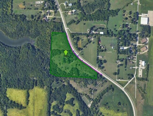
2400 Nw Lees Summit Rd
52-300-03-07-00-0-00-000
SEC-19 TWP-48 RNG-31--- TH PT OF TH SE SW & SW SE DAF: BEG N W COR SE SW TH E 382 MOL TO W LI LEES SUMMIT RD TH SLY & S ELY 1577 MOL TO A PT 123 E MOL & 173 MOL N OF SW COR SE 1
Agriculturalland
Jackson
AE
Missouri
29095C0409G
22.70 AC
2024
East Jackson County
2025
Kansas City
014300
Kansas City, MO-KS
2,153 SF
DEMOGRAPHICS near 2400 Nw Lees Summit Rd
1 Mile
3 Mile
5 Mile
2024 Total Population
438
32,586
100,950
2029 Population
422
32,414
99,760
Pop Growth 2024-2029
(3.65%)
(0.53%)
(1.18%)
Average Age
39
42
41
2024 Total Households
139
13,794
39,693
HH Growth 2024-2029
(4.32%)
(0.28%)
(1.28%)
Median Household Inc
$110,984
$80,575
$91,075
Avg Household Size
2.80
2.30
2.50
2024 Avg HH Vehicles
2.00
2.00
2.00
Median Home Value
$272,222
$262,372
$260,616
Median Year Built
1983
1985
1986
Nearby Places
Map Layers
Map Styles
 Street
 Aerial
- Restaurants
- Banks
- Shops
- Fitness
- Groceries
PUBLIC TRANSPORTATION
COMMUTER RAIL
Lee's Summit Amtrak (Lincoln Service Missouri River Runner - Amtrak, Missouri River Runner - Amtrak)
DRIVE
WALK
Distance
Lee's Summit Amtrak (Lincoln Service Missouri River Runner - Amtrak, Missouri River Runner - Amtrak)
7 min
3.4 mi
AIRPORT
Kansas City International
DRIVE
WALK
Distance
Kansas City International
54 min
38.6 mi
Freight Ports
Tulsa Port Of Catoosa
DRIVE
WALK
Distance
Tulsa Port Of Catoosa
267 min
242.5 mi
SALE & LEASE HISTORY
LISTING DATE
SALE/LEASE

Jun 17, 2024
For Sale
Nearby Properties
Address
Land Use
TOTAL SIZE
Lot Size
Zoning
Address
Land Use
TOTAL SIZE
Lot Size
Zoning
474,121 SF
40.14 AC
Address
Land Use
TOTAL SIZE
Lot Size
Zoning
535,500 SF
54.13 AC
Address
Land Use
TOTAL SIZE
Lot Size
Zoning
480,000 SF
45.89 AC
Address
Land Use
TOTAL SIZE
Lot Size
Zoning
246,379 SF
51.99 AC
Address
Land Use
TOTAL SIZE
Lot Size
Zoning
438,125 SF
Address
Land Use
TOTAL SIZE
Lot Size
Zoning
246,384 SF
22 AC
Address
Land Use
TOTAL SIZE
Lot Size
Zoning
195,589 SF
47.72 AC
Address
Land Use
TOTAL SIZE
Lot Size
Zoning
209,098 SF
Address
Land Use
TOTAL SIZE
Lot Size
Zoning
339,970 SF
Address
Land Use
TOTAL SIZE
Lot Size
Zoning
523,783 SF
1.61 AC
Address
Land Use
TOTAL SIZE
Lot Size
Zoning
52,030 SF
11.81 AC
Address
Land Use
TOTAL SIZE
Lot Size
Zoning
227,052 SF
12.78 AC
Address
Land Use
TOTAL SIZE
Lot Size
Zoning
100,573 SF
2.89 AC
Address
Land Use
TOTAL SIZE
Lot Size
Zoning
104,368 SF
13.90 AC
Address
Land Use
TOTAL SIZE
Lot Size
Zoning
248,600 SF
Address
Land Use
TOTAL SIZE
Lot Size
Zoning
140,377 SF
27 AC
Address
Land Use
TOTAL SIZE
Lot Size
Zoning
96,980 SF
66.45 AC
Address
Land Use
TOTAL SIZE
Lot Size
Zoning
165,827 SF
14.49 AC
Address
Land Use
TOTAL SIZE
Lot Size
Zoning
72,168 SF
Address
Land Use
TOTAL SIZE
Lot Size
Zoning
195,586 SF
20.91 AC
Address
Land Use
TOTAL SIZE
Lot Size
Zoning
184,445 SF
Address
Land Use
TOTAL SIZE
Lot Size
Zoning
136,224 SF
15.25 AC
Address
Land Use
TOTAL SIZE
Lot Size
Zoning
104,704 SF
11.28 AC
Address
Land Use
TOTAL SIZE
Lot Size
Zoning
126,081 SF
21 AC
Address
Land Use
TOTAL SIZE
Lot Size
Zoning
192,014 SF
20.95 AC
Address
Land Use
TOTAL SIZE
Lot Size
Zoning
108,530 SF
17.95 AC
Address
Land Use
TOTAL SIZE
Lot Size
Zoning
82,704 SF
148.69 AC
Address
Land Use
TOTAL SIZE
Lot Size
Zoning
125,609 SF
9.32 AC
Address
Land Use
TOTAL SIZE
Lot Size
Zoning
128,393 SF
27.30 AC
Address
Land Use
TOTAL SIZE
Lot Size
Zoning
59,820 SF
6.22 AC
The World's #1 Commercial Real Estate Marketplace
Connect with us
© 2026 CoStar Group
The information above has been obtained from sources believed reliable. While we do not doubt its accuracy we have not verified it and make no guarantee, warranty or representation about it. It is your responsibility to independently confirm its accuracy and completeness. Any projections, opinions, assumptions, or estimates used are for example only and do not represent the current or future performance of the property. The value of this transaction to you depends on tax and other factors which should be evaluated by your tax, financial, and legal advisors. You and your advisors should conduct a careful, independent investigation of the property to determine to your satisfaction the suitability of the property for your needs.