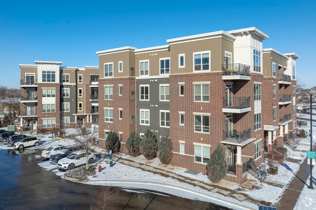
Property Record
2400 Parmenter St, Middleton, WI 53562


NEARBY LISTINGS FOR SALE OR LEASE
Property Detail
2400 Parmenter St
Madison, WI
Csm #13708
0708-112-8410-2
LOT 1 CSM 13708 CS90/159-161 05/08/2014 F/K/A LOT 2 CSM 11926 CS73/165 & 166 10- 04-06 DESCR AS SEC 11-07-08 PRT OF NE1/4 NW1/4 & SEC 11-7-8 PRT NE1/4NW1/4 DESCR AS COM AT N1/4 COR OF SEC 11 TH S01DEG2920W 1041.57 FT ALG E LN OF NW1/4 OF S EC 11 TH S
Commercialnec
Dane
X
Wisconsin
55025C0382G
1,2
2024
1.31 AC
2024
Sak's Woods
011101
Milwaukee/Madison
DEMOGRAPHICS near 2400 Parmenter St
1 Mile
3 Mile
5 Mile
2024 Total Population
9,265
50,785
111,624
2029 Population
9,684
52,879
116,126
Pop Growth 2024-2029
+ 4.52%
+ 4.12%
+ 4.03%
Average Age
41
41
40
2024 Total Households
3,968
23,272
51,331
HH Growth 2024-2029
+ 4.61%
+ 4.15%
+ 4.13%
Median Household Inc
$97,773
$91,334
$85,646
Avg Household Size
2.30
2.10
2.10
2024 Avg HH Vehicles
2.00
2.00
2.00
Median Home Value
$430,049
$432,502
$409,400
Median Year Built
1978
1988
1986
Nearby Places
Map Layers
Map Styles
 Street
 Aerial
- Restaurants
- Banks
- Shops
- Fitness
- Groceries
PUBLIC TRANSPORTATION
AIRPORT
Dane County Regional/Truax Field
DRIVE
WALK
Distance
Dane County Regional/Truax Field
23 min
14.1 mi
Freight Ports
Port Milwaukee
DRIVE
WALK
Distance
Port Milwaukee
112 min
91.1 mi
Nearby Properties
Address
Land Use
TOTAL SIZE
Lot Size
Zoning
Address
Land Use
TOTAL SIZE
Lot Size
Zoning
15.61 AC
Address
Land Use
TOTAL SIZE
Lot Size
Zoning
700,496 SF
23.94 AC
SR-V2
Address
Land Use
TOTAL SIZE
Lot Size
Zoning
37,909 SF
10.27 AC
SEC
Address
Land Use
TOTAL SIZE
Lot Size
Zoning
203,672 SF
7.34 AC
PD
Address
Land Use
TOTAL SIZE
Lot Size
Zoning
8.48 AC
Address
Land Use
TOTAL SIZE
Lot Size
Zoning
169,563 SF
19.82 AC
SEC
Address
Land Use
TOTAL SIZE
Lot Size
Zoning
10.12 AC
Address
Land Use
TOTAL SIZE
Lot Size
Zoning
5.95 AC
Address
Land Use
TOTAL SIZE
Lot Size
Zoning
11.09 AC
Address
Land Use
TOTAL SIZE
Lot Size
Zoning
2.91 AC
SE
Address
Land Use
TOTAL SIZE
Lot Size
Zoning
326,724 SF
4.23 AC
PD
Address
Land Use
TOTAL SIZE
Lot Size
Zoning
159,686 SF
7.39 AC
SEC
Address
Land Use
TOTAL SIZE
Lot Size
Zoning
4.37 AC
Address
Land Use
TOTAL SIZE
Lot Size
Zoning
Address
Land Use
TOTAL SIZE
Lot Size
Zoning
320,074 SF
9.28 AC
SR-V2
Address
Land Use
TOTAL SIZE
Lot Size
Zoning
37,909 SF
10.27 AC
SEC
Address
Land Use
TOTAL SIZE
Lot Size
Zoning
Address
Land Use
TOTAL SIZE
Lot Size
Zoning
10.01 AC
Address
Land Use
TOTAL SIZE
Lot Size
Zoning
264,603 SF
10.32 AC
PD
Address
Land Use
TOTAL SIZE
Lot Size
Zoning
142,082 SF
228.01 AC
PD
Address
Land Use
TOTAL SIZE
Lot Size
Zoning
40.70 AC
Address
Land Use
TOTAL SIZE
Lot Size
Zoning
Address
Land Use
TOTAL SIZE
Lot Size
Zoning
162,786 SF
17.48 AC
PD
Address
Land Use
TOTAL SIZE
Lot Size
Zoning
80,328 SF
5.31 AC
SE
Address
Land Use
TOTAL SIZE
Lot Size
Zoning
26.62 AC
Address
Land Use
TOTAL SIZE
Lot Size
Zoning
1.19 AC
Address
Land Use
TOTAL SIZE
Lot Size
Zoning
180,156 SF
3.48 AC
SE
Address
Land Use
TOTAL SIZE
Lot Size
Zoning
3.19 AC
Address
Land Use
TOTAL SIZE
Lot Size
Zoning
109,272 SF
10.76 AC
PD
Address
Land Use
TOTAL SIZE
Lot Size
Zoning
10.50 AC
The World's #1 Commercial Real Estate Marketplace
Connect with us
© 2025 CoStar Group
The information above has been obtained from sources believed reliable. While we do not doubt its accuracy we have not verified it and make no guarantee, warranty or representation about it. It is your responsibility to independently confirm its accuracy and completeness. Any projections, opinions, assumptions, or estimates used are for example only and do not represent the current or future performance of the property. The value of this transaction to you depends on tax and other factors which should be evaluated by your tax, financial, and legal advisors. You and your advisors should conduct a careful, independent investigation of the property to determine to your satisfaction the suitability of the property for your needs.