Property Record
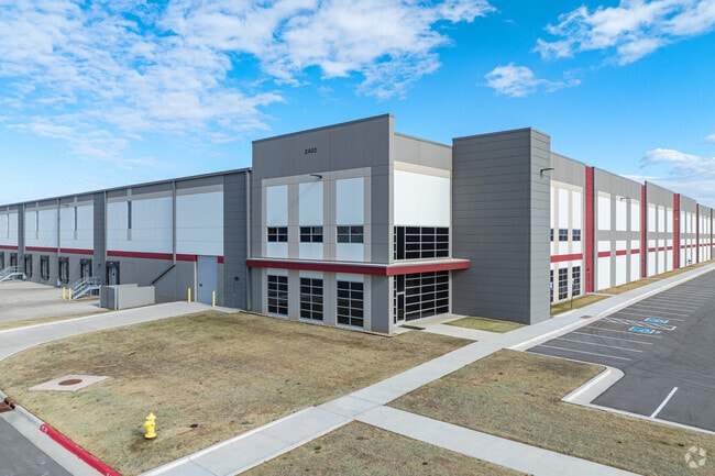
2400 S Council Rd, Oklahoma City, OK 73128


NEARBY LISTINGS FOR SALE OR LEASE
Property Detail
2400 S Council Rd
Oklahoma City, OK
Unpltd Pt Sec 08 11N 4W
142034015
UNPLTD PT OF SW4 SEC 8 11N 4W BEG 1081.08FT N OF SW/C SW4 TH N1383.17FT E1121.18FT S1383.17FT W1121.18FT TO BEG CONT 35.60ACRS MORE OR LESS SUBJ TO ESMTS & R/W
Warehouse
Oklahoma
2023
Oklahoma
2024
35.60 AC
108604
Southwest
615,435 SF
Oklahoma City
DEMOGRAPHICS near 2400 S Council Rd
1 Mile
3 Mile
5 Mile
2024 Total Population
306
34,175
126,638
2029 Population
323
38,520
140,300
Pop Growth 2024-2029
+ 5.56%
+ 12.71%
+ 10.79%
Average Age
36
36
36
2024 Total Households
126
12,007
46,884
HH Growth 2024-2029
+ 5.56%
+ 12.45%
+ 10.81%
Median Household Inc
$60,577
$65,018
$55,665
Avg Household Size
2.40
2.70
2.60
2024 Avg HH Vehicles
2.00
2.00
2.00
Median Home Value
$155,208
$179,113
$163,247
Median Year Built
1996
1992
1978
Nearby Places
Map Layers
Map Styles
 Street
 Aerial
- Restaurants
- Banks
- Shops
- Fitness
- Groceries
PUBLIC TRANSPORTATION
AIRPORT
Will Rogers World
DRIVE
WALK
Distance
Will Rogers World
18 min
7.5 mi
Freight Ports
Tulsa Port Of Catoosa
DRIVE
WALK
Distance
Tulsa Port Of Catoosa
147 min
132.8 mi
SALE & LEASE HISTORY
LISTING DATE
SALE/LEASE

Nov 09, 2021
For Lease
Nearby Properties
Address
Land Use
TOTAL SIZE
Lot Size
Zoning
Address
Land Use
TOTAL SIZE
Lot Size
Zoning
1,976,300 SF
217.95 AC
I-2
Address
Land Use
TOTAL SIZE
Lot Size
Zoning
1,953,545 SF
111.96 AC
PUD
Address
Land Use
TOTAL SIZE
Lot Size
Zoning
1,563,794 SF
127.94 AC
PUD
Address
Land Use
TOTAL SIZE
Lot Size
Zoning
388,082 SF
34.03 AC
I-2
Address
Land Use
TOTAL SIZE
Lot Size
Zoning
52,170 SF
14.24 AC
Address
Land Use
TOTAL SIZE
Lot Size
Zoning
2,141,947 SF
98.48 AC
I-2
Address
Land Use
TOTAL SIZE
Lot Size
Zoning
1,198 SF
145 AC
Address
Land Use
TOTAL SIZE
Lot Size
Zoning
653,359 SF
142.11 AC
I-2
Address
Land Use
TOTAL SIZE
Lot Size
Zoning
1,013,603 SF
66.29 AC
PUD
Address
Land Use
TOTAL SIZE
Lot Size
Zoning
460,564 SF
27.08 AC
Address
Land Use
TOTAL SIZE
Lot Size
Zoning
647,520 SF
28.23 AC
PUD
Address
Land Use
TOTAL SIZE
Lot Size
Zoning
136,387 SF
17.63 AC
Address
Land Use
TOTAL SIZE
Lot Size
Zoning
784,972 SF
68.99 AC
I-2
Address
Land Use
TOTAL SIZE
Lot Size
Zoning
40,625 SF
30.82 AC
Address
Land Use
TOTAL SIZE
Lot Size
Zoning
195,412 SF
4.42 AC
I-1
Address
Land Use
TOTAL SIZE
Lot Size
Zoning
1,194,497 SF
89.98 AC
I-2
Address
Land Use
TOTAL SIZE
Lot Size
Zoning
300,000 SF
123.06 AC
R-1
Address
Land Use
TOTAL SIZE
Lot Size
Zoning
720,640 SF
52.69 AC
PUD
Address
Land Use
TOTAL SIZE
Lot Size
Zoning
211,626 SF
12.67 AC
PUD
Address
Land Use
TOTAL SIZE
Lot Size
Zoning
279,224 SF
18.75 AC
PUD
Address
Land Use
TOTAL SIZE
Lot Size
Zoning
192,771 SF
11.20 AC
I-3
Address
Land Use
TOTAL SIZE
Lot Size
Zoning
177,623 SF
12.13 AC
Address
Land Use
TOTAL SIZE
Lot Size
Zoning
360 SF
30.13 AC
Address
Land Use
TOTAL SIZE
Lot Size
Zoning
305,154 SF
33.30 AC
I-2
Address
Land Use
TOTAL SIZE
Lot Size
Zoning
538,787 SF
34.39 AC
I-2
Address
Land Use
TOTAL SIZE
Lot Size
Zoning
336,750 SF
15.53 AC
I-3
Address
Land Use
TOTAL SIZE
Lot Size
Zoning
215,392 SF
63.71 AC
I-2
Address
Land Use
TOTAL SIZE
Lot Size
Zoning
9.28 AC
I-2
Address
Land Use
TOTAL SIZE
Lot Size
Zoning
256,500 SF
19.46 AC
I-3
The World's #1 Commercial Real Estate Marketplace
Connect with us
© 2026 CoStar Group
The information above has been obtained from sources believed reliable. While we do not doubt its accuracy we have not verified it and make no guarantee, warranty or representation about it. It is your responsibility to independently confirm its accuracy and completeness. Any projections, opinions, assumptions, or estimates used are for example only and do not represent the current or future performance of the property. The value of this transaction to you depends on tax and other factors which should be evaluated by your tax, financial, and legal advisors. You and your advisors should conduct a careful, independent investigation of the property to determine to your satisfaction the suitability of the property for your needs.