Property Record
2400 S Main St, Fort Scott, KS 66701
NEARBY LISTINGS FOR SALE OR LEASE
Property Detail
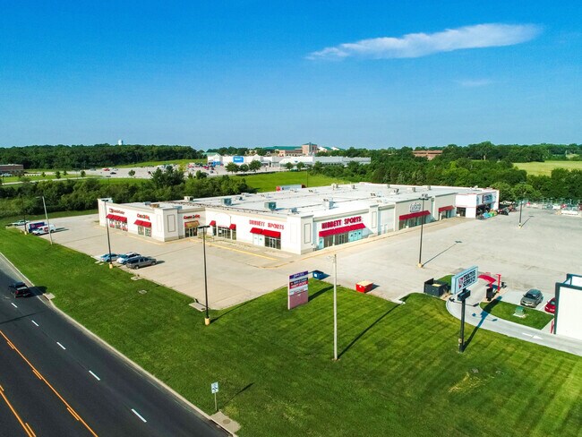
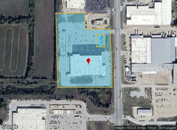
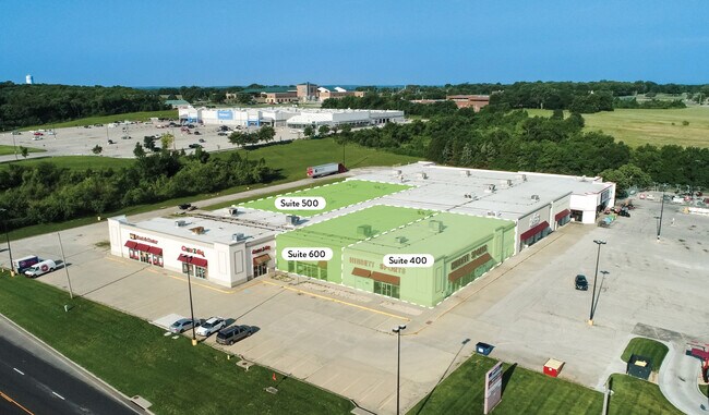
2400 S Main St
Wholesaleoutletdiscountstore
S06, T26, R25, 404028 SQUARE FEET, A TRACT SE4 BEG @ S498 & W85.04 NE COR SE4 SAID POINT BEING THE W R/O/W OF US 69 HWY TO
X
Bourbon
20011C0337F
Kansas
0
9.28 AC
2025
Kansas Area
955800
Other Market Areas
64,336 SF
203-06-0-40-01-008.00-0
DEMOGRAPHICS near 2400 S Main St
1 Mile
3 Mile
5 Mile
2024 Total Population
1,458
8,797
10,070
2029 Population
1,461
8,864
10,140
Pop Growth 2024-2029
+ 0.21%
+ 0.76%
+ 0.70%
Average Age
42
40
40
2024 Total Households
576
3,550
4,031
HH Growth 2024-2029
+ 0.35%
+ 0.85%
+ 0.77%
Median Household Inc
$40,441
$43,300
$46,940
Avg Household Size
2.30
2.30
2.40
2024 Avg HH Vehicles
2.00
2.00
2.00
Median Home Value
$98,979
$77,243
$84,051
Median Year Built
1961
1956
1958
Nearby Places
Map Layers
Map Styles
 Street
 Aerial
- Restaurants
- Banks
- Shops
- Fitness
- Groceries
SALE & LEASE HISTORY
LISTING DATE
SALE/LEASE

Oct 06, 2021
For Sale
Mar 29, 2022
For Lease
Mar 04, 2024
For Lease
Nearby Properties
Address
Land Use
TOTAL SIZE
Lot Size
Zoning
Address
Land Use
TOTAL SIZE
Lot Size
Zoning
275,486 SF
126 AC
RS
Address
Land Use
TOTAL SIZE
Lot Size
Zoning
185,420 SF
26.70 AC
RL
Address
Land Use
TOTAL SIZE
Lot Size
Zoning
136,112 SF
5.54 AC
R3
Address
Land Use
TOTAL SIZE
Lot Size
Zoning
103,420 SF
6.56 AC
R2
Address
Land Use
TOTAL SIZE
Lot Size
Zoning
21,318 SF
4.40 AC
Address
Land Use
TOTAL SIZE
Lot Size
Zoning
37,181 SF
1.78 AC
C3
Address
Land Use
TOTAL SIZE
Lot Size
Zoning
61,200 SF
8.46 AC
R1
Address
Land Use
TOTAL SIZE
Lot Size
Zoning
39,425 SF
4.47 AC
C2
Address
Land Use
TOTAL SIZE
Lot Size
Zoning
8,301 SF
16.27 AC
C2
Address
Land Use
TOTAL SIZE
Lot Size
Zoning
30,091 SF
4.25 AC
R2
Address
Land Use
TOTAL SIZE
Lot Size
Zoning
164,527 SF
17.15 AC
C2
Address
Land Use
TOTAL SIZE
Lot Size
Zoning
26,598 SF
1.69 AC
R2
Address
Land Use
TOTAL SIZE
Lot Size
Zoning
42,756 SF
2.27 AC
R3
Address
Land Use
TOTAL SIZE
Lot Size
Zoning
33,600 SF
0.59 AC
C3
Address
Land Use
TOTAL SIZE
Lot Size
Zoning
26,918 SF
1.75 AC
R2
Address
Land Use
TOTAL SIZE
Lot Size
Zoning
13,945 SF
1.78 AC
R2
Address
Land Use
TOTAL SIZE
Lot Size
Zoning
27,289 SF
0.83 AC
R3
Address
Land Use
TOTAL SIZE
Lot Size
Zoning
35,316 SF
0.86 AC
R3
Address
Land Use
TOTAL SIZE
Lot Size
Zoning
30,000 SF
10.90 AC
AL
Address
Land Use
TOTAL SIZE
Lot Size
Zoning
17,659 SF
0.41 AC
C3
Address
Land Use
TOTAL SIZE
Lot Size
Zoning
1,056 SF
7.40 AC
C3
Address
Land Use
TOTAL SIZE
Lot Size
Zoning
10,064 SF
35.10 AC
AL
Address
Land Use
TOTAL SIZE
Lot Size
Zoning
9,392 SF
16.20 AC
AL
Address
Land Use
TOTAL SIZE
Lot Size
Zoning
6,404 SF
10.20 AC
AL
Address
Land Use
TOTAL SIZE
Lot Size
Zoning
19,304 SF
4.50 AC
I2
Address
Land Use
TOTAL SIZE
Lot Size
Zoning
196,406 SF
9.40 AC
RS
Address
Land Use
TOTAL SIZE
Lot Size
Zoning
137,170 SF
9.93 AC
C2
Address
Land Use
TOTAL SIZE
Lot Size
Zoning
7,026 SF
6.45 AC
R2
Address
Land Use
TOTAL SIZE
Lot Size
Zoning
10,542 SF
2.46 AC
C0
Address
Land Use
TOTAL SIZE
Lot Size
Zoning
2,092 SF
5.25 AC
R4
The World's #1 Commercial Real Estate Marketplace
Connect with us
© 2026 CoStar Group
The information above has been obtained from sources believed reliable. While we do not doubt its accuracy we have not verified it and make no guarantee, warranty or representation about it. It is your responsibility to independently confirm its accuracy and completeness. Any projections, opinions, assumptions, or estimates used are for example only and do not represent the current or future performance of the property. The value of this transaction to you depends on tax and other factors which should be evaluated by your tax, financial, and legal advisors. You and your advisors should conduct a careful, independent investigation of the property to determine to your satisfaction the suitability of the property for your needs.