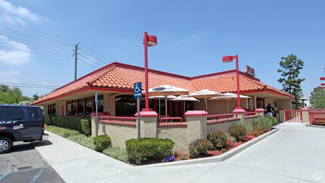
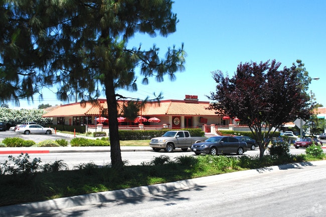
Property Record
24005 Calabasas Rd, Calabasas, CA 91302

NEARBY LISTINGS FOR SALE OR LEASE
Property Detail
24005 Calabasas Rd
Los Angeles-Long Beach-Glendale, CA
10935
2068-002-037
POR IN TRA 10932 OF LOT 1 PM 37-67 AND POR SW 1/4 OF SEC 22 T1N R17W
Parkinglot
Los Angeles
X
California
06111C1020E
1
2024
0.49 AC
2025
Calabasas/Westlake Vill
800204
Los Angeles
9,300 SF
DEMOGRAPHICS near 24005 Calabasas Rd
1 Mile
3 Mile
5 Mile
2024 Total Population
4,737
66,510
182,968
2029 Population
4,605
64,404
178,447
Pop Growth 2024-2029
(2.79%)
(3.17%)
(2.47%)
Average Age
46
43
42
2024 Total Households
1,750
24,162
68,885
HH Growth 2024-2029
(2.97%)
(3.44%)
(2.50%)
Median Household Inc
$187,852
$136,880
$106,384
Avg Household Size
2.70
2.70
2.60
2024 Avg HH Vehicles
2.00
2.00
2.00
Median Home Value
$1,114,346
$1,026,233
$922,979
Median Year Built
1975
1968
1974
Nearby Places
Map Layers
Map Styles
 Street
 Aerial
- Restaurants
- Banks
- Shops
- Fitness
- Groceries
PUBLIC TRANSPORTATION
COMMUTER RAIL
Chatsworth (Ventura County Line - Southern California Regional Rail Authority (Metrolink))
DRIVE
WALK
Distance
Chatsworth (Ventura County Line - Southern California Regional Rail Authority (Metrolink))
18 min
9.5 mi
AIRPORT
Bob Hope
DRIVE
WALK
Distance
Bob Hope
29 min
20.8 mi
Los Angeles International
DRIVE
WALK
Distance
Los Angeles International
38 min
28.9 mi
Freight Ports
The Port of Hueneme
DRIVE
WALK
Distance
The Port of Hueneme
49 min
36.3 mi
Nearby Properties
Address
Land Use
TOTAL SIZE
Lot Size
Zoning
Address
Land Use
TOTAL SIZE
Lot Size
Zoning
365,572 SF
8.95 AC
LAR3
Address
Land Use
TOTAL SIZE
Lot Size
Zoning
583,153 SF
4.22 AC
LACR
Address
Land Use
TOTAL SIZE
Lot Size
Zoning
221,414 SF
6.42 AC
LAP
Address
Land Use
TOTAL SIZE
Lot Size
Zoning
329,741 SF
20.14 AC
LCC3DP*
Address
Land Use
TOTAL SIZE
Lot Size
Zoning
107,395 SF
4.98 AC
CPD
Address
Land Use
TOTAL SIZE
Lot Size
Zoning
162,406 SF
10.60 AC
LAC2
Address
Land Use
TOTAL SIZE
Lot Size
Zoning
427,375 SF
7.61 AC
LAWC
Address
Land Use
TOTAL SIZE
Lot Size
Zoning
165,362 SF
4.08 AC
LCCM
Address
Land Use
TOTAL SIZE
Lot Size
Zoning
208,633 SF
4.62 AC
LAC4
Address
Land Use
TOTAL SIZE
Lot Size
Zoning
106,614 SF
0.78 AC
LAR3
Address
Land Use
TOTAL SIZE
Lot Size
Zoning
106,712 SF
11.55 AC
CSCM
Address
Land Use
TOTAL SIZE
Lot Size
Zoning
280,491 SF
4.74 AC
CSCM
Address
Land Use
TOTAL SIZE
Lot Size
Zoning
173,245 SF
6.16 AC
LCC2*
Address
Land Use
TOTAL SIZE
Lot Size
Zoning
257,344 SF
4.09 AC
CSCM
Address
Land Use
TOTAL SIZE
Lot Size
Zoning
249,703 SF
12.68 AC
LAC2
Address
Land Use
TOTAL SIZE
Lot Size
Zoning
92,367 SF
4.16 AC
CSCR-SC*
Address
Land Use
TOTAL SIZE
Lot Size
Zoning
91,706 SF
1.25 AC
LCC3
Address
Land Use
TOTAL SIZE
Lot Size
Zoning
361,121 SF
11.28 AC
LAC1
Address
Land Use
TOTAL SIZE
Lot Size
Zoning
173,964 SF
1.63 AC
LAR3
Address
Land Use
TOTAL SIZE
Lot Size
Zoning
161,565 SF
1.92 AC
LAC2
Address
Land Use
TOTAL SIZE
Lot Size
Zoning
98,270 SF
4.69 AC
CSCM
Address
Land Use
TOTAL SIZE
Lot Size
Zoning
58,252 SF
6.59 AC
LAC2
Address
Land Use
TOTAL SIZE
Lot Size
Zoning
101,087 SF
4.47 AC
Address
Land Use
TOTAL SIZE
Lot Size
Zoning
173,362 SF
7.41 AC
LARD2
Address
Land Use
TOTAL SIZE
Lot Size
Zoning
65,706 SF
1.24 AC
LACRA 1-A2
Address
Land Use
TOTAL SIZE
Lot Size
Zoning
173,272 SF
6.93 AC
LARD2
Address
Land Use
TOTAL SIZE
Lot Size
Zoning
138,764 SF
1.46 AC
LAR3
Address
Land Use
TOTAL SIZE
Lot Size
Zoning
141,432 SF
3.08 AC
LAC1.5
The World's #1 Commercial Real Estate Marketplace
Connect with us
© 2025 CoStar Group
The information above has been obtained from sources believed reliable. While we do not doubt its accuracy we have not verified it and make no guarantee, warranty or representation about it. It is your responsibility to independently confirm its accuracy and completeness. Any projections, opinions, assumptions, or estimates used are for example only and do not represent the current or future performance of the property. The value of this transaction to you depends on tax and other factors which should be evaluated by your tax, financial, and legal advisors. You and your advisors should conduct a careful, independent investigation of the property to determine to your satisfaction the suitability of the property for your needs.