Property Record
2401 108Th Ln Ne, Minneapolis, MN 55449

NEARBY LISTINGS FOR SALE OR LEASE
-
-
View all Minneapolis listings for sale on LoopNet.com
Property Detail
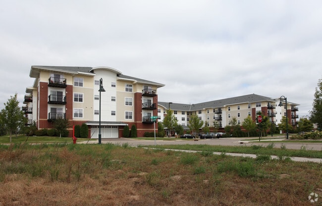
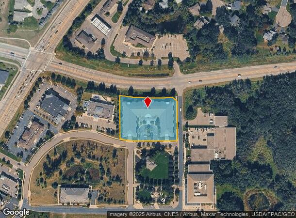
2401 108Th Ln Ne
Minneapolis-St. Paul-Bloomington, MN-WI
Blaine Town Square
21-31-23-11-0016
LOT 1 BLOCK 3 BLAINE TOWN SQUARE , SUBJ TO EASE OF REC
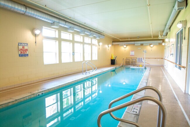
Apartment
Anoka
X
Minnesota
27003C0340E
1
2024
1.84 AC
2025
Outer Coon Rapids/Fridley/Blaine
050816
Minneapolis/St Paul
145,312 SF
DEMOGRAPHICS near 2401 108Th Ln Ne
1 Mile
3 Mile
5 Mile
2024 Total Population
3,910
67,933
159,166
2029 Population
4,055
71,038
164,640
Pop Growth 2024-2029
+ 3.71%
+ 4.57%
+ 3.44%
Average Age
41
38
39
2024 Total Households
1,459
24,540
58,983
HH Growth 2024-2029
+ 3.77%
+ 4.52%
+ 3.34%
Median Household Inc
$112,836
$92,933
$87,853
Avg Household Size
2.60
2.70
2.60
2024 Avg HH Vehicles
2.00
2.00
2.00
Median Home Value
$473,850
$289,823
$282,007
Median Year Built
2003
1995
1986
Nearby Places
Map Layers
Map Styles
 Street
 Aerial
- Restaurants
- Banks
- Shops
- Fitness
- Groceries
PUBLIC TRANSPORTATION
COMMUTER RAIL
Coon Rapids-Riverdale Station (Northstar Corridor - Northstar Commuter Rail)
DRIVE
WALK
Distance
Coon Rapids-Riverdale Station (Northstar Corridor - Northstar Commuter Rail)
16 min
8.3 mi
Fridley Station (Northstar Corridor - Northstar Commuter Rail)
DRIVE
WALK
Distance
Fridley Station (Northstar Corridor - Northstar Commuter Rail)
16 min
9.2 mi
AIRPORT
Minneapolis-St Paul International/Wold-Chamberlain
DRIVE
WALK
Distance
Minneapolis-St Paul International/Wold-Chamberlain
40 min
25.5 mi
Freight Ports
Port Milwaukee
DRIVE
WALK
Distance
Port Milwaukee
385 min
347.7 mi
Nearby Properties
Address
Land Use
TOTAL SIZE
Lot Size
Zoning
Address
Land Use
TOTAL SIZE
Lot Size
Zoning
100,260 SF
74.82 AC
Address
Land Use
TOTAL SIZE
Lot Size
Zoning
239,389 SF
5.73 AC
Address
Land Use
TOTAL SIZE
Lot Size
Zoning
214,300 SF
9.15 AC
Address
Land Use
TOTAL SIZE
Lot Size
Zoning
239,318 SF
Address
Land Use
TOTAL SIZE
Lot Size
Zoning
Address
Land Use
TOTAL SIZE
Lot Size
Zoning
195,000 SF
Address
Land Use
TOTAL SIZE
Lot Size
Zoning
8,400 SF
10.10 AC
Address
Land Use
TOTAL SIZE
Lot Size
Zoning
225,576 SF
6.07 AC
Address
Land Use
TOTAL SIZE
Lot Size
Zoning
208 SF
228 AC
Address
Land Use
TOTAL SIZE
Lot Size
Zoning
14,908 SF
28.38 AC
Address
Land Use
TOTAL SIZE
Lot Size
Zoning
179,853 SF
37.73 AC
Address
Land Use
TOTAL SIZE
Lot Size
Zoning
248,816 SF
14.02 AC
Address
Land Use
TOTAL SIZE
Lot Size
Zoning
192 SF
11.30 AC
Address
Land Use
TOTAL SIZE
Lot Size
Zoning
105,324 SF
13.36 AC
Address
Land Use
TOTAL SIZE
Lot Size
Zoning
74,366 SF
10 AC
Address
Land Use
TOTAL SIZE
Lot Size
Zoning
76,383 SF
7.60 AC
Address
Land Use
TOTAL SIZE
Lot Size
Zoning
190,377 SF
9.61 AC
Address
Land Use
TOTAL SIZE
Lot Size
Zoning
109,136 SF
Address
Land Use
TOTAL SIZE
Lot Size
Zoning
98,642 SF
20.01 AC
Address
Land Use
TOTAL SIZE
Lot Size
Zoning
46,557 SF
9.27 AC
Address
Land Use
TOTAL SIZE
Lot Size
Zoning
119,907 SF
36.99 AC
Address
Land Use
TOTAL SIZE
Lot Size
Zoning
61,740 SF
16.10 AC
Address
Land Use
TOTAL SIZE
Lot Size
Zoning
122,498 SF
31.67 AC
Address
Land Use
TOTAL SIZE
Lot Size
Zoning
135,994 SF
3.20 AC
Address
Land Use
TOTAL SIZE
Lot Size
Zoning
77,940 SF
19.07 AC
Address
Land Use
TOTAL SIZE
Lot Size
Zoning
135,746 SF
8.85 AC
Address
Land Use
TOTAL SIZE
Lot Size
Zoning
162,450 SF
9.97 AC
Address
Land Use
TOTAL SIZE
Lot Size
Zoning
287,568 SF
8.01 AC
Address
Land Use
TOTAL SIZE
Lot Size
Zoning
223,763 SF
24.89 AC
Address
Land Use
TOTAL SIZE
Lot Size
Zoning
83,688 SF
5.75 AC
The World's #1 Commercial Real Estate Marketplace
Connect with us
© 2026 CoStar Group
The information above has been obtained from sources believed reliable. While we do not doubt its accuracy we have not verified it and make no guarantee, warranty or representation about it. It is your responsibility to independently confirm its accuracy and completeness. Any projections, opinions, assumptions, or estimates used are for example only and do not represent the current or future performance of the property. The value of this transaction to you depends on tax and other factors which should be evaluated by your tax, financial, and legal advisors. You and your advisors should conduct a careful, independent investigation of the property to determine to your satisfaction the suitability of the property for your needs.