Property Record
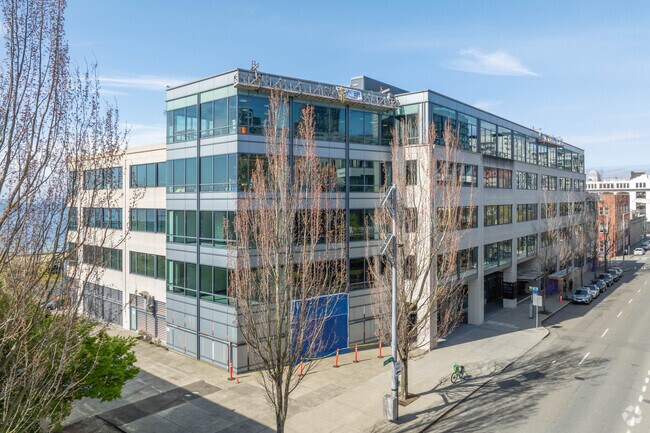
2401 Elliott Ave, Seattle, WA 98121


NEARBY LISTINGS FOR SALE OR LEASE
Property Detail
2401 Elliott Ave
Seattle/Puget Sound
Seattle Tide Lds Bl 01-376
Seattle-Tacoma-Bellevue, WA
SEATTLE TIDE LDS POR LOTS 5 THRU 8 BLK 1 BELL & DENNYS ADD TO C OF S & LOT 7 BLK 30 BELL&DENNYS 1ST ADD & LOT 1 BLK 171A & LOTS 1 THRU 4 BLK 170B SEATTLE TIDELANDS & VAC BATTERY ST ADJ DAF - BEG MOST NLY COR SD BLK 1 TH S 47-40-46 E ALG NELY LN SD BL
766620-2320
King
Officebuilding
Washington
2023
1-4
2024
0.91 AC
008002
Belltown/Denny Regrade
257,254 SF
DEMOGRAPHICS near 2401 Elliott Ave
1 Mile
3 Mile
5 Mile
2024 Total Population
57,238
260,597
495,630
2029 Population
59,238
266,673
504,287
Pop Growth 2024-2029
+ 3.49%
+ 2.33%
+ 1.75%
Average Age
39
38
38
2024 Total Households
36,818
144,525
248,882
HH Growth 2024-2029
+ 3.44%
+ 2.34%
+ 1.82%
Median Household Inc
$125,798
$112,549
$115,131
Avg Household Size
1.50
1.70
1.80
2024 Avg HH Vehicles
1.00
1.00
1.00
Median Home Value
$872,848
$962,682
$939,587
Median Year Built
2006
1991
1983
Nearby Places
Map Layers
Map Styles
 Street
 Aerial
- Restaurants
- Banks
- Shops
- Fitness
- Groceries
PUBLIC TRANSPORTATION
TRANSIT/SUBWAY
Seattle Center (Seattle Center Monorail - Seattle Monorail Services (Seattle Monorail))
DRIVE
WALK
Distance
Seattle Center (Seattle Center Monorail - Seattle Monorail Services (Seattle Monorail))
3 min
15 min
0.8 mi
Westlake (Central Link - Central Puget Sound Regional Transit Authority Rail (Link Light Rail/Sounder))
DRIVE
WALK
Distance
Westlake (Central Link - Central Puget Sound Regional Transit Authority Rail (Link Light Rail/Sounder))
5 min
16 min
0.8 mi
Westlake Center (Seattle Center Monorail - Seattle Monorail Services (Seattle Monorail))
DRIVE
WALK
Distance
Westlake Center (Seattle Center Monorail - Seattle Monorail Services (Seattle Monorail))
3 min
17 min
0.9 mi
Westlake & 7th South (South Lake Union Streetcar - Seattle Streetcar)
DRIVE
WALK
Distance
Westlake & 7th South (South Lake Union Streetcar - Seattle Streetcar)
3 min
17 min
0.9 mi
Westlake Hub (South Lake Union Streetcar - Seattle Streetcar)
DRIVE
WALK
Distance
Westlake Hub (South Lake Union Streetcar - Seattle Streetcar)
4 min
17 min
0.9 mi
COMMUTER RAIL
King Street (Seattle) Station (Sounder South Line - Central Puget Sound Regional Transit Authority Rail (Link Light Rail/Sounder))
DRIVE
WALK
Distance
King Street (Seattle) Station (Sounder South Line - Central Puget Sound Regional Transit Authority Rail (Link Light Rail/Sounder))
6 min
1.6 mi
AIRPORT
Seattle-Tacoma International
DRIVE
WALK
Distance
Seattle-Tacoma International
27 min
15.5 mi
Seattle Paine Field International
DRIVE
WALK
Distance
Seattle Paine Field International
38 min
23.9 mi
Freight Ports
Port of Seattle
DRIVE
WALK
Distance
Port of Seattle
12 min
4.4 mi
SALE & LEASE HISTORY
LISTING DATE
SALE/LEASE

Sep 25, 2016
For Lease
Jun 14, 2019
For Lease
Jun 03, 2020
For Lease
Dec 04, 2018
For Lease
Dec 03, 2018
For Lease
Nearby Properties
Address
Land Use
TOTAL SIZE
Lot Size
Zoning
Address
Land Use
TOTAL SIZE
Lot Size
Zoning
800,000 SF
8.57 AC
SM-UP 95 (
Address
Land Use
TOTAL SIZE
Lot Size
Zoning
2.84 AC
DMC 340/29
Address
Land Use
TOTAL SIZE
Lot Size
Zoning
793,990 SF
30.81 AC
UI U/85
Address
Land Use
TOTAL SIZE
Lot Size
Zoning
946,212 SF
1.58 AC
DMC 340/29
Address
Land Use
TOTAL SIZE
Lot Size
Zoning
686,722 SF
1.26 AC
SM-SLU 240
Address
Land Use
TOTAL SIZE
Lot Size
Zoning
36,864 SF
8.02 AC
SM-UP 95 (
Address
Land Use
TOTAL SIZE
Lot Size
Zoning
992,925 SF
4.28 AC
MIO-240-HR
Address
Land Use
TOTAL SIZE
Lot Size
Zoning
1,526,621 SF
1.36 AC
DOC1 U/450
Address
Land Use
TOTAL SIZE
Lot Size
Zoning
716,128 SF
1.41 AC
SM-SLU 175
Address
Land Use
TOTAL SIZE
Lot Size
Zoning
1,062,251 SF
1.47 AC
DOC2 500/3
Address
Land Use
TOTAL SIZE
Lot Size
Zoning
763,898 SF
2.03 AC
DOC2 500/3
Address
Land Use
TOTAL SIZE
Lot Size
Zoning
1,137,666 SF
2.07 AC
DOC1 U/450
Address
Land Use
TOTAL SIZE
Lot Size
Zoning
7,930 SF
4.14 AC
MIO-240-HR
Address
Land Use
TOTAL SIZE
Lot Size
Zoning
6,379 SF
127.60 AC
MML U/85
Address
Land Use
TOTAL SIZE
Lot Size
Zoning
1,128,575 SF
1.30 AC
DOC1 U/450
Address
Land Use
TOTAL SIZE
Lot Size
Zoning
615,000 SF
0.88 AC
DOC2 500/3
Address
Land Use
TOTAL SIZE
Lot Size
Zoning
861,221 SF
1.30 AC
DMC 340/29
Address
Land Use
TOTAL SIZE
Lot Size
Zoning
565,110 SF
29.11 AC
II U/85
Address
Land Use
TOTAL SIZE
Lot Size
Zoning
377,813 SF
1.65 AC
DOC2 500/3
Address
Land Use
TOTAL SIZE
Lot Size
Zoning
1,011,547 SF
0.35 AC
DOC1 U/450
Address
Land Use
TOTAL SIZE
Lot Size
Zoning
1,478,612 SF
0.80 AC
DOC2 500/3
Address
Land Use
TOTAL SIZE
Lot Size
Zoning
67,235 SF
0.45 AC
DOC2 500/3
Address
Land Use
TOTAL SIZE
Lot Size
Zoning
922,344 SF
1.33 AC
DRC 85-170
Address
Land Use
TOTAL SIZE
Lot Size
Zoning
413,982 SF
0.58 AC
DMC 340/29
Address
Land Use
TOTAL SIZE
Lot Size
Zoning
412,000 SF
1.27 AC
DOC1 U/450
Address
Land Use
TOTAL SIZE
Lot Size
Zoning
943,610 SF
1.24 AC
DOC1 U/450
Address
Land Use
TOTAL SIZE
Lot Size
Zoning
155,795 SF
7.89 AC
SM-UP 95 (
Address
Land Use
TOTAL SIZE
Lot Size
Zoning
411,654 SF
0.59 AC
DMC 240/29
The World's #1 Commercial Real Estate Marketplace
Connect with us
© 2026 CoStar Group
The information above has been obtained from sources believed reliable. While we do not doubt its accuracy we have not verified it and make no guarantee, warranty or representation about it. It is your responsibility to independently confirm its accuracy and completeness. Any projections, opinions, assumptions, or estimates used are for example only and do not represent the current or future performance of the property. The value of this transaction to you depends on tax and other factors which should be evaluated by your tax, financial, and legal advisors. You and your advisors should conduct a careful, independent investigation of the property to determine to your satisfaction the suitability of the property for your needs.