Property Record
2401 3Rd Ave, Seattle, WA 98121
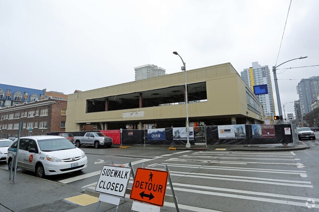

Property Detail
2401 3Rd Ave
Seattle-Tacoma-Bellevue, WA
King
065600-0215
Washington
Apartment
0.29 AC
DMR/R 145/
Belltown/Denny Regrade
B and X Area of moderate flood hazard, usually the area between the limits of the 100-year and 500-year floods.
Seattle/Puget Sound
95,568 SF
NEARBY LISTINGS FOR SALE OR LEASE
DEMOGRAPHICS near 2401 3Rd Ave
1 mile
3 mile
5 mile
2025 Total Population
76,082
276,966
526,969
2030 Population
80,935
293,011
554,313
Pop Growth 2025-2030
+ 6.38%
+ 5.79%
+ 5.19%
Average Age
38
38
38
2025 Total Households
49,483
152,745
262,723
HH Growth 2025-2030
+ 6.48%
+ 5.99%
+ 5.51%
Median Household Inc
$130,299
$121,343
$123,466
Avg Household Size
1.50
1.70
1.90
2025 Avg HH Vehicles
1.00
1.00
1.00
Median Home Value
$812,980
$997,608
$1,006,556
Median Year Built
2004
1992
1984
Nearby Places
Map Layers
Map Styles
 Street
 Aerial
Layers
 Traffic
 Biking
Places
Listings with unknown addresses are not visible on the map
- Restaurants
- Banks
- Shops
- Fitness
- Groceries
PUBLIC TRANSPORTATION
TRANSIT/SUBWAY
Westlake & 9th (South Lake Union Streetcar - Seattle Streetcar)
Drive
Walk
Distance
Westlake & 9th (South Lake Union Streetcar - Seattle Streetcar)
2 min
10 min
0.5 mi
Westlake Ave & 9th Ave (South Lake Union Streetcar - Seattle Streetcar)
Drive
Walk
Distance
Westlake Ave & 9th Ave (South Lake Union Streetcar - Seattle Streetcar)
2 min
10 min
0.6 mi
Westlake Ave & Virginia St (South Lake Union Streetcar - Seattle Streetcar)
Drive
Walk
Distance
Westlake Ave & Virginia St (South Lake Union Streetcar - Seattle Streetcar)
2 min
11 min
0.6 mi
Westlake & 7th South (South Lake Union Streetcar - Seattle Streetcar)
Drive
Walk
Distance
Westlake & 7th South (South Lake Union Streetcar - Seattle Streetcar)
2 min
11 min
0.6 mi
Westlake & 7th North (South Lake Union Streetcar - Seattle Streetcar)
Drive
Walk
Distance
Westlake & 7th North (South Lake Union Streetcar - Seattle Streetcar)
3 min
11 min
0.6 mi
COMMUTER RAIL
King Street (Seattle) Station (Sounder South Line - Central Puget Sound Regional Transit Authority Rail (Link Light Rail/Sounder))
Drive
Walk
Distance
King Street (Seattle) Station (Sounder South Line - Central Puget Sound Regional Transit Authority Rail (Link Light Rail/Sounder))
7 min
1.6 mi
AIRPORT
Seattle-Tacoma International
Drive
Walk
Distance
Seattle-Tacoma International
19 min
15.2 mi
Freight Ports
Port of Seattle
Drive
Walk
Distance
Port of Seattle
1 min
3.1 mi
Nearby Properties
Address
Land Use
TOTAL SIZE
Lot Size
Zoning
Address
Land Use
TOTAL SIZE
Lot Size
Zoning
800,000 SF
8.57 AC
SM-UP 95 (
Address
Land Use
TOTAL SIZE
Lot Size
Zoning
471.20 AC
MIO-37-LR1
Address
Land Use
TOTAL SIZE
Lot Size
Zoning
2.84 AC
DMC 340/29
Address
Land Use
TOTAL SIZE
Lot Size
Zoning
793,990 SF
30.81 AC
UI U/85
Address
Land Use
TOTAL SIZE
Lot Size
Zoning
946,212 SF
1.58 AC
DMC 340/29
Address
Land Use
TOTAL SIZE
Lot Size
Zoning
36,864 SF
8.02 AC
SM-UP 95 (
Address
Land Use
TOTAL SIZE
Lot Size
Zoning
77,885 SF
6.23 AC
DOC1 U/450
Address
Land Use
TOTAL SIZE
Lot Size
Zoning
686,722 SF
1.26 AC
SM-SLU 240
Address
Land Use
TOTAL SIZE
Lot Size
Zoning
778,752 SF
0.31 AC
DMC 240/29
Address
Land Use
TOTAL SIZE
Lot Size
Zoning
992,925 SF
4.28 AC
MIO-240-HR
Address
Land Use
TOTAL SIZE
Lot Size
Zoning
6,379 SF
127.60 AC
MML U/85
Address
Land Use
TOTAL SIZE
Lot Size
Zoning
716,128 SF
1.41 AC
SM-SLU 175
Address
Land Use
TOTAL SIZE
Lot Size
Zoning
1,062,251 SF
1.47 AC
DOC2 500/3
Address
Land Use
TOTAL SIZE
Lot Size
Zoning
1,137,666 SF
2.07 AC
DOC1 U/450
Address
Land Use
TOTAL SIZE
Lot Size
Zoning
1,526,621 SF
1.36 AC
DOC1 U/450
Address
Land Use
TOTAL SIZE
Lot Size
Zoning
7,930 SF
4.14 AC
MIO-240-HR
Address
Land Use
TOTAL SIZE
Lot Size
Zoning
763,898 SF
2.03 AC
DOC2 500/3
Address
Land Use
TOTAL SIZE
Lot Size
Zoning
615,000 SF
0.88 AC
DOC2 500/3
Address
Land Use
TOTAL SIZE
Lot Size
Zoning
1,128,575 SF
1.30 AC
DOC1 U/450
Address
Land Use
TOTAL SIZE
Lot Size
Zoning
861,221 SF
1.30 AC
DMC 340/29
Address
Land Use
TOTAL SIZE
Lot Size
Zoning
565,110 SF
29.11 AC
II U/85
Address
Land Use
TOTAL SIZE
Lot Size
Zoning
1,011,547 SF
0.35 AC
DOC1 U/450
Address
Land Use
TOTAL SIZE
Lot Size
Zoning
155,795 SF
7.89 AC
SM-UP 95 (
Address
Land Use
TOTAL SIZE
Lot Size
Zoning
1,478,612 SF
0.80 AC
DOC2 500/3
Address
Land Use
TOTAL SIZE
Lot Size
Zoning
5,073 SF
25.99 AC
II U/85
Address
Land Use
TOTAL SIZE
Lot Size
Zoning
412,000 SF
1.27 AC
DOC1 U/450
Address
Land Use
TOTAL SIZE
Lot Size
Zoning
413,982 SF
0.58 AC
DMC 340/29
Address
Land Use
TOTAL SIZE
Lot Size
Zoning
411,654 SF
0.59 AC
DMC 240/29
Address
Land Use
TOTAL SIZE
Lot Size
Zoning
67,235 SF
0.45 AC
DOC2 500/3
The World's #1 Commercial Real Estate Marketplace
Connect with us
© 2026 CoStar Group
The information above has been obtained from sources believed reliable. While we do not doubt its accuracy we have not verified it and make no guarantee, warranty or representation about it. It is your responsibility to independently confirm its accuracy and completeness. Any projections, opinions, assumptions, or estimates used are for example only and do not represent the current or future performance of the property. The value of this transaction to you depends on tax and other factors which should be evaluated by your tax, financial, and legal advisors. You and your advisors should conduct a careful, independent investigation of the property to determine to your satisfaction the suitability of the property for your needs.