Property Record
2401 Augusta Rd, West Columbia, SC 29169
NEARBY LISTINGS FOR SALE OR LEASE
Property Detail
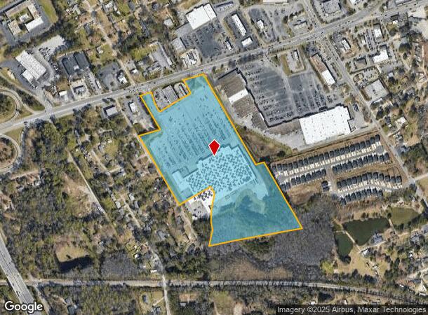
2401 Augusta Rd
004670-01-004
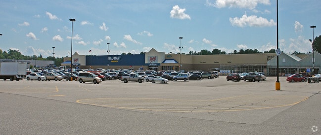
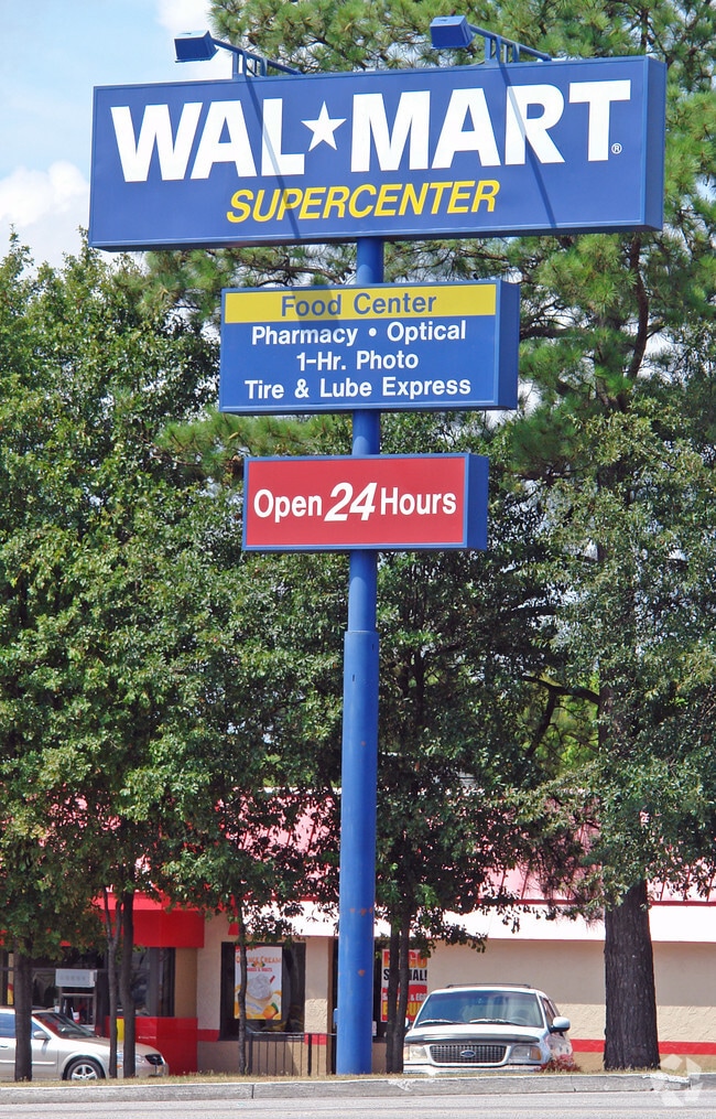
WALMART-WEST COLA
Wholesaleoutletdiscountstore
Lexington
X
South Carolina
45063C0276J
26.90 AC
2025
Cayce/West Columbia
2024
Columbia
020601
Columbia, SC
222,557 SF
DEMOGRAPHICS near 2401 Augusta Rd
1 Mile
3 Mile
5 Mile
2024 Total Population
5,291
46,294
124,794
2029 Population
5,810
50,577
132,560
Pop Growth 2024-2029
+ 9.81%
+ 9.25%
+ 6.22%
Average Age
42
41
37
2024 Total Households
2,305
21,268
54,555
HH Growth 2024-2029
+ 9.98%
+ 9.48%
+ 6.39%
Median Household Inc
$51,338
$52,722
$51,403
Avg Household Size
2.20
2.10
2.10
2024 Avg HH Vehicles
2.00
2.00
2.00
Median Home Value
$134,657
$154,507
$164,817
Median Year Built
1970
1975
1978
Nearby Places
Map Layers
Map Styles
 Street
 Aerial
- Restaurants
- Banks
- Shops
- Fitness
- Groceries
PUBLIC TRANSPORTATION
COMMUTER RAIL
Columbia Amtrak Station (Silver Star - Amtrak)
DRIVE
WALK
Distance
Columbia Amtrak Station (Silver Star - Amtrak)
7 min
4.3 mi
AIRPORT
Columbia Metro
DRIVE
WALK
Distance
Columbia Metro
17 min
6.9 mi
Freight Ports
North Charleston Terminal
DRIVE
WALK
Distance
North Charleston Terminal
117 min
103.2 mi
Nearby Properties
Address
Land Use
TOTAL SIZE
Lot Size
Zoning
Address
Land Use
TOTAL SIZE
Lot Size
Zoning
119,738 SF
10.30 AC
EC
Address
Land Use
TOTAL SIZE
Lot Size
Zoning
220,568 SF
14.53 AC
RM-2
Address
Land Use
TOTAL SIZE
Lot Size
Zoning
247,360 SF
6.61 AC
EC
Address
Land Use
TOTAL SIZE
Lot Size
Zoning
171,284 SF
10.50 AC
RG-2
Address
Land Use
TOTAL SIZE
Lot Size
Zoning
125,561 SF
12.10 AC
EC
Address
Land Use
TOTAL SIZE
Lot Size
Zoning
131,628 SF
4.39 AC
GC
Address
Land Use
TOTAL SIZE
Lot Size
Zoning
80,000 SF
4.76 AC
EC
Address
Land Use
TOTAL SIZE
Lot Size
Zoning
144,351 SF
17.88 AC
RM-2
Address
Land Use
TOTAL SIZE
Lot Size
Zoning
151,470 SF
8.44 AC
RM-2
Address
Land Use
TOTAL SIZE
Lot Size
Zoning
108,246 SF
4.46 AC
GC
Address
Land Use
TOTAL SIZE
Lot Size
Zoning
51,216 SF
2.30 AC
EC
Address
Land Use
TOTAL SIZE
Lot Size
Zoning
189,126 SF
15 AC
EC
Address
Land Use
TOTAL SIZE
Lot Size
Zoning
93,384 SF
7.24 AC
EC
Address
Land Use
TOTAL SIZE
Lot Size
Zoning
61,008 SF
6.92 AC
INS-ZOO
Address
Land Use
TOTAL SIZE
Lot Size
Zoning
13,879 SF
6.49 AC
GC
Address
Land Use
TOTAL SIZE
Lot Size
Zoning
66,640 SF
3.47 AC
EC
Address
Land Use
TOTAL SIZE
Lot Size
Zoning
66,640 SF
3.45 AC
GC
Address
Land Use
TOTAL SIZE
Lot Size
Zoning
51,794 SF
3.03 AC
EC
Address
Land Use
TOTAL SIZE
Lot Size
Zoning
66,640 SF
4.74 AC
EC
Address
Land Use
TOTAL SIZE
Lot Size
Zoning
25,700 SF
11.43 AC
RSF-1
Address
Land Use
TOTAL SIZE
Lot Size
Zoning
76,466 SF
7.52 AC
EC
Address
Land Use
TOTAL SIZE
Lot Size
Zoning
22,440 SF
3.56 AC
INS-ZOO
Address
Land Use
TOTAL SIZE
Lot Size
Zoning
9,636 SF
2.95 AC
GC
Address
Land Use
TOTAL SIZE
Lot Size
Zoning
17,244 SF
0.92 AC
GC
Address
Land Use
TOTAL SIZE
Lot Size
Zoning
19,312 SF
1.85 AC
EC
Address
Land Use
TOTAL SIZE
Lot Size
Zoning
461,888 SF
61.50 AC
ID
Address
Land Use
TOTAL SIZE
Lot Size
Zoning
3,614 SF
1,444.32 AC
ID
Address
Land Use
TOTAL SIZE
Lot Size
Zoning
17,589 SF
2.43 AC
GC
Address
Land Use
TOTAL SIZE
Lot Size
Zoning
62,886 SF
10.15 AC
C3
Address
Land Use
TOTAL SIZE
Lot Size
Zoning
2,813 SF
3.97 AC
C2
The World's #1 Commercial Real Estate Marketplace
Connect with us
© 2025 CoStar Group
The information above has been obtained from sources believed reliable. While we do not doubt its accuracy we have not verified it and make no guarantee, warranty or representation about it. It is your responsibility to independently confirm its accuracy and completeness. Any projections, opinions, assumptions, or estimates used are for example only and do not represent the current or future performance of the property. The value of this transaction to you depends on tax and other factors which should be evaluated by your tax, financial, and legal advisors. You and your advisors should conduct a careful, independent investigation of the property to determine to your satisfaction the suitability of the property for your needs.