Property Record
2401 Bethlehem Pike, Hatfield, PA 19440


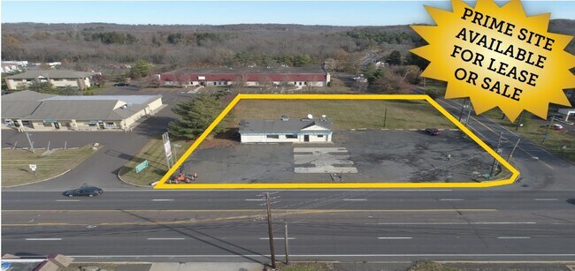
Property Detail
2401 Bethlehem Pike
15-022-065-002
1.01327 AC NE COR US309 & LR09112 207 US309
Servicestation
Montgomery
LI
Pennsylvania
B and X Area of moderate flood hazard, usually the area between the limits of the 100-year and 500-year floods.
1.01 AC
2025
Upper Bucks County
2026
Philadelphia
102104
Philadelphia-Camden-Wilmington, PA-NJ-DE-MD
1,554 SF
NEARBY LISTINGS FOR SALE OR LEASE
DEMOGRAPHICS near 2401 Bethlehem Pike
1 mile
3 mile
5 mile
2025 Total Population
2,874
49,574
143,179
2030 Population
2,953
51,612
146,218
Pop Growth 2025-2030
+ 2.75%
+ 4.11%
+ 2.12%
Average Age
38
42
43
2025 Total Households
1,265
18,767
54,684
HH Growth 2025-2030
+ 2.21%
+ 3.79%
+ 1.99%
Median Household Inc
$55,394
$100,424
$104,286
Avg Household Size
2.20
2.60
2.50
2025 Avg HH Vehicles
1.00
2.00
2.00
Median Home Value
$546,407
$416,934
$427,811
Median Year Built
1973
1978
1978
Nearby Places
Map Layers
Map Styles
 Street
 Aerial
Layers
 Traffic
 Biking
Places
Listings with unknown addresses are not visible on the map
- Restaurants
- Banks
- Shops
- Fitness
- Groceries
PUBLIC TRANSPORTATION
COMMUTER RAIL
Link Belt (R5 - Southeastern Pennsylvania Transportation Authority Regional Rail (SEPTA Regional Rail))
Drive
Walk
Distance
Link Belt (R5 - Southeastern Pennsylvania Transportation Authority Regional Rail (SEPTA Regional Rail))
6 min
2.9 mi
Colmar (R5 - Southeastern Pennsylvania Transportation Authority Regional Rail (SEPTA Regional Rail))
Drive
Walk
Distance
Colmar (R5 - Southeastern Pennsylvania Transportation Authority Regional Rail (SEPTA Regional Rail))
6 min
3.0 mi
AIRPORT
Lehigh Valley International
Drive
Walk
Distance
Lehigh Valley International
47 min
28.9 mi
Trenton Mercer
Drive
Walk
Distance
Trenton Mercer
57 min
33.4 mi
Philadelphia International
Drive
Walk
Distance
Philadelphia International
60 min
42.0 mi
SALE & LEASE HISTORY
LISTING DATE
SALE/LEASE

Sep 24, 2016
For Sale
Sep 17, 2020
For Sale
Sep 17, 2020
For Lease
Sep 04, 2018
For Sale
Jun 11, 2021
For Sale
Jan 24, 2017
For Sale
Jan 04, 2017
For Sale
Dec 04, 2019
For Sale
Nearby Properties
Address
Land Use
TOTAL SIZE
Lot Size
Zoning
Address
Land Use
TOTAL SIZE
Lot Size
Zoning
977,439 SF
70.93 AC
GA
Address
Land Use
TOTAL SIZE
Lot Size
Zoning
832,830 SF
53.72 AC
LI
Address
Land Use
TOTAL SIZE
Lot Size
Zoning
349,078 SF
18.46 AC
INST
Address
Land Use
TOTAL SIZE
Lot Size
Zoning
253,915 SF
17.78 AC
GA
Address
Land Use
TOTAL SIZE
Lot Size
Zoning
219,869 SF
41.98 AC
LI
Address
Land Use
TOTAL SIZE
Lot Size
Zoning
373,104 SF
31.94 AC
LI
Address
Land Use
TOTAL SIZE
Lot Size
Zoning
131,631 SF
18.12 AC
SC
Address
Land Use
TOTAL SIZE
Lot Size
Zoning
220,124 SF
33.16 AC
SC
Address
Land Use
TOTAL SIZE
Lot Size
Zoning
152,085 SF
38.16 AC
INST
Address
Land Use
TOTAL SIZE
Lot Size
Zoning
168,557 SF
44.77 AC
RA1
Address
Land Use
TOTAL SIZE
Lot Size
Zoning
444,718 SF
46.51 AC
LI
Address
Land Use
TOTAL SIZE
Lot Size
Zoning
324,796 SF
42.20 AC
LI
Address
Land Use
TOTAL SIZE
Lot Size
Zoning
502,169 SF
83.16 AC
LI
Address
Land Use
TOTAL SIZE
Lot Size
Zoning
333,888 SF
35.37 AC
LI
Address
Land Use
TOTAL SIZE
Lot Size
Zoning
214,042 SF
26.53 AC
LI
Address
Land Use
TOTAL SIZE
Lot Size
Zoning
230,016 SF
11.27 AC
LI
Address
Land Use
TOTAL SIZE
Lot Size
Zoning
184,471 SF
0.80 AC
INST
Address
Land Use
TOTAL SIZE
Lot Size
Zoning
65,178 SF
16.86 AC
B
Address
Land Use
TOTAL SIZE
Lot Size
Zoning
198,551 SF
21.17 AC
LI
Address
Land Use
TOTAL SIZE
Lot Size
Zoning
94,598 SF
27.72 AC
INST
Address
Land Use
TOTAL SIZE
Lot Size
Zoning
301,131 SF
18.98 AC
LI
Address
Land Use
TOTAL SIZE
Lot Size
Zoning
182,010 SF
12.25 AC
LI
Address
Land Use
TOTAL SIZE
Lot Size
Zoning
380,875 SF
40.10 AC
LI
Address
Land Use
TOTAL SIZE
Lot Size
Zoning
40,754 SF
6.23 AC
LI
Address
Land Use
TOTAL SIZE
Lot Size
Zoning
71,153 SF
20.48 AC
A1
Address
Land Use
TOTAL SIZE
Lot Size
Zoning
82,592 SF
11.50 AC
LI
Address
Land Use
TOTAL SIZE
Lot Size
Zoning
60,620 SF
14.60 AC
ER
Address
Land Use
TOTAL SIZE
Lot Size
Zoning
85,508 SF
25.83 AC
Address
Land Use
TOTAL SIZE
Lot Size
Zoning
237,667 SF
37.86 AC
LI
Address
Land Use
TOTAL SIZE
Lot Size
Zoning
121,762 SF
16.66 AC
LI
The World's #1 Commercial Real Estate Marketplace
Connect with us
© 2026 CoStar Group
The information above has been obtained from sources believed reliable. While we do not doubt its accuracy we have not verified it and make no guarantee, warranty or representation about it. It is your responsibility to independently confirm its accuracy and completeness. Any projections, opinions, assumptions, or estimates used are for example only and do not represent the current or future performance of the property. The value of this transaction to you depends on tax and other factors which should be evaluated by your tax, financial, and legal advisors. You and your advisors should conduct a careful, independent investigation of the property to determine to your satisfaction the suitability of the property for your needs.