Property Record
2401 N Reed Station Pky, Carbondale, IL 62901
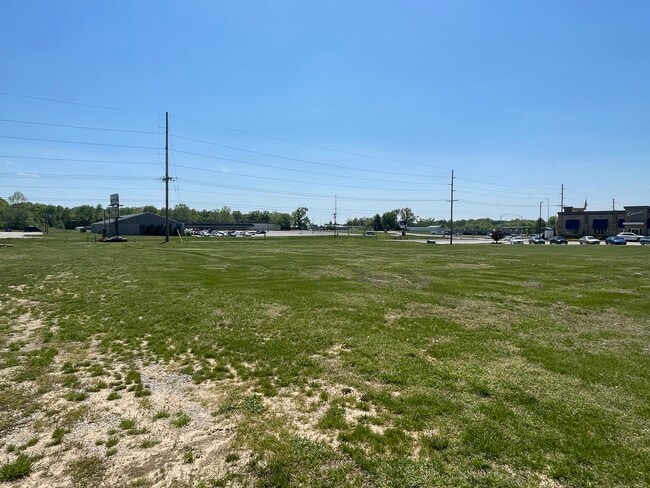
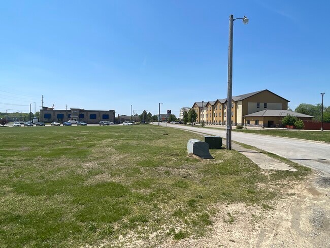
This Property Is For Sale
NEARBY LISTINGS FOR SALE OR LEASE
Property Detail
2401 N Reed Station Pky
15-13-201-007
First Corner Subdivision
Commercialnec
FROM: 15-13-201-003-0061 LOT 3 - FIRST CORNER SUBDIVISION 13-9-1 PC 2 SL 182 2018R002186 2022R002331
X
Jackson
17199C0150D
Illinois
2024
3
2024
0.82 AC
010900
Other Market Areas
4,488 SF
Carbondale, IL
DEMOGRAPHICS near 2401 N Reed Station Pky
1 Mile
3 Mile
5 Mile
2024 Total Population
1,158
8,328
30,767
2029 Population
1,158
8,243
30,564
Pop Growth 2024-2029
0.00%
(1.02%)
(0.66%)
Average Age
39
35
36
2024 Total Households
509
3,799
14,098
HH Growth 2024-2029
(0.20%)
(1.24%)
(0.67%)
Median Household Inc
$62,692
$32,322
$35,614
Avg Household Size
2.30
2.10
2.00
2024 Avg HH Vehicles
2.00
1.00
2.00
Median Home Value
$142,441
$140,309
$145,354
Median Year Built
1983
1979
1979
Nearby Places
Map Layers
Map Styles
 Street
 Aerial
- Restaurants
- Banks
- Shops
- Fitness
- Groceries
PUBLIC TRANSPORTATION
COMMUTER RAIL
Carbondale (City of New Orleans - Amtrak, Illini - Amtrak, Saluki - Amtrak)
DRIVE
WALK
Distance
Carbondale (City of New Orleans - Amtrak, Illini - Amtrak, Saluki - Amtrak)
7 min
4.2 mi
Freight Ports
Port Milwaukee
DRIVE
WALK
Distance
Port Milwaukee
466 min
413.0 mi
Nearby Properties
Address
Land Use
TOTAL SIZE
Lot Size
Zoning
Address
Land Use
TOTAL SIZE
Lot Size
Zoning
Address
Land Use
TOTAL SIZE
Lot Size
Zoning
16.78 AC
Address
Land Use
TOTAL SIZE
Lot Size
Zoning
84,270 SF
6.50 AC
Address
Land Use
TOTAL SIZE
Lot Size
Zoning
17,700 SF
18.37 AC
Address
Land Use
TOTAL SIZE
Lot Size
Zoning
17.78 AC
Address
Land Use
TOTAL SIZE
Lot Size
Zoning
17,820 SF
9 AC
Address
Land Use
TOTAL SIZE
Lot Size
Zoning
6,750 SF
4.53 AC
Address
Land Use
TOTAL SIZE
Lot Size
Zoning
119,175 SF
2.84 AC
Address
Land Use
TOTAL SIZE
Lot Size
Zoning
18.41 AC
Address
Land Use
TOTAL SIZE
Lot Size
Zoning
79,800 SF
2.50 AC
Address
Land Use
TOTAL SIZE
Lot Size
Zoning
Address
Land Use
TOTAL SIZE
Lot Size
Zoning
14,040 SF
2.37 AC
Address
Land Use
TOTAL SIZE
Lot Size
Zoning
88,081 SF
11.29 AC
Address
Land Use
TOTAL SIZE
Lot Size
Zoning
61,600 SF
6.99 AC
Address
Land Use
TOTAL SIZE
Lot Size
Zoning
3.88 AC
Address
Land Use
TOTAL SIZE
Lot Size
Zoning
3,072 SF
1.89 AC
Address
Land Use
TOTAL SIZE
Lot Size
Zoning
84,810 SF
7.50 AC
Address
Land Use
TOTAL SIZE
Lot Size
Zoning
63,000 SF
2.62 AC
Address
Land Use
TOTAL SIZE
Lot Size
Zoning
1.64 AC
Address
Land Use
TOTAL SIZE
Lot Size
Zoning
2,800 SF
3.58 AC
Address
Land Use
TOTAL SIZE
Lot Size
Zoning
4,080 SF
0.85 AC
Address
Land Use
TOTAL SIZE
Lot Size
Zoning
5,532 SF
7.93 AC
Address
Land Use
TOTAL SIZE
Lot Size
Zoning
3,768 SF
2.01 AC
Address
Land Use
TOTAL SIZE
Lot Size
Zoning
11,000 SF
1.17 AC
Address
Land Use
TOTAL SIZE
Lot Size
Zoning
4,400 SF
3.03 AC
Address
Land Use
TOTAL SIZE
Lot Size
Zoning
1.86 AC
Address
Land Use
TOTAL SIZE
Lot Size
Zoning
1.48 AC
Address
Land Use
TOTAL SIZE
Lot Size
Zoning
The World's #1 Commercial Real Estate Marketplace
Connect with us
© 2026 CoStar Group
The information above has been obtained from sources believed reliable. While we do not doubt its accuracy we have not verified it and make no guarantee, warranty or representation about it. It is your responsibility to independently confirm its accuracy and completeness. Any projections, opinions, assumptions, or estimates used are for example only and do not represent the current or future performance of the property. The value of this transaction to you depends on tax and other factors which should be evaluated by your tax, financial, and legal advisors. You and your advisors should conduct a careful, independent investigation of the property to determine to your satisfaction the suitability of the property for your needs.