Property Record
2401 Ne Cornell Rd, Hillsboro, OR 97124
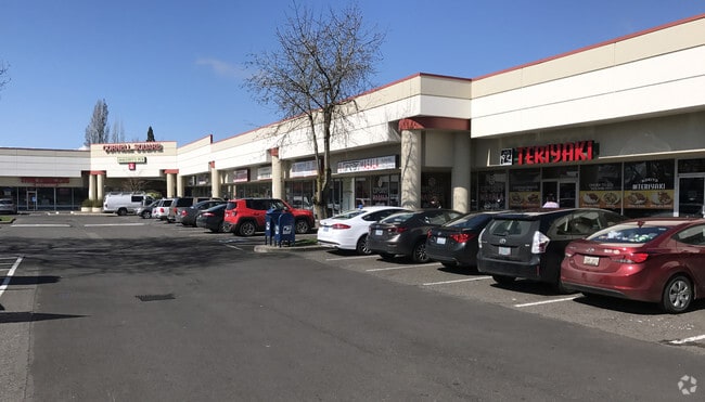

Property Detail
2401 Ne Cornell Rd
R0709709
ACRES 3.25
Commercialbuilding
WASHINGTON
C-G
Oregon
B and X Area of moderate flood hazard, usually the area between the limits of the 100-year and 500-year floods.
27
2024
3.25 AC
2026
Sunset Corridor/Hillsboro
032606
Portland
3,805 SF
Portland-Vancouver-Hillsboro, OR-WA
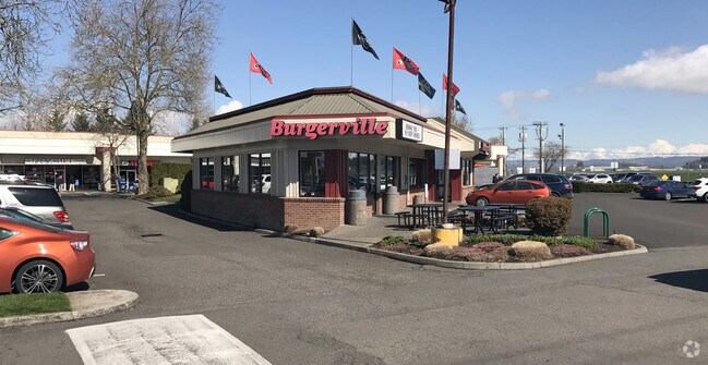
NEARBY LISTINGS FOR SALE OR LEASE
DEMOGRAPHICS near 2401 Ne Cornell Rd
1 mile
3 mile
5 mile
2024 Total Population
14,196
84,577
171,148
2029 Population
14,267
85,365
173,645
Pop Growth 2024-2029
+ 0.50%
+ 0.93%
+ 1.46%
Average Age
39
39
38
2024 Total Households
4,779
30,398
63,269
HH Growth 2024-2029
+ 0.67%
+ 1.04%
+ 1.58%
Median Household Inc
$95,600
$109,029
$104,077
Avg Household Size
2.90
2.70
2.60
2024 Avg HH Vehicles
2.00
2.00
2.00
Median Home Value
$494,866
$543,121
$534,921
Median Year Built
1978
1993
1994
Nearby Places
Map Layers
Map Styles
 Street
 Aerial
Transit
 Traffic
 Biking
Places
Listings with unknown addresses are not visible on the map
- Restaurants
- Banks
- Shops
- Fitness
- Groceries
PUBLIC TRANSPORTATION
TRANSIT/SUBWAY
Hillsboro Airport/Fairgrounds Max Stn (MAX Blue Line - TriMet, MAX Red Line - TriMet)
Drive
Walk
Distance
Hillsboro Airport/Fairgrounds Max Stn (MAX Blue Line - TriMet, MAX Red Line - TriMet)
3 min
16 min
0.9 mi
COMMUTER RAIL
Beaverton Transit Center (West Side Express) (Westside Express Service - Tri-County Metropolitan Transportation District of Oregon Rail (TriMet Rail))
Drive
Walk
Distance
Beaverton Transit Center (West Side Express) (Westside Express Service - Tri-County Metropolitan Transportation District of Oregon Rail (TriMet Rail))
19 min
9.6 mi
AIRPORT
Portland International
Drive
Walk
Distance
Portland International
45 min
28.2 mi
Freight Ports
Port of Portland
Drive
Walk
Distance
Port of Portland
28 min
17.2 mi
SALE & LEASE HISTORY
LISTING DATE
SALE/LEASE

Sep 24, 2016
For Lease
Nearby Properties
Address
Land Use
TOTAL SIZE
Lot Size
Zoning
Address
Land Use
TOTAL SIZE
Lot Size
Zoning
21.21 AC
I-P
Address
Land Use
TOTAL SIZE
Lot Size
Zoning
0.13 AC
I-P
Address
Land Use
TOTAL SIZE
Lot Size
Zoning
4,603 SF
90.28 AC
I-S
Address
Land Use
TOTAL SIZE
Lot Size
Zoning
337.91 AC
I-P
Address
Land Use
TOTAL SIZE
Lot Size
Zoning
14.02 AC
Address
Land Use
TOTAL SIZE
Lot Size
Zoning
1,619,885 SF
115.71 AC
I-P
Address
Land Use
TOTAL SIZE
Lot Size
Zoning
35.87 AC
SSID
Address
Land Use
TOTAL SIZE
Lot Size
Zoning
9.97 AC
SCC-DT
Address
Land Use
TOTAL SIZE
Lot Size
Zoning
3,126 SF
11.38 AC
FD-20
Address
Land Use
TOTAL SIZE
Lot Size
Zoning
47.85 AC
I-P
Address
Land Use
TOTAL SIZE
Lot Size
Zoning
60.97 AC
INST
Address
Land Use
TOTAL SIZE
Lot Size
Zoning
5.83 AC
INST
Address
Land Use
TOTAL SIZE
Lot Size
Zoning
Address
Land Use
TOTAL SIZE
Lot Size
Zoning
2,016 SF
0.10 AC
I-S
Address
Land Use
TOTAL SIZE
Lot Size
Zoning
0.05 AC
I-S
Address
Land Use
TOTAL SIZE
Lot Size
Zoning
0.17 AC
I-P
Address
Land Use
TOTAL SIZE
Lot Size
Zoning
Address
Land Use
TOTAL SIZE
Lot Size
Zoning
248,332 SF
4.26 AC
SCC-DT
Address
Land Use
TOTAL SIZE
Lot Size
Zoning
4,603 SF
0.09 AC
I-S
Address
Land Use
TOTAL SIZE
Lot Size
Zoning
20.33 AC
I-S
Address
Land Use
TOTAL SIZE
Lot Size
Zoning
174,233 SF
14.74 AC
I-P
Address
Land Use
TOTAL SIZE
Lot Size
Zoning
53.13 AC
SC-BP
Address
Land Use
TOTAL SIZE
Lot Size
Zoning
2,822 SF
13.23 AC
Address
Land Use
TOTAL SIZE
Lot Size
Zoning
53.49 AC
SCFI
Address
Land Use
TOTAL SIZE
Lot Size
Zoning
256,652 SF
48.72 AC
SFR-7
Address
Land Use
TOTAL SIZE
Lot Size
Zoning
13,368 SF
112.70 AC
I-G
Address
Land Use
TOTAL SIZE
Lot Size
Zoning
82,297 SF
175.24 AC
I-G
Address
Land Use
TOTAL SIZE
Lot Size
Zoning
38.36 AC
I-P
Address
Land Use
TOTAL SIZE
Lot Size
Zoning
The World's #1 Commercial Real Estate Marketplace
Connect with us
© 2026 CoStar Group
The information above has been obtained from sources believed reliable. While we do not doubt its accuracy we have not verified it and make no guarantee, warranty or representation about it. It is your responsibility to independently confirm its accuracy and completeness. Any projections, opinions, assumptions, or estimates used are for example only and do not represent the current or future performance of the property. The value of this transaction to you depends on tax and other factors which should be evaluated by your tax, financial, and legal advisors. You and your advisors should conduct a careful, independent investigation of the property to determine to your satisfaction the suitability of the property for your needs.