Property Record
2401 Ne Loop 289, Lubbock, TX 79403
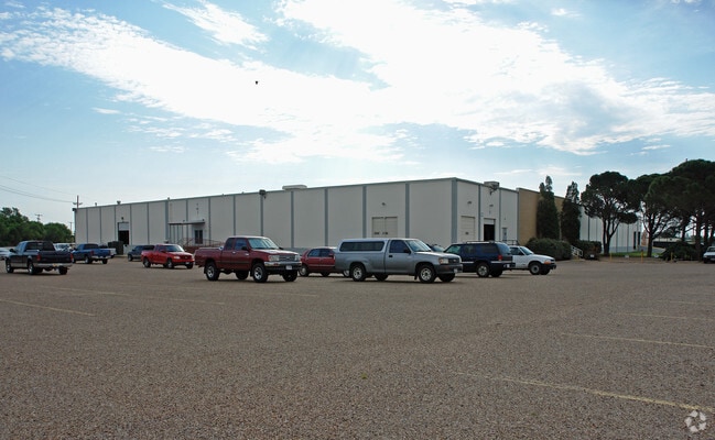


Property Detail
2401 Ne Loop 289
Lubbock, TX
ALLAN INDUSTRIAL PARK L 1
R99146
Lubbock
Lightindustrial
Texas
B and X Area of moderate flood hazard, usually the area between the limits of the 100-year and 500-year floods.
10
2024
9.30 AC
2025
North Outer Lubbock
010203
Lubbock
75,000 SF
NEARBY LISTINGS FOR SALE OR LEASE
DEMOGRAPHICS near 2401 Ne Loop 289
1 mile
3 mile
5 mile
2025 Total Population
2,708
15,657
65,876
2030 Population
2,818
16,538
68,630
Pop Growth 2025-2030
+ 4.06%
+ 5.63%
+ 4.18%
Average Age
38
39
34
2025 Total Households
1,001
5,550
23,061
HH Growth 2025-2030
+ 4.50%
+ 6.11%
+ 4.97%
Median Household Inc
$35,886
$41,514
$37,621
Avg Household Size
2.60
2.50
2.40
2025 Avg HH Vehicles
2.00
2.00
2.00
Median Home Value
$69,764
$80,635
$86,258
Median Year Built
1968
1974
1975
Nearby Places
Map Layers
Map Styles
 Street
 Aerial
Transit
 Traffic
 Biking
Places
Listings with unknown addresses are not visible on the map
- Restaurants
- Banks
- Shops
- Fitness
- Groceries
PUBLIC TRANSPORTATION
AIRPORT
Lubbock Preston Smith International
Drive
Walk
Distance
Lubbock Preston Smith International
21 min
10.2 mi
SALE & LEASE HISTORY
LISTING DATE
SALE/LEASE

Sep 25, 2016
For Lease
Nearby Properties
Address
Land Use
TOTAL SIZE
Lot Size
Zoning
Address
Land Use
TOTAL SIZE
Lot Size
Zoning
281,000 SF
6.19 AC
Address
Land Use
TOTAL SIZE
Lot Size
Zoning
378,274 SF
53.07 AC
Address
Land Use
TOTAL SIZE
Lot Size
Zoning
281,520 SF
37.21 AC
Address
Land Use
TOTAL SIZE
Lot Size
Zoning
14.37 AC
Address
Land Use
TOTAL SIZE
Lot Size
Zoning
201,700 SF
16.98 AC
Address
Land Use
TOTAL SIZE
Lot Size
Zoning
202,925 SF
25.10 AC
Address
Land Use
TOTAL SIZE
Lot Size
Zoning
324.17 AC
Address
Land Use
TOTAL SIZE
Lot Size
Zoning
64,317 SF
4.50 AC
Address
Land Use
TOTAL SIZE
Lot Size
Zoning
160,000 SF
10.90 AC
Address
Land Use
TOTAL SIZE
Lot Size
Zoning
126,457 SF
6.96 AC
Address
Land Use
TOTAL SIZE
Lot Size
Zoning
105,097 SF
20.99 AC
Address
Land Use
TOTAL SIZE
Lot Size
Zoning
126,881 SF
17.07 AC
Address
Land Use
TOTAL SIZE
Lot Size
Zoning
279,143 SF
26.32 AC
Address
Land Use
TOTAL SIZE
Lot Size
Zoning
213,611 SF
30.10 AC
Address
Land Use
TOTAL SIZE
Lot Size
Zoning
253,852 SF
17.98 AC
Address
Land Use
TOTAL SIZE
Lot Size
Zoning
175,122 SF
1.44 AC
Address
Land Use
TOTAL SIZE
Lot Size
Zoning
77,400 SF
9.81 AC
Address
Land Use
TOTAL SIZE
Lot Size
Zoning
28,246 SF
3.84 AC
Address
Land Use
TOTAL SIZE
Lot Size
Zoning
45,640 SF
150.86 AC
Address
Land Use
TOTAL SIZE
Lot Size
Zoning
44,271 SF
9.38 AC
Address
Land Use
TOTAL SIZE
Lot Size
Zoning
156,480 SF
12.20 AC
Address
Land Use
TOTAL SIZE
Lot Size
Zoning
50,489 SF
8.87 AC
Address
Land Use
TOTAL SIZE
Lot Size
Zoning
44,080 SF
12.20 AC
Address
Land Use
TOTAL SIZE
Lot Size
Zoning
211.45 AC
Address
Land Use
TOTAL SIZE
Lot Size
Zoning
111,240 SF
9.52 AC
Address
Land Use
TOTAL SIZE
Lot Size
Zoning
195.61 AC
Address
Land Use
TOTAL SIZE
Lot Size
Zoning
28,930 SF
1.61 AC
Address
Land Use
TOTAL SIZE
Lot Size
Zoning
302,000 SF
23.94 AC
Address
Land Use
TOTAL SIZE
Lot Size
Zoning
74,531 SF
156.55 AC
Address
Land Use
TOTAL SIZE
Lot Size
Zoning
14.05 AC
The World's #1 Commercial Real Estate Marketplace
Connect with us
© 2026 CoStar Group
The information above has been obtained from sources believed reliable. While we do not doubt its accuracy we have not verified it and make no guarantee, warranty or representation about it. It is your responsibility to independently confirm its accuracy and completeness. Any projections, opinions, assumptions, or estimates used are for example only and do not represent the current or future performance of the property. The value of this transaction to you depends on tax and other factors which should be evaluated by your tax, financial, and legal advisors. You and your advisors should conduct a careful, independent investigation of the property to determine to your satisfaction the suitability of the property for your needs.