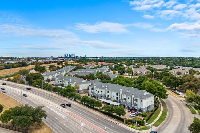
Property Record
2401 Oak Hill Cir, Fort Worth, TX 76109


NEARBY LISTINGS FOR SALE OR LEASE
Property Detail
2401 Oak Hill Cir
05663059
Stonegate Addition-Ft Worth
Multifamilydwelling
STONEGATE ADDITION-FT WORTH BLOCK 6
AE
Tarrant
48439C0285L
Texas
2024
12.50 AC
2025
TCU District
105403
Dallas/Ft Worth
446,116 SF
Dallas-Fort Worth-Arlington, TX
DEMOGRAPHICS near 2401 Oak Hill Cir
1 Mile
3 Mile
5 Mile
2024 Total Population
10,861
112,339
305,460
2029 Population
11,619
119,267
324,442
Pop Growth 2024-2029
+ 6.98%
+ 6.17%
+ 6.21%
Average Age
38
37
37
2024 Total Households
5,052
47,867
122,115
HH Growth 2024-2029
+ 7.52%
+ 6.50%
+ 6.53%
Median Household Inc
$80,198
$70,198
$59,646
Avg Household Size
2.10
2.20
2.40
2024 Avg HH Vehicles
2.00
2.00
2.00
Median Home Value
$520,624
$392,846
$265,597
Median Year Built
1986
1973
1976
Nearby Places
Map Layers
Map Styles
 Street
 Aerial
- Restaurants
- Banks
- Shops
- Fitness
- Groceries
PUBLIC TRANSPORTATION
COMMUTER RAIL
Texas And Pacific (T&P) (Trinity Railway Express - Dallas Area Rapid Transit (DART))
DRIVE
WALK
Distance
Texas And Pacific (T&P) (Trinity Railway Express - Dallas Area Rapid Transit (DART))
11 min
5.4 mi
Fort Worth (Heartland Flyer - Amtrak, Texas Eagle - Amtrak)
DRIVE
WALK
Distance
Fort Worth (Heartland Flyer - Amtrak, Texas Eagle - Amtrak)
11 min
5.8 mi
AIRPORT
Dallas-Fort Worth International
DRIVE
WALK
Distance
Dallas-Fort Worth International
41 min
30.3 mi
Freight Ports
Port of Shreveport
DRIVE
WALK
Distance
Port of Shreveport
253 min
234.2 mi
Nearby Properties
Address
Land Use
TOTAL SIZE
Lot Size
Zoning
Address
Land Use
TOTAL SIZE
Lot Size
Zoning
802,865 SF
17.38 AC
Address
Land Use
TOTAL SIZE
Lot Size
Zoning
1,135,360 SF
7.30 AC
Address
Land Use
TOTAL SIZE
Lot Size
Zoning
1,545,212 SF
8.90 AC
Address
Land Use
TOTAL SIZE
Lot Size
Zoning
505,069 SF
6.49 AC
Address
Land Use
TOTAL SIZE
Lot Size
Zoning
616,686 SF
2.82 AC
Address
Land Use
TOTAL SIZE
Lot Size
Zoning
438,943 SF
3.77 AC
Address
Land Use
TOTAL SIZE
Lot Size
Zoning
508,378 SF
6.02 AC
Address
Land Use
TOTAL SIZE
Lot Size
Zoning
477,907 SF
11.83 AC
Address
Land Use
TOTAL SIZE
Lot Size
Zoning
346,920 SF
9.88 AC
Address
Land Use
TOTAL SIZE
Lot Size
Zoning
1,259,660 SF
52.13 AC
Address
Land Use
TOTAL SIZE
Lot Size
Zoning
482,938 SF
22.22 AC
Address
Land Use
TOTAL SIZE
Lot Size
Zoning
407,056 SF
17.20 AC
Address
Land Use
TOTAL SIZE
Lot Size
Zoning
509,560 SF
3.06 AC
Address
Land Use
TOTAL SIZE
Lot Size
Zoning
323,685 SF
19.61 AC
Address
Land Use
TOTAL SIZE
Lot Size
Zoning
353,842 SF
101.26 AC
Address
Land Use
TOTAL SIZE
Lot Size
Zoning
765,141 SF
56.28 AC
Address
Land Use
TOTAL SIZE
Lot Size
Zoning
336,310 SF
2.85 AC
Address
Land Use
TOTAL SIZE
Lot Size
Zoning
348,025 SF
26.33 AC
Address
Land Use
TOTAL SIZE
Lot Size
Zoning
382,376 SF
21.61 AC
Address
Land Use
TOTAL SIZE
Lot Size
Zoning
492,130 SF
6.55 AC
Address
Land Use
TOTAL SIZE
Lot Size
Zoning
437,641 SF
6.60 AC
Address
Land Use
TOTAL SIZE
Lot Size
Zoning
525,051 SF
6.87 AC
Address
Land Use
TOTAL SIZE
Lot Size
Zoning
283,106 SF
11.17 AC
Address
Land Use
TOTAL SIZE
Lot Size
Zoning
411,395 SF
12.24 AC
Address
Land Use
TOTAL SIZE
Lot Size
Zoning
642,632 SF
27.73 AC
Address
Land Use
TOTAL SIZE
Lot Size
Zoning
355,125 SF
21.29 AC
Address
Land Use
TOTAL SIZE
Lot Size
Zoning
595,372 SF
12.24 AC
Address
Land Use
TOTAL SIZE
Lot Size
Zoning
350,654 SF
21.29 AC
Address
Land Use
TOTAL SIZE
Lot Size
Zoning
296,664 SF
14.71 AC
The World's #1 Commercial Real Estate Marketplace
Connect with us
© 2025 CoStar Group
The information above has been obtained from sources believed reliable. While we do not doubt its accuracy we have not verified it and make no guarantee, warranty or representation about it. It is your responsibility to independently confirm its accuracy and completeness. Any projections, opinions, assumptions, or estimates used are for example only and do not represent the current or future performance of the property. The value of this transaction to you depends on tax and other factors which should be evaluated by your tax, financial, and legal advisors. You and your advisors should conduct a careful, independent investigation of the property to determine to your satisfaction the suitability of the property for your needs.