Property Record
2401 W Main St, Rapid City, SD 57702


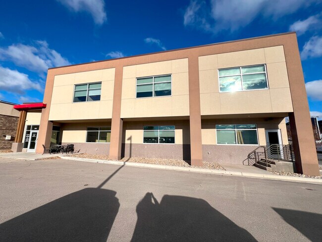
Property Detail
2401 W Main St
Rapid City, SD
HARTER, LOT 5-7 OF LOT Z OF LOT 2 LESS HIWAY LOT
0036059
Pennington
Officebuilding
South Dakota
B and X Area of moderate flood hazard, usually the area between the limits of the 100-year and 500-year floods.
2,5-7,z
2025
0.63 AC
2025
Rapid City
011200
Other Market Areas
7,776 SF
NEARBY LISTINGS FOR SALE OR LEASE
DEMOGRAPHICS near 2401 W Main St
1 mile
3 mile
5 mile
2025 Total Population
2,896
47,644
78,008
2030 Population
2,987
49,407
81,238
Pop Growth 2025-2030
+ 3.14%
+ 3.70%
+ 4.14%
Average Age
44
41
41
2025 Total Households
1,363
20,321
33,012
HH Growth 2025-2030
+ 3.37%
+ 4.02%
+ 4.40%
Median Household Inc
$68,891
$64,293
$70,804
Avg Household Size
2.00
2.10
2.20
2025 Avg HH Vehicles
2.00
2.00
2.00
Median Home Value
$301,620
$285,056
$310,169
Median Year Built
1969
1972
1980
Nearby Places
Map Layers
Map Styles
 Street
 Aerial
Layers
 Traffic
 Biking
Places
Listings with unknown addresses are not visible on the map
- Restaurants
- Banks
- Shops
- Fitness
- Groceries
PUBLIC TRANSPORTATION
AIRPORT
Rapid City Regional
Drive
Walk
Distance
Rapid City Regional
22 min
12.3 mi
Freight Ports
Tulsa Port Of Catoosa
Drive
Walk
Distance
Tulsa Port Of Catoosa
970 min
891.7 mi
SALE & LEASE HISTORY
LISTING DATE
SALE/LEASE

Feb 16, 2018
For Lease
Dec 20, 2024
For Lease
Nearby Properties
Address
Land Use
TOTAL SIZE
Lot Size
Zoning
Address
Land Use
TOTAL SIZE
Lot Size
Zoning
5,244 SF
17.53 AC
Address
Land Use
TOTAL SIZE
Lot Size
Zoning
40,853 SF
8.09 AC
Address
Land Use
TOTAL SIZE
Lot Size
Zoning
48,204 SF
15.19 AC
Address
Land Use
TOTAL SIZE
Lot Size
Zoning
6,820 SF
10.60 AC
Address
Land Use
TOTAL SIZE
Lot Size
Zoning
48,108 SF
38.14 AC
Address
Land Use
TOTAL SIZE
Lot Size
Zoning
26,807 SF
0.58 AC
Address
Land Use
TOTAL SIZE
Lot Size
Zoning
7,680 SF
9.34 AC
Address
Land Use
TOTAL SIZE
Lot Size
Zoning
29,226 SF
1.38 AC
Address
Land Use
TOTAL SIZE
Lot Size
Zoning
14,360 SF
2.07 AC
Address
Land Use
TOTAL SIZE
Lot Size
Zoning
25,762 SF
5.74 AC
Address
Land Use
TOTAL SIZE
Lot Size
Zoning
10,608 SF
10.90 AC
Address
Land Use
TOTAL SIZE
Lot Size
Zoning
50,656 SF
9.17 AC
Address
Land Use
TOTAL SIZE
Lot Size
Zoning
46,025 SF
36.26 AC
Address
Land Use
TOTAL SIZE
Lot Size
Zoning
4,576 SF
4.85 AC
Address
Land Use
TOTAL SIZE
Lot Size
Zoning
26,845 SF
3.49 AC
Address
Land Use
TOTAL SIZE
Lot Size
Zoning
35,999 SF
3.01 AC
Address
Land Use
TOTAL SIZE
Lot Size
Zoning
105,621 SF
10 AC
Address
Land Use
TOTAL SIZE
Lot Size
Zoning
5,448 SF
7.92 AC
Address
Land Use
TOTAL SIZE
Lot Size
Zoning
3,008 SF
4.66 AC
Address
Land Use
TOTAL SIZE
Lot Size
Zoning
30,740 SF
3.22 AC
Address
Land Use
TOTAL SIZE
Lot Size
Zoning
95,992 SF
56.73 AC
Address
Land Use
TOTAL SIZE
Lot Size
Zoning
23,089 SF
0.30 AC
Address
Land Use
TOTAL SIZE
Lot Size
Zoning
48,786 SF
5 AC
Address
Land Use
TOTAL SIZE
Lot Size
Zoning
19,170 SF
1.28 AC
Address
Land Use
TOTAL SIZE
Lot Size
Zoning
9,395 SF
3.26 AC
Address
Land Use
TOTAL SIZE
Lot Size
Zoning
19,302 SF
4.74 AC
Address
Land Use
TOTAL SIZE
Lot Size
Zoning
21,722 SF
7.50 AC
Address
Land Use
TOTAL SIZE
Lot Size
Zoning
24,609 SF
0.46 AC
Address
Land Use
TOTAL SIZE
Lot Size
Zoning
144,045 SF
11.96 AC
Address
Land Use
TOTAL SIZE
Lot Size
Zoning
10,455 SF
0.24 AC
The World's #1 Commercial Real Estate Marketplace
Connect with us
© 2026 CoStar Group
The information above has been obtained from sources believed reliable. While we do not doubt its accuracy we have not verified it and make no guarantee, warranty or representation about it. It is your responsibility to independently confirm its accuracy and completeness. Any projections, opinions, assumptions, or estimates used are for example only and do not represent the current or future performance of the property. The value of this transaction to you depends on tax and other factors which should be evaluated by your tax, financial, and legal advisors. You and your advisors should conduct a careful, independent investigation of the property to determine to your satisfaction the suitability of the property for your needs.