Property Record
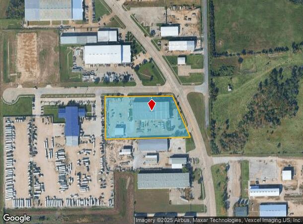
2402 S Battleground Rd, La Porte, TX 77571


NEARBY LISTINGS FOR SALE OR LEASE
Property Detail
2402 S Battleground Rd
1306580010001
Underwood Industrial Park Sec 1
Lightindustrial
TR C1 BLK 1 UNDERWOOD INDUSTRIAL PARK SEC 1
X
Harris
48201C0930M
Texas
2024
3.47 AC
2025
East-Southeast Far
342802
Houston
31,240 SF
Houston-The Woodlands-Sugar Land, TX
DEMOGRAPHICS near 2402 S Battleground Rd
1 Mile
3 Mile
5 Mile
2024 Total Population
5,257
55,951
104,161
2029 Population
5,300
56,898
106,087
Pop Growth 2024-2029
+ 0.82%
+ 1.69%
+ 1.85%
Average Age
37
38
38
2024 Total Households
1,667
19,521
36,177
HH Growth 2024-2029
+ 0.84%
+ 1.65%
+ 1.80%
Median Household Inc
$118,259
$82,266
$76,564
Avg Household Size
3.10
2.80
2.80
2024 Avg HH Vehicles
2.00
2.00
2.00
Median Home Value
$281,487
$215,463
$200,965
Median Year Built
2001
1983
1982
Nearby Places
Map Layers
Map Styles
 Street
 Aerial
- Restaurants
- Banks
- Shops
- Fitness
- Groceries
PUBLIC TRANSPORTATION
AIRPORT
William P Hobby
DRIVE
WALK
Distance
William P Hobby
32 min
16.1 mi
George Bush Intcntl/Houston
DRIVE
WALK
Distance
George Bush Intcntl/Houston
42 min
32.1 mi
Freight Ports
Port of Houston
DRIVE
WALK
Distance
Port of Houston
24 min
15.0 mi
SALE & LEASE HISTORY
LISTING DATE
SALE/LEASE

Apr 05, 2022
For Sale
Nearby Properties
Address
Land Use
TOTAL SIZE
Lot Size
Zoning
Address
Land Use
TOTAL SIZE
Lot Size
Zoning
55.98 AC
Address
Land Use
TOTAL SIZE
Lot Size
Zoning
Address
Land Use
TOTAL SIZE
Lot Size
Zoning
Address
Land Use
TOTAL SIZE
Lot Size
Zoning
263.71 AC
Address
Land Use
TOTAL SIZE
Lot Size
Zoning
4,960,504 SF
141.62 AC
Address
Land Use
TOTAL SIZE
Lot Size
Zoning
36.31 AC
Address
Land Use
TOTAL SIZE
Lot Size
Zoning
67.91 AC
Address
Land Use
TOTAL SIZE
Lot Size
Zoning
64.83 AC
Address
Land Use
TOTAL SIZE
Lot Size
Zoning
13.76 AC
Address
Land Use
TOTAL SIZE
Lot Size
Zoning
Address
Land Use
TOTAL SIZE
Lot Size
Zoning
900,000 SF
42.88 AC
Address
Land Use
TOTAL SIZE
Lot Size
Zoning
120.26 AC
Address
Land Use
TOTAL SIZE
Lot Size
Zoning
Address
Land Use
TOTAL SIZE
Lot Size
Zoning
46.10 AC
Address
Land Use
TOTAL SIZE
Lot Size
Zoning
66.05 AC
Address
Land Use
TOTAL SIZE
Lot Size
Zoning
767,630 SF
41.71 AC
Address
Land Use
TOTAL SIZE
Lot Size
Zoning
1,120,800 SF
35.24 AC
Address
Land Use
TOTAL SIZE
Lot Size
Zoning
711,094 SF
35.47 AC
Address
Land Use
TOTAL SIZE
Lot Size
Zoning
411,864 SF
12.61 AC
Address
Land Use
TOTAL SIZE
Lot Size
Zoning
562,760 SF
21.90 AC
Address
Land Use
TOTAL SIZE
Lot Size
Zoning
66.50 AC
Address
Land Use
TOTAL SIZE
Lot Size
Zoning
371,097 SF
10.32 AC
Address
Land Use
TOTAL SIZE
Lot Size
Zoning
Address
Land Use
TOTAL SIZE
Lot Size
Zoning
Address
Land Use
TOTAL SIZE
Lot Size
Zoning
Address
Land Use
TOTAL SIZE
Lot Size
Zoning
155.74 AC
Address
Land Use
TOTAL SIZE
Lot Size
Zoning
38.51 AC
Address
Land Use
TOTAL SIZE
Lot Size
Zoning
414,900 SF
25.29 AC
Address
Land Use
TOTAL SIZE
Lot Size
Zoning
403,572 SF
24.68 AC
Address
Land Use
TOTAL SIZE
Lot Size
Zoning
371,072 SF
19.71 AC
The World's #1 Commercial Real Estate Marketplace
Connect with us
© 2025 CoStar Group
The information above has been obtained from sources believed reliable. While we do not doubt its accuracy we have not verified it and make no guarantee, warranty or representation about it. It is your responsibility to independently confirm its accuracy and completeness. Any projections, opinions, assumptions, or estimates used are for example only and do not represent the current or future performance of the property. The value of this transaction to you depends on tax and other factors which should be evaluated by your tax, financial, and legal advisors. You and your advisors should conduct a careful, independent investigation of the property to determine to your satisfaction the suitability of the property for your needs.