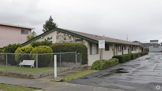
Property Record
24043 Park St, Hayward, CA 94541

NEARBY LISTINGS FOR SALE OR LEASE
Property Detail
24043 Park St
431-0056-047-00
LOT: 00047 BLK: AR: 0431 PAGE: 0056 ;LOT: 00049 BLK: AR: 0431 PAGE: 0056
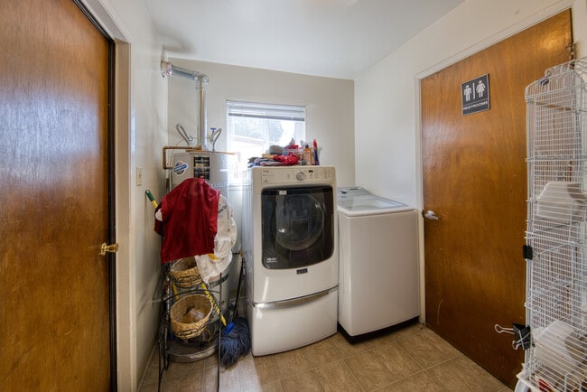
Multifamilydwelling
Alameda
X
California
06001C0287G
6
2024
0.22 AC
2025
Burbank
436301
East Bay/Oakland
3,609 SF
Oakland-Fremont-Berkeley, CA
DEMOGRAPHICS near 24043 Park St
1 mile
3 mile
5 mile
2024 Total Population
36,203
223,613
348,673
2029 Population
35,046
216,181
337,023
Pop Growth 2024-2029
(3.20%)
(3.32%)
(3.34%)
Average Age
38
39
40
2024 Total Households
11,729
70,756
111,664
HH Growth 2024-2029
(3.36%)
(3.51%)
(3.53%)
Median Household Inc
$93,275
$92,773
$98,214
Avg Household Size
2.90
3.00
3.00
2024 Avg HH Vehicles
2.00
2.00
2.00
Median Home Value
$707,632
$734,404
$774,143
Median Year Built
1973
1966
1968
Nearby Places
Map Layers
Map Styles
 Street
 Aerial
Transit
 Traffic
 Biking
Places
Listings with unknown addresses are not visible on the map
- Restaurants
- Banks
- Shops
- Fitness
- Groceries
PUBLIC TRANSPORTATION
TRANSIT/SUBWAY
Hayward Station (Fremont - Daly City - Bay Area Rapid Transit (BART), Fremont - Richmond - Bay Area Rapid Transit (BART))
Drive
Walk
Distance
Hayward Station (Fremont - Daly City - Bay Area Rapid Transit (BART), Fremont - Richmond - Bay Area Rapid Transit (BART))
2 min
13 min
0.7 mi
COMMUTER RAIL
Hayward Amtrak (Capitol Corridor - Amtrak)
Drive
Walk
Distance
Hayward Amtrak (Capitol Corridor - Amtrak)
3 min
16 min
0.9 mi
Hayward (Capitol Corridor - Capitol Corridor Joint Powers Authority)
Drive
Walk
Distance
Hayward (Capitol Corridor - Capitol Corridor Joint Powers Authority)
3 min
16 min
0.9 mi
AIRPORT
Metro Oakland International
Drive
Walk
Distance
Metro Oakland International
15 min
10.5 mi
San Francisco International
Drive
Walk
Distance
San Francisco International
29 min
22.4 mi
Norman Y Mineta San Jose International
Drive
Walk
Distance
Norman Y Mineta San Jose International
34 min
27.0 mi
Freight Ports
Port of Redwood City
Drive
Walk
Distance
Port of Redwood City
30 min
22.8 mi
SALE & LEASE HISTORY
LISTING DATE
SALE/LEASE

Oct 17, 2025
For Sale
Oct 16, 2024
For Sale
Nearby Properties
Address
Land Use
TOTAL SIZE
Lot Size
Zoning
Address
Land Use
TOTAL SIZE
Lot Size
Zoning
710,091 SF
50.34 AC
Address
Land Use
TOTAL SIZE
Lot Size
Zoning
367,398 SF
21.94 AC
Address
Land Use
TOTAL SIZE
Lot Size
Zoning
4.90 AC
Address
Land Use
TOTAL SIZE
Lot Size
Zoning
6.57 AC
Address
Land Use
TOTAL SIZE
Lot Size
Zoning
500,913 SF
22.59 AC
Address
Land Use
TOTAL SIZE
Lot Size
Zoning
240,556 SF
11.63 AC
Address
Land Use
TOTAL SIZE
Lot Size
Zoning
2.48 AC
Address
Land Use
TOTAL SIZE
Lot Size
Zoning
200,451 SF
11.22 AC
Address
Land Use
TOTAL SIZE
Lot Size
Zoning
236,976 SF
18.36 AC
Address
Land Use
TOTAL SIZE
Lot Size
Zoning
173,948 SF
6.10 AC
Address
Land Use
TOTAL SIZE
Lot Size
Zoning
10.64 AC
Address
Land Use
TOTAL SIZE
Lot Size
Zoning
333,302 SF
13.20 AC
Address
Land Use
TOTAL SIZE
Lot Size
Zoning
175,325 SF
2.91 AC
Address
Land Use
TOTAL SIZE
Lot Size
Zoning
470,929 SF
31.62 AC
Address
Land Use
TOTAL SIZE
Lot Size
Zoning
1.50 AC
Address
Land Use
TOTAL SIZE
Lot Size
Zoning
Address
Land Use
TOTAL SIZE
Lot Size
Zoning
150,856 SF
5.99 AC
Address
Land Use
TOTAL SIZE
Lot Size
Zoning
187,926 SF
1.19 AC
Address
Land Use
TOTAL SIZE
Lot Size
Zoning
160,987 SF
7.20 AC
Address
Land Use
TOTAL SIZE
Lot Size
Zoning
297,592 SF
11.65 AC
Address
Land Use
TOTAL SIZE
Lot Size
Zoning
310,072 SF
14.96 AC
Address
Land Use
TOTAL SIZE
Lot Size
Zoning
8,804 SF
52.60 AC
Address
Land Use
TOTAL SIZE
Lot Size
Zoning
228,736 SF
5.95 AC
Address
Land Use
TOTAL SIZE
Lot Size
Zoning
169,371 SF
4.63 AC
Address
Land Use
TOTAL SIZE
Lot Size
Zoning
147,489 SF
9.90 AC
Address
Land Use
TOTAL SIZE
Lot Size
Zoning
116,485 SF
1.81 AC
Address
Land Use
TOTAL SIZE
Lot Size
Zoning
137,889 SF
18.44 AC
Address
Land Use
TOTAL SIZE
Lot Size
Zoning
116,750 SF
4.72 AC
Address
Land Use
TOTAL SIZE
Lot Size
Zoning
253,812 SF
14.49 AC
Address
Land Use
TOTAL SIZE
Lot Size
Zoning
146,944 SF
4.21 AC
The World's #1 Commercial Real Estate Marketplace
Connect with us
© 2026 CoStar Group
The information above has been obtained from sources believed reliable. While we do not doubt its accuracy we have not verified it and make no guarantee, warranty or representation about it. It is your responsibility to independently confirm its accuracy and completeness. Any projections, opinions, assumptions, or estimates used are for example only and do not represent the current or future performance of the property. The value of this transaction to you depends on tax and other factors which should be evaluated by your tax, financial, and legal advisors. You and your advisors should conduct a careful, independent investigation of the property to determine to your satisfaction the suitability of the property for your needs.