Property Record
Highway 80 W, Demopolis, AL 36732
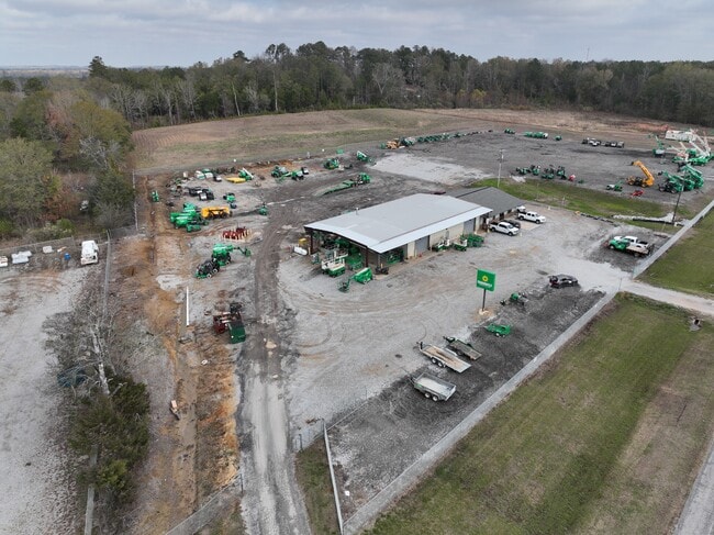
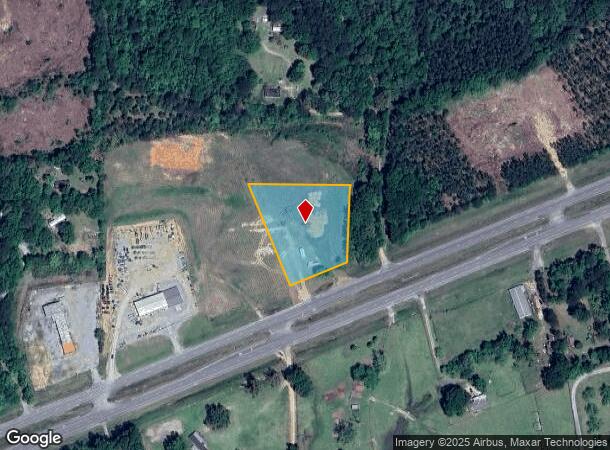

This Property Is For Sale
NEARBY LISTINGS FOR SALE OR LEASE
-
-
View all Demopolis listings for sale on LoopNet.com
Property Detail
Highway 80 W
Vacantlandnec
1.8 AC COM @ NW COR OF NE 1/4 E 512' TO POB SE 365'TO HWY 80 NE ALG R/W 203' N 270', W 337' TO POB SEC8-T17N-R2E
X
Marengo
01119C0525D
Alabama
2024
1.80 AC
2024
Alabama South Area
973400
Other Market Areas
3,850 SF
06-03-08-0-000-002-0000
DEMOGRAPHICS near Highway 80 W
1 Mile
3 Mile
5 Mile
2024 Total Population
102
407
3,524
2029 Population
96
386
3,366
Pop Growth 2024-2029
(5.88%)
(5.16%)
(4.48%)
Average Age
42
43
42
2024 Total Households
44
175
1,465
HH Growth 2024-2029
(6.82%)
(5.71%)
(4.51%)
Median Household Inc
$33,499
$36,000
$66,176
Avg Household Size
2.00
2.10
2.30
2024 Avg HH Vehicles
2.00
2.00
2.00
Median Home Value
$158,333
$160,416
$220,420
Median Year Built
1977
1977
1978
Nearby Places
Map Layers
Map Styles
 Street
 Aerial
- Restaurants
- Banks
- Shops
- Fitness
- Groceries
Nearby Properties
Address
Land Use
TOTAL SIZE
Lot Size
Zoning
Address
Land Use
TOTAL SIZE
Lot Size
Zoning
10,431 SF
3 AC
Address
Land Use
TOTAL SIZE
Lot Size
Zoning
5,040 SF
3.93 AC
Address
Land Use
TOTAL SIZE
Lot Size
Zoning
Address
Land Use
TOTAL SIZE
Lot Size
Zoning
3,850 SF
6.50 AC
Address
Land Use
TOTAL SIZE
Lot Size
Zoning
1,800 SF
7.85 AC
Address
Land Use
TOTAL SIZE
Lot Size
Zoning
Address
Land Use
TOTAL SIZE
Lot Size
Zoning
599 AC
Address
Land Use
TOTAL SIZE
Lot Size
Zoning
4,084 SF
24 AC
Address
Land Use
TOTAL SIZE
Lot Size
Zoning
5,500 SF
1.90 AC
Address
Land Use
TOTAL SIZE
Lot Size
Zoning
Address
Land Use
TOTAL SIZE
Lot Size
Zoning
4,080 SF
2.50 AC
Address
Land Use
TOTAL SIZE
Lot Size
Zoning
400 SF
20 AC
Address
Land Use
TOTAL SIZE
Lot Size
Zoning
Address
Land Use
TOTAL SIZE
Lot Size
Zoning
Address
Land Use
TOTAL SIZE
Lot Size
Zoning
269 AC
Address
Land Use
TOTAL SIZE
Lot Size
Zoning
295 AC
Address
Land Use
TOTAL SIZE
Lot Size
Zoning
Address
Land Use
TOTAL SIZE
Lot Size
Zoning
1,080 SF
4 AC
Address
Land Use
TOTAL SIZE
Lot Size
Zoning
2,880 SF
2.40 AC
Address
Land Use
TOTAL SIZE
Lot Size
Zoning
Address
Land Use
TOTAL SIZE
Lot Size
Zoning
Address
Land Use
TOTAL SIZE
Lot Size
Zoning
Address
Land Use
TOTAL SIZE
Lot Size
Zoning
Address
Land Use
TOTAL SIZE
Lot Size
Zoning
165 AC
Address
Land Use
TOTAL SIZE
Lot Size
Zoning
Address
Land Use
TOTAL SIZE
Lot Size
Zoning
Address
Land Use
TOTAL SIZE
Lot Size
Zoning
2,510 SF
60 AC
Address
Land Use
TOTAL SIZE
Lot Size
Zoning
Address
Land Use
TOTAL SIZE
Lot Size
Zoning
101 AC
Address
Land Use
TOTAL SIZE
Lot Size
Zoning
121 AC
The World's #1 Commercial Real Estate Marketplace
Connect with us
© 2026 CoStar Group
The information above has been obtained from sources believed reliable. While we do not doubt its accuracy we have not verified it and make no guarantee, warranty or representation about it. It is your responsibility to independently confirm its accuracy and completeness. Any projections, opinions, assumptions, or estimates used are for example only and do not represent the current or future performance of the property. The value of this transaction to you depends on tax and other factors which should be evaluated by your tax, financial, and legal advisors. You and your advisors should conduct a careful, independent investigation of the property to determine to your satisfaction the suitability of the property for your needs.