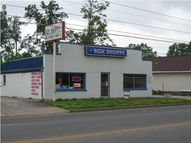
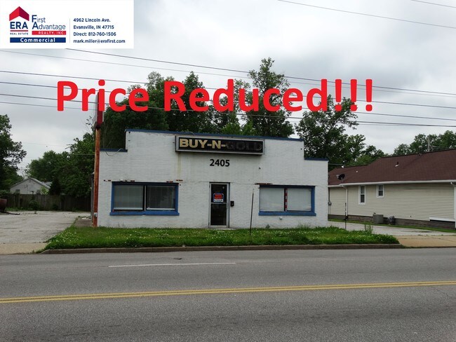
Property Record
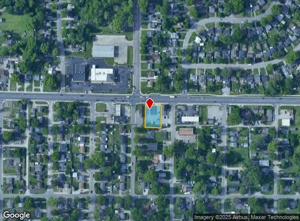
2405 Covert Ave, Evansville, IN 47714
NEARBY LISTINGS FOR SALE OR LEASE
Property Detail
2405 Covert Ave
82-06-34-017-081.002-027
PT NW SE SEC 34-6-10
Storebuilding
Vanderburgh
X
Indiana
18163C0185E
0.32 AC
2024
Eastside
2024
Evansville
000900
Evansville, IN-KY
2,515 SF
DEMOGRAPHICS near 2405 Covert Ave
1 Mile
3 Mile
5 Mile
2024 Total Population
15,458
68,512
114,332
2029 Population
15,453
69,067
115,422
Pop Growth 2024-2029
(0.03%)
+ 0.81%
+ 0.95%
Average Age
39
39
40
2024 Total Households
6,721
29,749
50,071
HH Growth 2024-2029
+ 0.01%
+ 0.79%
+ 0.93%
Median Household Inc
$52,559
$47,897
$48,547
Avg Household Size
2.20
2.20
2.20
2024 Avg HH Vehicles
2.00
2.00
2.00
Median Home Value
$101,980
$105,704
$124,355
Median Year Built
1958
1958
1963
Nearby Places
Map Layers
Map Styles
 Street
 Aerial
- Restaurants
- Banks
- Shops
- Fitness
- Groceries
PUBLIC TRANSPORTATION
AIRPORT
Evansville Regional
DRIVE
WALK
Distance
Evansville Regional
14 min
7.2 mi
Freight Ports
Port of Toledo
DRIVE
WALK
Distance
Port of Toledo
458 min
393.6 mi
SALE & LEASE HISTORY
LISTING DATE
SALE/LEASE

Dec 03, 2018
For Sale
Nearby Properties
Address
Land Use
TOTAL SIZE
Lot Size
Zoning
Address
Land Use
TOTAL SIZE
Lot Size
Zoning
109,983 SF
27.50 AC
Address
Land Use
TOTAL SIZE
Lot Size
Zoning
451,370 SF
23.93 AC
Address
Land Use
TOTAL SIZE
Lot Size
Zoning
169,860 SF
20.33 AC
Address
Land Use
TOTAL SIZE
Lot Size
Zoning
176,128 SF
18.79 AC
Address
Land Use
TOTAL SIZE
Lot Size
Zoning
21,831 SF
3.03 AC
Address
Land Use
TOTAL SIZE
Lot Size
Zoning
165,472 SF
1.38 AC
Address
Land Use
TOTAL SIZE
Lot Size
Zoning
5,000 SF
21.20 AC
Address
Land Use
TOTAL SIZE
Lot Size
Zoning
92,132 SF
1.68 AC
Address
Land Use
TOTAL SIZE
Lot Size
Zoning
7,705 SF
27.73 AC
Address
Land Use
TOTAL SIZE
Lot Size
Zoning
8,700 SF
22.09 AC
Address
Land Use
TOTAL SIZE
Lot Size
Zoning
87,099 SF
2.28 AC
Address
Land Use
TOTAL SIZE
Lot Size
Zoning
103,226 SF
10.64 AC
Address
Land Use
TOTAL SIZE
Lot Size
Zoning
3,757 SF
18.83 AC
Address
Land Use
TOTAL SIZE
Lot Size
Zoning
82,488 SF
1.90 AC
8
Address
Land Use
TOTAL SIZE
Lot Size
Zoning
10,587 SF
11.69 AC
Address
Land Use
TOTAL SIZE
Lot Size
Zoning
61,652 SF
15.02 AC
Address
Land Use
TOTAL SIZE
Lot Size
Zoning
15,670 SF
9.55 AC
Address
Land Use
TOTAL SIZE
Lot Size
Zoning
184,046 SF
10.05 AC
Address
Land Use
TOTAL SIZE
Lot Size
Zoning
13,364 SF
5.57 AC
Address
Land Use
TOTAL SIZE
Lot Size
Zoning
37,404 SF
12 AC
Address
Land Use
TOTAL SIZE
Lot Size
Zoning
3,552 SF
9.48 AC
Address
Land Use
TOTAL SIZE
Lot Size
Zoning
12,744 SF
6.19 AC
Address
Land Use
TOTAL SIZE
Lot Size
Zoning
170,760 SF
15.49 AC
Address
Land Use
TOTAL SIZE
Lot Size
Zoning
9,916 SF
11.62 AC
Address
Land Use
TOTAL SIZE
Lot Size
Zoning
2,453 SF
20.30 AC
Address
Land Use
TOTAL SIZE
Lot Size
Zoning
151,262 SF
11.03 AC
Address
Land Use
TOTAL SIZE
Lot Size
Zoning
56,125 SF
21.60 AC
Address
Land Use
TOTAL SIZE
Lot Size
Zoning
13,231 SF
8.04 AC
Address
Land Use
TOTAL SIZE
Lot Size
Zoning
83,218 SF
1.83 AC
Address
Land Use
TOTAL SIZE
Lot Size
Zoning
8,920 SF
2.62 AC
The World's #1 Commercial Real Estate Marketplace
Connect with us
© 2025 CoStar Group
The information above has been obtained from sources believed reliable. While we do not doubt its accuracy we have not verified it and make no guarantee, warranty or representation about it. It is your responsibility to independently confirm its accuracy and completeness. Any projections, opinions, assumptions, or estimates used are for example only and do not represent the current or future performance of the property. The value of this transaction to you depends on tax and other factors which should be evaluated by your tax, financial, and legal advisors. You and your advisors should conduct a careful, independent investigation of the property to determine to your satisfaction the suitability of the property for your needs.