Property Record
2405 Montopolis Dr, Austin, TX 78741
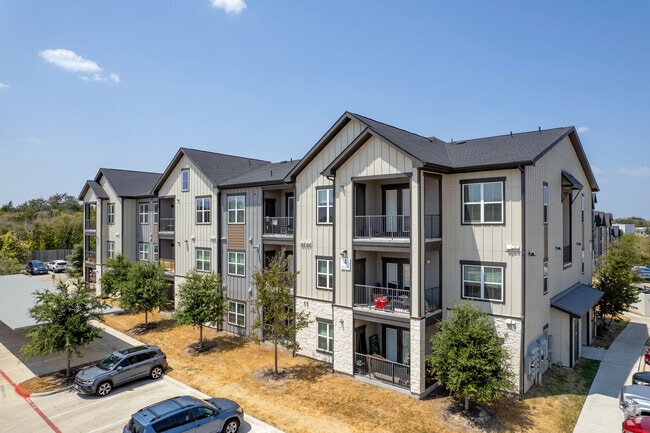

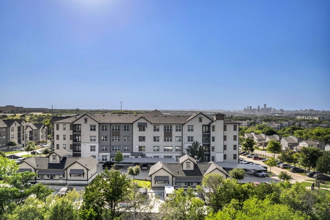
Property Detail
2405 Montopolis Dr
Austin-Round Rock-San Marcos, TX
9.3924AC OF LOT 1 MONT SUBD
920583
Travis
Multifamilydwelling
Texas
B and X Area of moderate flood hazard, usually the area between the limits of the 100-year and 500-year floods.
1
2025
9.39 AC
2025
Montopolis
002320
Austin
247,104 SF
NEARBY LISTINGS FOR SALE OR LEASE
DEMOGRAPHICS near 2405 Montopolis Dr
1 mile
3 mile
5 mile
2025 Total Population
14,362
92,519
261,997
2030 Population
15,361
98,051
277,131
Pop Growth 2025-2030
+ 6.96%
+ 5.98%
+ 5.78%
Average Age
34
34
36
2025 Total Households
5,598
40,401
116,306
HH Growth 2025-2030
+ 7.68%
+ 6.60%
+ 6.59%
Median Household Inc
$77,727
$74,018
$90,742
Avg Household Size
2.50
2.20
2.10
2025 Avg HH Vehicles
2.00
2.00
2.00
Median Home Value
$439,817
$488,891
$609,840
Median Year Built
2009
1999
2002
Nearby Places
Map Layers
Map Styles
 Street
 Aerial
Transit
 Traffic
 Biking
Places
Listings with unknown addresses are not visible on the map
- Restaurants
- Banks
- Shops
- Fitness
- Groceries
PUBLIC TRANSPORTATION
COMMUTER RAIL
Austin (Texas Eagle - Amtrak)
Drive
Walk
Distance
Austin (Texas Eagle - Amtrak)
13 min
5.4 mi
AIRPORT
Austin-Bergstrom International
Drive
Walk
Distance
Austin-Bergstrom International
16 min
6.8 mi
Freight Ports
Calhoun Port
Drive
Walk
Distance
Calhoun Port
181 min
150.3 mi
Nearby Properties
Address
Land Use
TOTAL SIZE
Lot Size
Zoning
Address
Land Use
TOTAL SIZE
Lot Size
Zoning
9,768 SF
386.80 AC
Address
Land Use
TOTAL SIZE
Lot Size
Zoning
999,200 SF
25 AC
Address
Land Use
TOTAL SIZE
Lot Size
Zoning
356,147 SF
10.48 AC
Address
Land Use
TOTAL SIZE
Lot Size
Zoning
492,715 SF
9.22 AC
Address
Land Use
TOTAL SIZE
Lot Size
Zoning
456,650 SF
15 AC
Address
Land Use
TOTAL SIZE
Lot Size
Zoning
307,610 SF
8.95 AC
Address
Land Use
TOTAL SIZE
Lot Size
Zoning
454,740 SF
27.77 AC
Address
Land Use
TOTAL SIZE
Lot Size
Zoning
387,267 SF
3.25 AC
Address
Land Use
TOTAL SIZE
Lot Size
Zoning
290,643 SF
13.59 AC
Address
Land Use
TOTAL SIZE
Lot Size
Zoning
91,639 SF
35.97 AC
Address
Land Use
TOTAL SIZE
Lot Size
Zoning
558,324 SF
45.12 AC
Address
Land Use
TOTAL SIZE
Lot Size
Zoning
4,944 SF
25.09 AC
Address
Land Use
TOTAL SIZE
Lot Size
Zoning
255,483 SF
35 AC
Address
Land Use
TOTAL SIZE
Lot Size
Zoning
335,913 SF
13.83 AC
Address
Land Use
TOTAL SIZE
Lot Size
Zoning
190,546 SF
5.85 AC
Address
Land Use
TOTAL SIZE
Lot Size
Zoning
390,384 SF
34.08 AC
Address
Land Use
TOTAL SIZE
Lot Size
Zoning
301,125 SF
5.23 AC
Address
Land Use
TOTAL SIZE
Lot Size
Zoning
236,503 SF
6.86 AC
Address
Land Use
TOTAL SIZE
Lot Size
Zoning
19.76 AC
Address
Land Use
TOTAL SIZE
Lot Size
Zoning
272,084 SF
3.87 AC
Address
Land Use
TOTAL SIZE
Lot Size
Zoning
266,871 SF
9.13 AC
Address
Land Use
TOTAL SIZE
Lot Size
Zoning
372,125 SF
26.22 AC
Address
Land Use
TOTAL SIZE
Lot Size
Zoning
264,897 SF
2.54 AC
Address
Land Use
TOTAL SIZE
Lot Size
Zoning
279,539 SF
3.99 AC
Address
Land Use
TOTAL SIZE
Lot Size
Zoning
297,552 SF
15.93 AC
Address
Land Use
TOTAL SIZE
Lot Size
Zoning
215,109 SF
4.09 AC
Address
Land Use
TOTAL SIZE
Lot Size
Zoning
193,788 SF
107.16 AC
Address
Land Use
TOTAL SIZE
Lot Size
Zoning
270,688 SF
8.37 AC
Address
Land Use
TOTAL SIZE
Lot Size
Zoning
206,608 SF
10.61 AC
Address
Land Use
TOTAL SIZE
Lot Size
Zoning
278,730 SF
19.78 AC
The World's #1 Commercial Real Estate Marketplace
Connect with us
© 2026 CoStar Group
The information above has been obtained from sources believed reliable. While we do not doubt its accuracy we have not verified it and make no guarantee, warranty or representation about it. It is your responsibility to independently confirm its accuracy and completeness. Any projections, opinions, assumptions, or estimates used are for example only and do not represent the current or future performance of the property. The value of this transaction to you depends on tax and other factors which should be evaluated by your tax, financial, and legal advisors. You and your advisors should conduct a careful, independent investigation of the property to determine to your satisfaction the suitability of the property for your needs.