Property Record
2405 S Kolb Rd, Tucson, AZ 85710


NEARBY LISTINGS FOR SALE OR LEASE
Property Detail
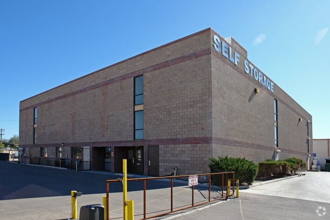
2405 S Kolb Rd
Tucson, AZ
Manana Grande
135-10-150V
MANANA GRANDE N154.99 E350.97 LOT 19 & PTN S17 N26 W224.67 THEREOF BLK 15
Publicstorage
Pima
X
Arizona
04019C2304L
19
2025
0.93 AC
2025
Southeast Tucson
004076
Tucson
41,486 SF
DEMOGRAPHICS near 2405 S Kolb Rd
1 Mile
3 Mile
5 Mile
2024 Total Population
18,721
104,814
210,430
2029 Population
19,336
108,401
217,577
Pop Growth 2024-2029
+ 3.29%
+ 3.42%
+ 3.40%
Average Age
38
40
41
2024 Total Households
7,545
45,274
92,495
HH Growth 2024-2029
+ 3.33%
+ 3.55%
+ 3.44%
Median Household Inc
$48,135
$48,615
$53,267
Avg Household Size
2.40
2.20
2.20
2024 Avg HH Vehicles
2.00
2.00
2.00
Median Home Value
$199,167
$198,971
$230,673
Median Year Built
1973
1975
1976
Nearby Places
Map Layers
Map Styles
 Street
 Aerial
- Restaurants
- Banks
- Shops
- Fitness
- Groceries
PUBLIC TRANSPORTATION
COMMUTER RAIL
DRIVE
WALK
Distance
15 min
8.6 mi
AIRPORT
Tucson International
DRIVE
WALK
Distance
Tucson International
20 min
11.0 mi
Nearby Properties
Address
Land Use
TOTAL SIZE
Lot Size
Zoning
Address
Land Use
TOTAL SIZE
Lot Size
Zoning
2,323,062 SF
628.02 AC
I1
Address
Land Use
TOTAL SIZE
Lot Size
Zoning
2,041,946 SF
640 AC
I1
Address
Land Use
TOTAL SIZE
Lot Size
Zoning
53,431 SF
9.98 AC
Address
Land Use
TOTAL SIZE
Lot Size
Zoning
88,741 SF
8.02 AC
Address
Land Use
TOTAL SIZE
Lot Size
Zoning
684,356 SF
19.65 AC
PAD13
Address
Land Use
TOTAL SIZE
Lot Size
Zoning
66,438 SF
8.53 AC
C2
Address
Land Use
TOTAL SIZE
Lot Size
Zoning
473,573 SF
22.65 AC
C3
Address
Land Use
TOTAL SIZE
Lot Size
Zoning
137,890 SF
8.28 AC
PAD1
Address
Land Use
TOTAL SIZE
Lot Size
Zoning
318,290 SF
32 AC
R1
Address
Land Use
TOTAL SIZE
Lot Size
Zoning
157,473 SF
56.40 AC
SR
Address
Land Use
TOTAL SIZE
Lot Size
Zoning
504,584 SF
18.17 AC
O3
Address
Land Use
TOTAL SIZE
Lot Size
Zoning
278,632 SF
37.62 AC
RX1
Address
Land Use
TOTAL SIZE
Lot Size
Zoning
259,360 SF
45 AC
R1
Address
Land Use
TOTAL SIZE
Lot Size
Zoning
209,980 SF
6.16 AC
C2
Address
Land Use
TOTAL SIZE
Lot Size
Zoning
26,554 SF
5.08 AC
I1
Address
Land Use
TOTAL SIZE
Lot Size
Zoning
109,335 SF
7.83 AC
PAD13
Address
Land Use
TOTAL SIZE
Lot Size
Zoning
256,775 SF
6.69 AC
C1
Address
Land Use
TOTAL SIZE
Lot Size
Zoning
180,149 SF
17.48 AC
PAD3
Address
Land Use
TOTAL SIZE
Lot Size
Zoning
1,804 SF
8.29 AC
R3
Address
Land Use
TOTAL SIZE
Lot Size
Zoning
162,473 SF
6.08 AC
C3
Address
Land Use
TOTAL SIZE
Lot Size
Zoning
240,585 SF
18.16 AC
R2
Address
Land Use
TOTAL SIZE
Lot Size
Zoning
265,649 SF
12.63 AC
R3
Address
Land Use
TOTAL SIZE
Lot Size
Zoning
217,152 SF
5.37 AC
PAD1
Address
Land Use
TOTAL SIZE
Lot Size
Zoning
145,152 SF
11.54 AC
C2
Address
Land Use
TOTAL SIZE
Lot Size
Zoning
286,164 SF
5.80 AC
C3
Address
Land Use
TOTAL SIZE
Lot Size
Zoning
273,640 SF
21.20 AC
O3
Address
Land Use
TOTAL SIZE
Lot Size
Zoning
188,350 SF
10.81 AC
Address
Land Use
TOTAL SIZE
Lot Size
Zoning
118,655 SF
8.74 AC
C1
Address
Land Use
TOTAL SIZE
Lot Size
Zoning
171,301 SF
6.36 AC
C3
The World's #1 Commercial Real Estate Marketplace
Connect with us
© 2025 CoStar Group
The information above has been obtained from sources believed reliable. While we do not doubt its accuracy we have not verified it and make no guarantee, warranty or representation about it. It is your responsibility to independently confirm its accuracy and completeness. Any projections, opinions, assumptions, or estimates used are for example only and do not represent the current or future performance of the property. The value of this transaction to you depends on tax and other factors which should be evaluated by your tax, financial, and legal advisors. You and your advisors should conduct a careful, independent investigation of the property to determine to your satisfaction the suitability of the property for your needs.