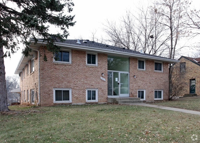
Property Record
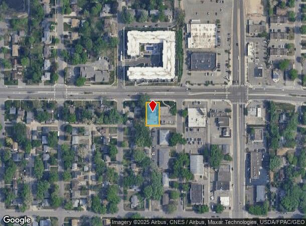
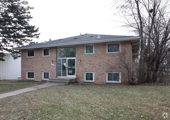
2405 W 66Th St, Minneapolis, MN 55423
NEARBY LISTINGS FOR SALE OR LEASE
Property Detail
2405 W 66Th St
Minneapolis-St. Paul-Bloomington, MN-WI
Tingdale Bros Lincoln Hills
29-028-24-41-0014
LOT 003 BLOCK 002 A TINGDALE BROS LINCOLN HILLS LOT 3 AND W 20 FT OF LOT 2 73 X 129.2
Apartment
Hennepin
X
Minnesota
27053C0368F
3
2024
0.22 AC
2024
Northwest Richfield
024100
Minneapolis/St Paul
DEMOGRAPHICS near 2405 W 66Th St
1 Mile
3 Mile
5 Mile
2024 Total Population
17,208
131,390
313,710
2029 Population
17,136
129,187
308,841
Pop Growth 2024-2029
(0.42%)
(1.68%)
(1.55%)
Average Age
43
41
40
2024 Total Households
8,209
55,297
136,438
HH Growth 2024-2029
(0.24%)
(1.71%)
(1.56%)
Median Household Inc
$80,542
$98,885
$90,874
Avg Household Size
2.00
2.30
2.20
2024 Avg HH Vehicles
2.00
2.00
2.00
Median Home Value
$314,564
$385,439
$364,510
Median Year Built
1964
1958
1959
Nearby Places
Map Layers
Map Styles
 Street
 Aerial
- Restaurants
- Banks
- Shops
- Fitness
- Groceries
PUBLIC TRANSPORTATION
COMMUTER RAIL
Target Field Station (Northstar Corridor - Northstar Commuter Rail)
DRIVE
WALK
Distance
Target Field Station (Northstar Corridor - Northstar Commuter Rail)
16 min
9.1 mi
AIRPORT
Minneapolis-St Paul International/Wold-Chamberlain
DRIVE
WALK
Distance
Minneapolis-St Paul International/Wold-Chamberlain
13 min
7.3 mi
Freight Ports
Port Milwaukee
DRIVE
WALK
Distance
Port Milwaukee
380 min
342.7 mi
Nearby Properties
Address
Land Use
TOTAL SIZE
Lot Size
Zoning
Address
Land Use
TOTAL SIZE
Lot Size
Zoning
364,730 SF
13.40 AC
PCD3
Address
Land Use
TOTAL SIZE
Lot Size
Zoning
18,088 SF
5.44 AC
MDD6
Address
Land Use
TOTAL SIZE
Lot Size
Zoning
21.50 AC
Address
Land Use
TOTAL SIZE
Lot Size
Zoning
12,308 SF
1.25 AC
PCD3
Address
Land Use
TOTAL SIZE
Lot Size
Zoning
45.77 AC
Address
Land Use
TOTAL SIZE
Lot Size
Zoning
79,717 SF
4.62 AC
Address
Land Use
TOTAL SIZE
Lot Size
Zoning
19,726 SF
2.08 AC
PCD1
Address
Land Use
TOTAL SIZE
Lot Size
Zoning
35.28 AC
Address
Land Use
TOTAL SIZE
Lot Size
Zoning
1.50 AC
Address
Land Use
TOTAL SIZE
Lot Size
Zoning
3.51 AC
Address
Land Use
TOTAL SIZE
Lot Size
Zoning
50,484 SF
5.12 AC
Address
Land Use
TOTAL SIZE
Lot Size
Zoning
8.55 AC
Address
Land Use
TOTAL SIZE
Lot Size
Zoning
25,780 SF
5.24 AC
Address
Land Use
TOTAL SIZE
Lot Size
Zoning
435,796 SF
36.44 AC
Address
Land Use
TOTAL SIZE
Lot Size
Zoning
31,646 SF
5.85 AC
Address
Land Use
TOTAL SIZE
Lot Size
Zoning
Address
Land Use
TOTAL SIZE
Lot Size
Zoning
1.74 AC
Address
Land Use
TOTAL SIZE
Lot Size
Zoning
7,614 SF
2.01 AC
PCD3
Address
Land Use
TOTAL SIZE
Lot Size
Zoning
25,909 SF
6.09 AC
Address
Land Use
TOTAL SIZE
Lot Size
Zoning
94,827 SF
5.86 AC
RMD
Address
Land Use
TOTAL SIZE
Lot Size
Zoning
22,119 SF
4.02 AC
Address
Land Use
TOTAL SIZE
Lot Size
Zoning
8.80 AC
Address
Land Use
TOTAL SIZE
Lot Size
Zoning
Address
Land Use
TOTAL SIZE
Lot Size
Zoning
21.69 AC
Address
Land Use
TOTAL SIZE
Lot Size
Zoning
60,320 SF
11.50 AC
Address
Land Use
TOTAL SIZE
Lot Size
Zoning
Address
Land Use
TOTAL SIZE
Lot Size
Zoning
2.23 AC
Address
Land Use
TOTAL SIZE
Lot Size
Zoning
39,118 SF
3.48 AC
Address
Land Use
TOTAL SIZE
Lot Size
Zoning
22,393 SF
4.12 AC
Address
Land Use
TOTAL SIZE
Lot Size
Zoning
137,728 SF
11.31 AC
The World's #1 Commercial Real Estate Marketplace
Connect with us
© 2025 CoStar Group
The information above has been obtained from sources believed reliable. While we do not doubt its accuracy we have not verified it and make no guarantee, warranty or representation about it. It is your responsibility to independently confirm its accuracy and completeness. Any projections, opinions, assumptions, or estimates used are for example only and do not represent the current or future performance of the property. The value of this transaction to you depends on tax and other factors which should be evaluated by your tax, financial, and legal advisors. You and your advisors should conduct a careful, independent investigation of the property to determine to your satisfaction the suitability of the property for your needs.